
Schwarzenfeld
Schwarzenfeld | ||
|---|---|---|
 Aerial view of the town | ||
 Coat of arms | ||
Location of Schwarzenfeld within Schwandorf district 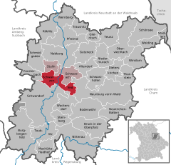 | ||
Municipal assoc. Schwarzenfeld | | |
| Government | ||
| • Mayor (2020–26) | Peter Neumeier[1] (FW) | |
| Area | ||
| • Total | 38.27 km2 (14.78 sq mi) | |
| Highest elevation | 415 m (1,362 ft) | |
| Lowest elevation | 360 m (1,180 ft) | |
| Population (2022-12-31)[2] | ||
| • Total | 6,422 | |
| • Density | 170/km2 (430/sq mi) | |
| Time zone | UTC+01:00 (CET) | |
| • Summer (DST) | UTC+02:00 (CEST) | |
| Postal codes | 92521 | |
| Dialling codes | 0 94 35 | |
| Vehicle registration | SAD | |
| Website | www.schwarzenfeld.de | |
Schwarzenfeld is a municipality in the district of Schwandorf in Bavaria, Germany.
The
Deadlock
is based in this municipality.
Climate
| ||||||||||||||||||||||||||||||||||||||||||||||||||||||||||||||||||||||||||||||||||||||||||||||||||||||||||||||||||||||||||||
Notable buildings

References
- Bayerisches Landesamt für Statistik, 15 July 2021.
- ^ Genesis Online-Datenbank des Bayerischen Landesamtes für Statistik Tabelle 12411-003r Fortschreibung des Bevölkerungsstandes: Gemeinden, Stichtag (Einwohnerzahlen auf Grundlage des Zensus 2011).
- ^ "NASA Earth Observations Data Set Index". NASA. Retrieved 30 January 2016.

| International | |
|---|---|
| National | |