
Silas, Alabama
Silas, Alabama | ||
|---|---|---|
FIPS code 01-70416 | | |
| GNIS feature ID | 2407336[2] | |
| Website | www | |
Silas is a town in
The town was struck by a tornado on March 17, 2021. The tornado downed trees and inflicted minor damage to outbuildings and homes at EF1 strength. It reached EF2 strength well northeast of town and injured two people.[3][4]
Geography
Silas is located in southern Choctaw County at 31°46'17.850" North, 88°19'51.568" West (31.771625, -88.330991).[5]
According to the
The town is located next to U.S. Route 84 near the Mississippi state line.
Demographics
| Census | Pop. | Note | %± |
|---|---|---|---|
| 1950 | 383 | — | |
| 1960 | 353 | −7.8% | |
| 1970 | 345 | −2.3% | |
| 1980 | 343 | −0.6% | |
| 1990 | 245 | −28.6% | |
| 2000 | 529 | 115.9% | |
| 2010 | 452 | −14.6% | |
| 2020 | 377 | −16.6% | |
| U.S. Decennial Census[7] 2013 Estimate[8] | |||
As of the
There were 220 households, out of which 29.5% had children under the age of 18 living with them, 55.9% were married couples living together, 15.0% had a female householder with no husband present, and 28.6% were non-families. 27.7% of all households were made up of individuals, and 8.6% had someone living alone who was 65 years of age or older. The average household size was 2.40 and the average family size was 2.94.
In the town, the population was spread out, with 26.3% under the age of 18, 6.2% from 18 to 24, 28.0% from 25 to 44, 25.0% from 45 to 64, and 14.6% who were 65 years of age or older. The median age was 38 years. For every 100 females, there were 88.3 males. For every 100 females age 18 and over, there were 86.6 males.
The median income for a household in the town was $20,882, and the median income for a family was $25,833. Males had a median income of $27,955 versus $18,500 for females. The
Notable people
- Jeff Branson, Major League Baseball coach and former player; attended Southern Choctaw High School
- Spencer Johnson, NFL defensive tackle, attended Southern Choctaw High School
- Travis Pearson, football player
References
- ^ "2020 U.S. Gazetteer Files". United States Census Bureau. Retrieved October 29, 2021.
- ^ a b U.S. Geological Survey Geographic Names Information System: Silas, Alabama
- ^ "St Patrick's Day Tornado/Severe Weather Event". National Oceanic and Atmospheric Administration. National Weather Service Weather Forecast Office in Mobile, Alabama. Retrieved March 22, 2021.
- ^ "NWS Damage Survey for 03/17/21 Tornado Event Update #15". Iowa Environmental Mesonet. National Weather Service Weather Forecast Office in Birmingham, Alabama. March 22, 2021. Retrieved March 22, 2021.
- ^ "US Gazetteer files: 2010, 2000, and 1990". United States Census Bureau. February 12, 2011. Retrieved April 23, 2011.
- ^ "Geographic Identifiers: 2010 Demographic Profile Data (G001): Silas town, Alabama". U.S. Census Bureau, American Factfinder. Archived from the original on February 12, 2020. Retrieved June 5, 2014.
- ^ "U.S. Decennial Census". Census.gov. Retrieved June 6, 2013.
- ^ "Annual Estimates of the Resident Population: April 1, 2010 to July 1, 2013". Retrieved June 3, 2014.
- ^ "U.S. Census website". United States Census Bureau. Retrieved January 31, 2008.
External links
31°46′18″N 88°19′52″W / 31.771625°N 88.330991°W
Municipalities and communities of Choctaw County, Alabama, United States | ||
|---|---|---|
| Towns | 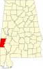 | |
| CDP | ||
| Unincorporated communities | ||
| Footnotes | ‡This populated place also has portions in an adjacent county or counties | |
| ||