
Choctaw County, Alabama
Choctaw County | |
|---|---|
UTC−5 (CDT) | |
| Congressional district | 7th |
| Website | www |
| |
Choctaw County is a county located in the southwestern portion of the U.S. state of Alabama. As of the 2020 census, the population was 12,665.[1] The county seat is Butler.[2] The county was established on December 29, 1847, and named for the Choctaw tribe of Native Americans.[3]
History
Choctaw County was originally part of the
Most of the early European American pioneers of Choctaw County were farmers from North and South Carolina. In 1912 the Alabama, Tennessee and Northern Railroad was completed through the county from north to south, connecting the area to the Port of Mobile and northern Alabama. It induced a population shift from areas near the Tombigbee River to the central part of the county.[5]
The county's population reached its peak in the 1920s, due in part from jobs created by a
An
Apparel factories opened during the 1950s–60s in Silas, Toxey, and Butler, although the plants had largely closed by the 21st century. The 1950s also saw the building a paper mill at Naheola, now owned and operated by Georgia-Pacific.[5][8] The county was declared a disaster area in September 1979, due to damage from Hurricane Frederic. The 1980s saw the main railroad close and the tracks removed.[5]
Historic sites
Choctaw County has one site listed on the National Register of Historic Places, the Mount Sterling Methodist Church.[9][10] Additionally, five sites are listed on the Alabama Register of Landmarks and Heritage.[11]
Geography
According to the United States Census Bureau, the county has a total area of 921 square miles (2,390 km2), of which 914 square miles (2,370 km2) is land and 7.4 square miles (19 km2) (0.8%) is water.[12]
Major highways
- U.S. Highway 84
- State Route 10
- State Route 17
- State Route 114
- State Route 156
Adjacent counties
- Sumter County (north)
- Marengo County (northeast)
- Clarke County (southeast)
- Washington County (south)
- Wayne County, Mississippi (southwest)
- Clarke County, Mississippi (west)
- Lauderdale County, Mississippi (northwest)
National protected area
Demographics
| Census | Pop. | Note | %± |
|---|---|---|---|
| 1850 | 8,389 | — | |
| 1860 | 13,877 | 65.4% | |
| 1870 | 12,676 | −8.7% | |
| 1880 | 15,731 | 24.1% | |
| 1890 | 17,526 | 11.4% | |
| 1900 | 18,136 | 3.5% | |
| 1910 | 18,483 | 1.9% | |
| 1920 | 20,753 | 12.3% | |
| 1930 | 20,513 | −1.2% | |
| 1940 | 20,195 | −1.6% | |
| 1950 | 19,152 | −5.2% | |
| 1960 | 17,870 | −6.7% | |
| 1970 | 16,589 | −7.2% | |
| 1980 | 16,839 | 1.5% | |
| 1990 | 16,018 | −4.9% | |
| 2000 | 15,922 | −0.6% | |
| 2010 | 13,859 | −13.0% | |
| 2020 | 12,665 | −8.6% | |
| 2023 (est.) | 12,252 | [13] | −3.3% |
| U.S. Decennial Census[14] 1790–1960[15] 1900–1990[16] 1990–2000[17] 2010–2020[1] | |||
2020 Census
| Race / Ethnicity | Pop 2000[18] | Pop 2010[19] | Pop 2020[20] | % 2000 | % 2010 | % 2020 |
|---|---|---|---|---|---|---|
White alone (NH)
|
8,724 | 7,700 | 7,039 | 54.79% | 55.56% | 55.58% |
Black or African American alone (NH)
|
6,985 | 5,990 | 5,217 | 43.87% | 43.22% | 41.19% |
Alaska Native alone (NH)
|
24 | 18 | 24 | 0.15% | 0.13% | 0.19% |
| Asian alone (NH) | 6 | 12 | 19 | 0.04% | 0.09% | 0.15% |
| Pacific Islander alone (NH) | 0 | 0 | 0 | 0.00% | 0.00% | 0.00% |
| Some Other Race alone (NH) | 15 | 10 | 13 | 0.09% | 0.07% | 0.10% |
| Mixed Race/Multi-Racial (NH) | 61 | 56 | 240 | 0.38% | 0.40% | 1.89% |
| Hispanic or Latino (any race) | 107 | 73 | 113 | 0.67% | 0.53% | 0.89% |
| Total | 15,922 | 13,859 | 12,665 | 100.00% | 100.00% | 100.00% |
As of the 2020 United States census, there were 12,665 people, 5,300 households, and 3,440 families residing in the county.
2010 census
As of the
2000 census
As of the
There were 6,363 households, out of which 32.50% had children under the age of 18 living with them, 52.00% were married couples living together, 16.00% had a female householder with no husband present, and 28.10% were non-families. 26.50% of all households were made up of individuals, and 11.60% had someone living alone who was 65 years of age or older. The average household size was 2.48 and the average family size was 2.99.
In the county, the population was spread out, with 26.10% under the age of 18, 7.90% from 18 to 24, 26.20% from 25 to 44, 25.20% from 45 to 64, and 14.60% who were 65 years of age or older. The median age was 38 years. For every 100 females there were 88.80 males. For every 100 females age 18 and over, there were 85.40 males.
The median income for a household in the county was $24,749, and the median income for a family was $31,870. Males had a median income of $32,316 versus $18,760 for females. The
Education
Choctaw County contains one
Districts
School districts include:[23]
Government
Choctaw County leans Republican at the presidential level. The last Democrat to win the county in a presidential election is Al Gore, who won it by a slim majority in 2000.
| Year | Republican | Democratic | Third party | |||
|---|---|---|---|---|---|---|
| No. | % | No. | % | No. | % | |
| 2020 | 4,296 | 57.56% | 3,127 | 41.89% | 41 | 0.55% |
| 2016 | 4,106 | 56.31% | 3,109 | 42.64% | 77 | 1.06% |
| 2012 | 4,152 | 52.06% | 3,786 | 47.47% | 38 | 0.48% |
| 2008 | 4,223 | 53.50% | 3,636 | 46.06% | 35 | 0.44% |
| 2004 | 3,897 | 53.92% | 3,303 | 45.70% | 27 | 0.37% |
| 2000 | 3,600 | 48.82% | 3,707 | 50.27% | 67 | 0.91% |
| 1996 | 2,623 | 36.78% | 4,074 | 57.13% | 434 | 6.09% |
| 1992 | 3,069 | 40.60% | 3,941 | 52.13% | 550 | 7.28% |
| 1988 | 3,629 | 50.89% | 3,491 | 48.96% | 11 | 0.15% |
| 1984 | 3,960 | 53.88% | 3,373 | 45.90% | 16 | 0.22% |
| 1980 | 2,859 | 43.45% | 3,680 | 55.93% | 41 | 0.62% |
| 1976 | 3,033 | 43.50% | 3,911 | 56.10% | 28 | 0.40% |
| 1972 | 3,055 | 60.74% | 1,934 | 38.45% | 41 | 0.82% |
| 1968 | 176 | 2.89% | 1,641 | 26.93% | 4,276 | 70.18% |
| 1964 | 2,497 | 85.81% | 0 | 0.00% | 413 | 14.19% |
| 1960 | 612 | 34.04% | 1,094 | 60.85% | 92 | 5.12% |
| 1956 | 457 | 25.69% | 1,250 | 70.26% | 72 | 4.05% |
| 1952 | 593 | 27.14% | 1,583 | 72.45% | 9 | 0.41% |
| 1948 | 16 | 1.10% | 0 | 0.00% | 1,441 | 98.90% |
| 1944 | 86 | 6.46% | 1,243 | 93.32% | 3 | 0.23% |
| 1940 | 73 | 3.48% | 2,023 | 96.52% | 0 | 0.00% |
| 1936 | 74 | 4.68% | 1,507 | 95.32% | 0 | 0.00% |
| 1932 | 48 | 3.03% | 1,533 | 96.90% | 1 | 0.06% |
| 1928 | 429 | 25.67% | 1,242 | 74.33% | 0 | 0.00% |
| 1924 | 19 | 1.82% | 1,021 | 97.80% | 4 | 0.38% |
| 1920 | 82 | 7.09% | 1,071 | 92.65% | 3 | 0.26% |
| 1916 | 21 | 2.63% | 765 | 95.63% | 14 | 1.75% |
| 1912 | 7 | 1.24% | 489 | 86.40% | 70 | 12.37% |
| 1908 | 44 | 6.66% | 590 | 89.26% | 27 | 4.08% |
| 1904 | 45 | 7.14% | 558 | 88.57% | 27 | 4.29% |
Communities
Towns
- Butler (county seat)
- Gilbertown
- Lisman
- Needham
- Pennington
- Silas
- Toxey
Census-designated place
- Cullomburg (partly in Washington County)
Unincorporated communities
See also
- National Register of Historic Places listings in Choctaw County, Alabama
- Properties on the Alabama Register of Landmarks and Heritage in Choctaw County, Alabama
References
- ^ a b "State & County QuickFacts". United States Census Bureau. Retrieved September 9, 2023.
- ^ "Find a County". National Association of Counties. Archived from the original on May 3, 2015. Retrieved June 7, 2011.
- ^ "Alabama Counties: Choctaw County". Alabama Department of Archives and History. Retrieved June 21, 2011.
- ^ "Choctaw County". THE ENCYCLOPEDIA OF ALABAMA. Retrieved July 25, 2020.
- ^ a b c d "County History". Choctaw County Genealogy Society. Retrieved June 21, 2011.
- ISSN 0024-3019. Retrieved September 14, 2011.
- ISBN 9781931082280. Retrieved September 14, 2011.
- ^ "Southeastern Facilities and Wood Specifications". Georgia-Pacific. Archived from the original on June 12, 2011. Retrieved June 21, 2011.
- ISBN 978-0-471-14502-8.
Mount Sterling Methodist Church Choctaw County Historical Society.
- ^ "National Register Information System". National Register of Historic Places. National Park Service. March 13, 2009.
- ^ "The Alabama Register of Landmarks & Heritage". preserveala.org. Alabama Historical Commission. May 31, 2011. Archived from the original (PDF) on June 6, 2011. Retrieved June 6, 2011.
- ^ "2010 Census Gazetteer Files". United States Census Bureau. August 22, 2012. Retrieved August 22, 2015.
- ^ "Annual Estimates of the Resident Population for Counties: April 1, 2020 to July 1, 2023". United States Census Bureau. Retrieved March 27, 2024.
- ^ "U.S. Decennial Census". United States Census Bureau. Retrieved August 22, 2015.
- ^ "Historical Census Browser". University of Virginia Library. Retrieved August 22, 2015.
- ^ Forstall, Richard L., ed. (March 24, 1995). "Population of Counties by Decennial Census: 1900 to 1990". United States Census Bureau. Retrieved August 22, 2015.
- ^ "Census 2000 PHC-T-4. Ranking Tables for Counties: 1990 and 2000" (PDF). United States Census Bureau. April 2, 2001. Retrieved August 22, 2015.
- ^ "P004 HISPANIC OR LATINO, AND NOT HISPANIC OR LATINO BY RACE – 2000: DEC Summary File 1 – Choctaw County, Alabama". United States Census Bureau.
- ^ "P2 HISPANIC OR LATINO, AND NOT HISPANIC OR LATINO BY RACE – 2010: DEC Redistricting Data (PL 94-171) – Choctaw County, Alabama". United States Census Bureau.
- ^ "P2 HISPANIC OR LATINO, AND NOT HISPANIC OR LATINO BY RACE - 2020: DEC Redistricting Data (PL 94-171) – Choctaw County, Alabama". United States Census Bureau.
- ^ "U.S. Census website". United States Census Bureau. Retrieved May 14, 2011.
- ^ "Search for Public School Districts – Choctaw County, AL". National Center for Education Statistics. Institute of Education Sciences. Retrieved October 2, 2022.
- ^ "2020 Census – School District Reference Map: Choctaw County, AL" (PDF). United States Census Bureau. Retrieved October 2, 2022. Text list.
- ^ "Dave Leip's Atlas of U.S. Presidential Elections". Retrieved November 16, 2016.
External links
- The Choctaw Sun-Advocate
- Coastal Gateway Regional Economic Development Alliance
- Choctaw County map of roads/towns (map © 2007 Univ. of Alabama).
- Choctaw County Tourism and Business Directory
Places adjacent to Choctaw County, Alabama | |
|---|---|
Municipalities and communities of Choctaw County, Alabama, United States | ||
|---|---|---|
| Towns | 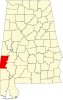 | |
| CDP | ||
| Unincorporated communities | ||
| Footnotes | ‡This populated place also has portions in an adjacent county or counties | |
| ||
Montgomery (capital) | |
| Topics | |
| Society |
|
| Regions | |
| Flora and fauna | |
Largest cities | |
| Metros |
|
| Counties |
|
| International | |
|---|---|
| National | |
| Other | |