
South End, Boston
South End District | |
Boston, Massachusetts | |
| Architect | Multiple |
|---|---|
| Architectural style | Greek Revival, Late Victorian, Italianate |
| Website | www |
| NRHP reference No. | 73000324[1] |
| Added to NRHP | May 8, 1973 |
The South End is a
It is home to diverse groups, including immigrants, young families and professionals, and it is popular with Boston's gay and lesbian community.[3] The South End has been characterized by diversity since the 1880s, with substantial Irish, Jewish, African-American, Puerto Rican (in the San Juan Street area), Chinese, and Greek populations. Its 2010 population was 55.2 percent white, 13.3 percent Hispanic, 12.5 percent Black, 16.2 percent Asian, and 2.7 percent "other". 55.2 percent of South End residents had a bachelor's degree or higher; median household income was $57,699, and the median age was 36. 65.6 percent were primarily English speakers, and 12.9 percent primarily spoke Spanish.[4]
Geographic history


The South End is south of the
Land belonging to the South End has been part of the city of Boston since its founding, although it was smaller when first settled and surrounded by large
The South End was bordered on the north and west by the Boston and Providence Railroad,[10] which terminated at the B&PRR station bordering the Public Garden. The rail line is now covered by Southwest Corridor Park.[11]
The primary business thoroughfares in the South End are
Subdistricts
The
- Massachusetts Avenue
- New York Streets, between Herald, East Berkeley, Albany, and Tremont Streets
- Back Streets, roughly between I-93, Harrison, East Brookline, and East Berkeley Streets
- Medical area, roughly between the highway, Massachusetts Avenue, Franklin Square, and East Brookline Street
Parks
The South End has eleven residential parks, varying in size and inspired by English-style residential squares first laid out downtown by Charles Bulfinch. The neighborhood also has newer parks, including Peters Park, and a series of sixteen community gardens and pocket parks operated by the Trustees of Reservations.
History
Residential history

As the South End expanded with fill north and west of "the Neck", Boston envisioned a large inner-city residential neighborhood to relieve the crowded downtown and Beacon Hill neighborhoods and hoped for a large, stable tax base. Architect Charles Bulfinch laid out some of the first filled land.[16] He designed a large residential park called Columbia Square[16] located at the present Franklin and Blackstone Squares.[17] Bulfinch's plan was to route traffic around the square. His plan was abandoned, and Washington Street was allowed to again divide the square (creating separate squares).[16]
Many rooming houses on the Back Bay side of the South End had no bathing facilities, and roomers bathed in public showers. Filled land in the neighborhood was originally eight feet above sea level, but has settled to four feet. The original shoreline of Boston Neck crosses in front of 40 St. George Street, and tapers to the narrowest point of the Neck at Dover Street. Blackstone and Franklin Square is solid land on the original neck, but clam and snail shells are just beneath its surface because high seas would occasionally overrun the Neck.
Middle-class people moved to the South End, including business owners, two mayors, bankers, and industrialists, but the neighborhood's wealthy status was relatively short-lived. A series of national
By the close of the nineteenth century, the South End was becoming a tenement district; it attracted immigrants and, during the 1940s, gay men. The neighborhood also became a center of Black middle-class Boston life and culture. The largest concentration of Pullman porters in the country lived in the South End, primarily between Columbus Avenue and the railroad.
The first
Urban renewal


The South End was one of many large-scale Boston landfill projects to create new residential districts.
The connection of Boston and Albany by railroad (by some of the various companies that would later merge into the Boston and Albany Railroad) was celebrated in 1841 as a way to keep Boston competitive with New York City as an Atlantic port. The New York Streets district, a residential area of the South End whose streets were named after cities on the route to Albany, arose south of the Boston and Worcester Railroad (the present-day Massachusetts Turnpike) over the next decade. Albany Street still exists, although it now ends at the turnpike instead of Kneeland; connecting it with Harrison Street from north to south were Seneca, Oneida, Oswego, Genesee, Rochester and Troy Streets. Troy is the present-day Traveler Street.[19][20][21]
Nearly all the buildings in New York Streets began to be bulldozed in 1955 as part of an urban renewal project to clear slums and make room for industrial activity during a period characterized by urban decline. The resulting superblock was redeveloped into the headquarters of the Boston Herald.[19] The Herald-Traveler Corporation extended from the new Herald Street to Traveler Street until 2012, when it moved to the Seaport District in South Boston.[22] It was redeveloped as a mixed-use area known as the Ink Block, with apartments, a grocery store, restaurants, and other retail businesses.[19] Other populated sites in the South End received similar treatment, particularly the early high-rise, high-density Cathedral Housing Projects adjacent to Holy Cross Cathedral and high- and low-rise redevelopments such as Castle Square, from 1964 to 1966.[23]
The South End is residential and commercial. Since it is near access to railroads and port facilities, it attracted a number of manufacturers.[2] Albany Street, along the Roxbury Canal, became occupied by warehouses and factories and was the center of Boston's furniture and piano-making industry by the 19th century.[2] The South End has new developments that will add residential and commercial space. According to the Boston Redevelopment Authority (BRA), a new project will be built on Albany Street which will "include two hotels: a 16-story select service hotel, which will have a restaurant on its first floor; and a 9-story extended-stay hotel. The hotels together will have approximately 408 rooms. While the split between the two types of hotels has not been finally determined, current plans anticipate approximately 210 rooms in the select service hotel and approximately 198 rooms in the extended-stay hotel. The select-service hotel will include an approximately 4,000 square-foot (approximately 267-seat) restaurant on its first floor. A 3-level, above-ground parking garage with approximately 137 parking spaces will serve both hotels."[24] The project was expected to provide about 200 new jobs for construction workers and "employ approximately 200 employees (full-time equivalents) in management, operations, customer service, retail, and food service functions."[24]
Jazz

Until the 1950s, the South End and nearby Roxbury was a jazz mecca with clubs such as the Royal Palms, Eddie Levine's, the Pioneer Club, Handy's Grille, Tic-Toc, Connolly's, Estelle's, the Hi-Hat, The Savoy, The Cave, Basin Street, Louie's Lounge, and Wally's Paradise; Wally's is the only club still in operation. The American Federation of Musicians Local 535 was the top black musicians' union in the country from 1915 to 1970, with local and national musicians including Duke Ellington, Cab Calloway, Chick Webb, Earl Hines, and Jimmie Lunceford. Its offices were originally above Charlie's Sandwich Shoppe (whose walls are lined with photographs of jazz musicians who ate there), but moved to 409 Massachusetts Avenue around 1930. Local 535 and Local 9 (the white union) were ordered by the courts to merge into Boston Musicians Association Local 9-535 in 1970, and most of the Black musicians left.[25]
Education

The South End has five primary and secondary schools, providing education from kindergarten through grade 12 as part of Boston Public Schools. The McKinley South End Academy is four schools, a special-education school that focuses on behavioral, emotional and learning needs.[26] The Josiah Quincy Upper School teaches grades six to 12, balancing core-subject requirements with world languages, the arts and physical education.[27] Blackstone Elementary School has over 500 students from diverse backgrounds from pre-kindergarten to grade five.[28] Benjamin Franklin Institute of Technology, established in 1908, is a four-year South End school for students desiring a technical degree.
Community resources
The South End is served by three public libraries, and the South End Branch has a diverse collection of popular and scholarly materials for adults and children.
Other community organizations include South End Baseball, Youth Enrichment Services, the South End Lower Roxbury Open Space Land Trust, Mytown (an organization training youth to lead walking tours on neighborhood and Boston history), the South End Historical Society, Inquilinos Boricuas en Accion, and United South End Settlements. The Animal Rescue League of Boston, founded in 1899 by Anna Harris Smith, is at 10 Chandler Street. The league has an animal shelter, an animal-cruelty investigation and prosecution law-enforcement department, a rescue department, an animal-behavior department and Boston Veterinary Care, an outpatient veterinary facility.
Diversity

The South End's population has been diverse since the 1880s when
In the 1940s, particularly after the end of World War II, the South End's rooming houses became home to a growing number of gays and lesbians; single-sex rooming houses provided a home and social cover for LGBT people. Late in the decade, the Hispanic population began to grow; at first, much of this settlement was centered around the Cathedral of the Holy Cross. The neighborhood remains diverse, with people of nearly every race, religion, and sexual orientation.[31]
Income levels are anecdotally reported as stratified, with concentrations of wealth and poverty, but neither the U.S. census or the city of Boston reports the neighborhood's income. Although gentrification is sometimes cited as a reason for the flight of poorer, non-white residents, the neighborhood has maintained racial and income diversity due to its subsidized, publicly owned, or otherwise low-income housing units and a homeless shelter. Subsidized, below-market-rate housing developments such as Methunion Manor, Cathedral Housing (a public housing project), Villa Victoria, Tent City, Lenox Street Apartments, Camden, Camfield Gardens, 1850 Washington St, and Mandela Homes and represent evolving attitudes to public-housing design and governance.
Although all neighborhoods in Boston experience crime, the city has a comparatively low incidence of
The South End has been known as a gay, artistic, and cultural neighborhood, although costs in the neighborhood are rising. Unlike cities such as New York, there are no city policies to help artists keep their long-term studios. Existing art galleries, however, are flourishing. GardenMoms, one of Boston's most popular online parent groups with over 2,500 members citywide, was founded by several South End mothers in 2002.[32]
2010 census

According to the 2010 census, the South End's population was 24,577 (a 12.2-percent increase from 2000).[4] The neighborhood was 55.2 percent white, 13.3 percent Hispanic or Latino, 12.5 percent Black, 16.2 percent Asian, and 2.7 percent other groups.[4] As for age, 33.8 percent of the population was between 20 and 34 years old and eight percent were under age nine;[4] 5.9 percent of South End residents were 10–19 years old, 31.2 percent were 35-54, 10.5 percent were 55-64, and 10.6 percent were 65 or older.[4] The median age for the South End is 36.[4] About 55.2 percent of the population hold a college degree; 29.2 percent have a bachelor's degree, and 26 percent hold a graduate degree.[4] The primary language spoken in the neighborhood is English (65.6 percent), followed by Spanish (12.9 percent), Chinese (10.4 percent), French (2.7 percent), Portuguese (one percent), and other languages (7.4 percent).[4] The median annual South End income is $57,699, with 10.9 percent of the population earning $50,000 to $74,000.[4] There are 12,831 households in the South End, with 23.3 percent living in a family that includes a wife and a husband; 47.4 percent live alone.[4] In 2010, 45.2 percent of residents did not own a vehicle.[4] Thirty-four percent of residents use public transportation, excluding taxis.[4] The South End has 58.1 percent of its population working in the management, business, science, and arts sectors, with 79.1 percent of the labor force between the ages of 20 and 34.[4] According to the 2010 census, 72.6 percent of the South End has lived in the same place for the past year; 12.8 percent moved to a different location in the same county, 7.5 percent moved from a different county, and 5.9 percent moved from a different state to the South End.[4]
Public transportation

The South End is near
The
Gallery
1950s
-
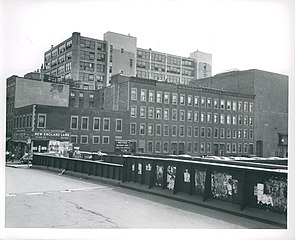
 Boston Herald Traveler Building, 1952–1956
 -
 Motte Street with 1000 Washington in the background, June 24, 1952
 -
 Rear of houses on Harrision Avenue and Johnny Court, 1952–1958
 -
 Tot lot on Troy Street, 1952–1958
 -
 Shawmut Avenue at Tremont Street, December 4, 1956
 -
 Don Bosco Technical High School, Warrenton Street, December 4, 1956
 -
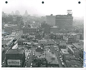 Northeast from roof of 100 Arlington Street, December 4, 1956


Contemporary images
-
 Columbus Avenue and Dartmouth Street
 -
 Lawrence Street
 -
 Dartmouth Place
 -
 Side street
 -
 Union Park Street
 -
 Worcester Square
 -
 Union Park and Tremont Streets
 -
 Tremont Street
 -
 Clarendon Street, with the John Hancock Tower in the background


References
- ^ "National Register Information System". National Register of Historic Places. National Park Service. January 23, 2007.
- ^ a b c d e f g h i j k l m n o p q r Hughes, Carolyn; Shiland, Kimberley. "Exploring Boston Neighborhoods" (PDF). South End & St. Botolph. Retrieved April 3, 2015.
- ^ a b "At a Glance – South End". Boston Redevelopment Authority. Retrieved May 9, 2015.
- ^ a b c d e f g h i j k l m n "Boston In Context: Neighborhood". Boston Redevelopment Authority. Retrieved April 5, 2015.
- ^ a b c "How Boston Made Itself Bigger". National Geographic News. June 13, 2017. Archived from the original on August 23, 2020. Retrieved January 27, 2021.
- ^ "Creating Land in Boston's South End". Boston Rocks.
- ^ ISSN 0099-9660. Retrieved January 27, 2021.
- ^ Macguire, Ken (March 12, 2006). "Falling Water Level Puts Boston Residents at Risk". Los Angeles Times. Retrieved January 27, 2021.
- ^ "The Issue". Boston Groundwater Trust.
- ^ "Getting to Know Your Neighborhood: The South End". Boston University.
- ISBN 978-0-262-35021-1.
- ^ a b Doyle, Patrick (October 17, 2012). "11 Retro Photos of the Orange Line".
- ISSN 0362-4331. Retrieved January 27, 2021.
- ^ "New Silver Line plan offered, stirring critics - The Boston Globe". archive.boston.com. Retrieved January 27, 2021.
- ^ Kaiser, Johanna (September 17, 2012). "Hotel, residential towers OK'd for South End's New York Streets area". The Boston Globe.
- ^ ISBN 978-1-58465-298-4.
- ISBN 978-1-58465-298-4.
- ^ Finding aid for the United South End Settlements Records, Northeastern University Libraries, Boston, MA
- ^ a b c Marstall, Christopher (August 19, 2012). "Boston's vanished New York Streets". Boston Globe.
- ^ "Detailed 1938 map". bp.blogspot.com.
- ^ "New York Streets, Part Two". March 23, 2006. Retrieved October 1, 2012. – detailed street history
- ^ Quaratiello, Frank (September 6, 2011). "Boston Herald will move headquarters to Seaport District". Boston Herald.
- ^ "South End Urban Renewal Project Request for Proposals". Boston Redevelopment Authority. December 8, 1988.
- ^ a b BH Normandy. Project Notificiation Form. Boston redevelopment Authority. pp. 13–21. Retrieved April 21, 2015.
- ^ "New England Jazz Alliance - New England Jazz Notes". nejazz.org. Archived from the original on August 22, 2007.
- ^ "School Listings". Boston Public Schools. Retrieved April 27, 2015.
- ^ "Josiah Quincy Upper School". Josiah Quincy Upper School. Retrieved April 27, 2015.
- ^ a b c d "Blackstone Elementary School". Friends of Blackstone School. Retrieved April 28, 2015.
- ^ a b c "The South End Branch". Boston Public Library. Retrieved April 5, 2015.
- ^ a b "South End Community Health Center". South End Community Health Center. Retrieved April 5, 2015.
- ^ Kiki Edozie, Rita (March 3, 2023). "Changing Faces of Greater Boston" (PDF).
- ^ "Findsmith Groups". gardenmoms.findsmithgroups.com.
- ^ BU Today staff. "Getting to Know Your Neighborhood: The South End". BU Today. Retrieved April 15, 2015.
Further reading
- Leading business men of Back Bay, South End, Boston Highlands, Jamaica Plain and Dorchester: illustrated. Boston. Mercantile Pub. Co., 1888.
- Krieger, Alex, and David Cobb. Mapping Boston. The MIT Press: 1999. ISBN 0-262-11244-2.
- Griffin, Arthur, and Esther Forbes. The Boston Book. Houghton Mifflin Company: 1947.
- Goodman, Phoebe. The Garden Squares of Boston. University Press of New England: 2003. ISBN 1-58465-298-5.
- Sammarco, Anthony Mitchell (1998). 'Boston's South End. Images of America. Charleston, SC: Arcadia Publishing. OL 16025408W.
External links
Pictures
 Media related to South End, Boston at Wikimedia Commons
- Boston Pictorial Archive. Boston Public Library. Images of the South End, Boston.
Records
- The Inquilinos Boricuas en Acción records, 1967-2004 (bulk 1974-1999) are located in the Northeastern University Libraries, Archives and Special Collections Department, Boston, MA.
- The Escuelita Agueybana Day Care Centers records, 1978-1996 are located in the Northeastern University Libraries, Archives and Special Collections Department, Boston, MA.
- The United South End Settlements records, 1892-2006 (bulk 1980-1999) are located in the Northeastern University Libraries, Archives and Special Collections Department, Boston, MA.
- City of Boston,Boston Landmark South End Landmark District
Digital Resources
Organizations
- Official SoWa District Website
- Eight Streets Neighborhood Association, South End
- St. John the Baptist, Hellenic/Greek Orthodox Church of the South End
- The Animal Rescue League of Boston
- Ellis Memorial & Eldredge House
- A Short History of Boston's South End
Places adjacent to South End, Boston | ||||||||||||||||
|---|---|---|---|---|---|---|---|---|---|---|---|---|---|---|---|---|
| ||||||||||||||||