
Spar City, Colorado
Spar City, Colorado | |
|---|---|
UTC-6 (MDT) | |
| GNIS feature ID | 204765[1] |
Spar City (also Fisher City) is an
History
Spar City was historically a mining town when the surrounding area was believed to hold much silver ore. It quickly became a ghost town before becoming a corporation. It is owned by 35 shareholders, each of whom are given access to a cabin. Owners are free to make improvements to their cabins, often through the caretaker.
Life
Most owners only come to Spar City over the summer, when they enjoy many activities such as hiking, fishing, and riding ATVs. This is because the summer is the only time the cabins are accessible.
Climate
Hermit 8 SE is a weather station near Spar City.[3] Hermit 8 SE has a subalpine climate (Köppen Dfc) bordering on a humid continental climate (Köppen Dfb).
| Climate data for Hermit 8 SE, Colorado, 1991–2020 normals, 1920-2020 records: 8949ft (2728m) | |||||||||||||
|---|---|---|---|---|---|---|---|---|---|---|---|---|---|
| Month | Jan | Feb | Mar | Apr | May | Jun | Jul | Aug | Sep | Oct | Nov | Dec | Year |
| Record high °F (°C) | 59 (15) |
65 (18) |
65 (18) |
80 (27) |
84 (29) |
89 (32) |
93 (34) |
95 (35) |
85 (29) |
82 (28) |
70 (21) |
65 (18) |
95 (35) |
| Mean maximum °F (°C) | 44.8 (7.1) |
47.9 (8.8) |
55.0 (12.8) |
63.2 (17.3) |
72.8 (22.7) |
81.9 (27.7) |
84.4 (29.1) |
81.7 (27.6) |
77.2 (25.1) |
70.1 (21.2) |
58.9 (14.9) |
47.3 (8.5) |
85.4 (29.7) |
| Mean daily maximum °F (°C) | 34.3 (1.3) |
37.6 (3.1) |
44.6 (7.0) |
52.7 (11.5) |
62.3 (16.8) |
73.9 (23.3) |
79.0 (26.1) |
75.7 (24.3) |
69.9 (21.1) |
59.3 (15.2) |
46.6 (8.1) |
35.0 (1.7) |
55.9 (13.3) |
| Daily mean °F (°C) | 16.4 (−8.7) |
19.4 (−7.0) |
28.0 (−2.2) |
36.5 (2.5) |
45.1 (7.3) |
53.9 (12.2) |
60.0 (15.6) |
57.9 (14.4) |
51.2 (10.7) |
41.1 (5.1) |
28.8 (−1.8) |
17.4 (−8.1) |
38.0 (3.3) |
| Mean daily minimum °F (°C) | −1.5 (−18.6) |
1.3 (−17.1) |
11.3 (−11.5) |
20.4 (−6.4) |
27.8 (−2.3) |
33.8 (1.0) |
41.1 (5.1) |
40.0 (4.4) |
32.5 (0.3) |
23.0 (−5.0) |
11.1 (−11.6) |
−0.1 (−17.8) |
20.1 (−6.6) |
| Mean minimum °F (°C) | −19.8 (−28.8) |
−18.4 (−28.0) |
−9.5 (−23.1) |
4.7 (−15.2) |
16.2 (−8.8) |
24.3 (−4.3) |
31.5 (−0.3) |
30.5 (−0.8) |
20.2 (−6.6) |
8.1 (−13.3) |
−8.9 (−22.7) |
−19.4 (−28.6) |
−23.0 (−30.6) |
| Record low °F (°C) | −45 (−43) |
−40 (−40) |
−36 (−38) |
−25 (−32) |
2 (−17) |
13 (−11) |
20 (−7) |
18 (−8) |
9 (−13) |
−8 (−22) |
−40 (−40) |
−44 (−42) |
−45 (−43) |
| Average precipitation inches (mm) | 0.56 (14) |
0.80 (20) |
0.94 (24) |
0.71 (18) |
0.77 (20) |
0.65 (17) |
1.89 (48) |
2.39 (61) |
1.68 (43) |
1.00 (25) |
0.97 (25) |
0.52 (13) |
12.88 (328) |
| Average snowfall inches (cm) | 9.00 (22.9) |
10.10 (25.7) |
9.60 (24.4) |
5.70 (14.5) |
1.30 (3.3) |
0.00 (0.00) |
0.00 (0.00) |
0.00 (0.00) |
0.20 (0.51) |
3.80 (9.7) |
8.10 (20.6) |
7.20 (18.3) |
55 (139.91) |
| Average extreme snow depth inches (cm) | 12.7 (32) |
14.6 (37) |
10.3 (26) |
4.2 (11) |
1.9 (4.8) |
0.1 (0.25) |
0.0 (0.0) |
0.0 (0.0) |
0.2 (0.51) |
1.9 (4.8) |
5.2 (13) |
10.0 (25) |
16.8 (43) |
| Average precipitation days (≥ 0.01 in) | 4.1 | 4.7 | 4.5 | 4.5 | 4.4 | 4.9 | 12.2 | 14.3 | 8.5 | 5.1 | 4.4 | 4.1 | 75.7 |
| Average snowy days (≥ 0.1 in) | 3.9 | 4.4 | 3.8 | 2.6 | 0.8 | 0.0 | 0.0 | 0.0 | 0.1 | 1.2 | 3.2 | 3.9 | 23.9 |
| Source 1: NOAA[4] | |||||||||||||
| Source 2: XMACIS2 (records, monthly max/mins & 2000-2020 snow depth)[5] | |||||||||||||
References
- ^ a b "Spar City, Colorado". Geographic Names Information System. United States Geological Survey, United States Department of the Interior. Retrieved January 9, 2008.
- ^ Rand McNally. The Road Atlas '06. Chicago: Rand McNally, 2006, p. 40.
- ^ "Station Details - HERMIT 8 SE, CO US". NOAA. Retrieved January 3, 2024.
- ^ "Hermit 8 SE, Colorado 1991-2020 Monthly Normals". Retrieved January 3, 2024.
- ^ "xmACIS". National Oceanic and Atmospheric Administration. Retrieved January 3, 2024.
Municipalities and communities of Mineral County, Colorado, United States | ||
|---|---|---|
| Town | 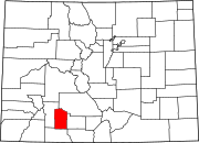 | |
| Unincorporated community | ||
| Former town | ||
| ||
| International | |
|---|---|
| National | |
This Colorado state location article is a stub. You can help Wikipedia by expanding it. |