
Studsgård
Studsgaard | |
|---|---|
Railway town | |
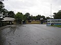
 Snejbjergvej in Studsgård | |
 Studsgaard Location in Central Denmark Region  Studsgaard Studsgaard (Denmark) | |
| Coordinates: 56°5′22″N 8°54′26″E / 56.08944°N 8.90722°E | |
| Country | Denmark |
| Region | Central Denmark Region |
| Municipality | Herning Municipality |
| Population (2024)[1] | 434 |
Studsgård is a small
Skanderborg-Skjern railway line and is served by Studsgård railway station.[2]
Gallery
-
 Momhøjvej
 -

-
 Studsgård Friskole
 -
 Studsgård Church
 -
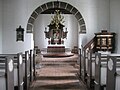 Studsgård Church


References
- ^ a b BY3: Population 1. January, by urban areas The Mobile Statbank from Statistics Denmark
- ^ "Studsgård Station" (in Danish). GoCollective. Retrieved 20 April 2024.
External links
Wikimedia Commons has media related to Studsgård.
- Studsgård local website (in Danish)
56°05′22″N 8°54′26″E / 56.089444°N 8.907222°E
This article about a location in the Central Denmark Region is a stub. You can help Wikipedia by expanding it. |