Sulu Range
Appearance
| Sulu Range | |
|---|---|
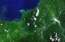
 Forested volcanoes of the Sulu Range, NASA Landsat image. | |
| Highest point | |
| Elevation | 610 m (2,000 ft) |
| Coordinates | 5°30′S 150°56′E / 5.500°S 150.933°E |
| Geography | |
| Location | New Britain, Papua New Guinea |
| Geology | |
| Mountain type | Stratovolcanoes |
| Last eruption | Unknown |
The Sulu Range is a small volcanic mountain range on the Papua New Guinean island of New Britain. It consists of a group of partially overlapping small stratovolcanoes and lava domes, with the highest point being 610 m (2,000 ft) Mount Malopu at the southwestern end of the range. Kaiamu, a maar at the northwestern end of the Sulu Range, forms a peninsula with a small lake extending about 1 km (0.62 mi) into Bangula Bay. Other volcanoes in the range include Mount Ululu, Mount Ruckenberg, Mount Talutu and Mount Ubia.[1]
The Sulu Range consists of
fumarolic vent, which was preceded by vegetation die-off, seismicity and dust-producing landslides.[1]
On the coastal plain west of the southwest base of the Sulu Range lies the Walo hydrothermal area, which consists of
solfataras and mudpots.[1] The fumaroles in this hydrothermal area have been used by locals for cooking food.[2]
See also
References
- ^ a b c "Sulu Range". Global Volcanism Program. Smithsonian Institution.
- ^ "Walo". VolcanoDiscovery. Retrieved 2020-11-22.
