
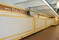
Susquehanna–Dauphin station
Susquehanna–Dauphin 39 | ||||||||||||||||||
|---|---|---|---|---|---|---|---|---|---|---|---|---|---|---|---|---|---|---|
| Construction | ||||||||||||||||||
| Structure type | Underground | |||||||||||||||||
| Accessible | Yes | |||||||||||||||||
| History | ||||||||||||||||||
| Opened | September 1, 1928 | |||||||||||||||||
| Previous names | Dauphin–Susquehanna (1928–1978) | |||||||||||||||||
| Services | ||||||||||||||||||
| ||||||||||||||||||
| ||||||||||||||||||
| Location | ||||||||||||||||||
 Susquehanna–Dauphin Location within Philadelphia | ||||||||||||||||||
Susquehanna–Dauphin station is a
City Hall station to Olney station.[4]
Until February 25, 1956, Trolley Routes 8 and
Kensington neighborhood.[5]
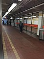
Station layout
Fares are collected at the center of the platforms on each side of the tracks, as there is no crossover built at this station.
Station mural
The station features a
ft (8.53 m) and 19 ft (5.79 m), respectively. Over 170 children between the ages of 6 and 16 contributed to the project, which was dedicated to the station on June 11, 1997.[6]
Gallery
-
 Station entrance
 -
 Platform south
 -
 Platform north
 -
 The platform of the Susquehanna–Dauphin Station
 -
 Center tracks


References
- ^ a b "Broad Street Line Map" (PDF). SEPTA. 2010-09-05. Retrieved 2010-10-30.
- ^ "Susquehanna-Dauphin Station". Google Maps. Retrieved 2007-11-19.
- ^ "Getting Around Philly on Public Transportation". Temple University School of Communications and Theater. Archived from the original on 2007-09-20. Retrieved 2007-11-19.
- ^ "Broad Street Subway". world.nycsubway.org. Retrieved 2007-11-19.
- ^ "SEPTA Route 39 Map" (PDF). SEPTA. 2010-09-05. Retrieved 2010-10-30.
- ^ Rice, Robin. "Platform Party". Philadelphia City Paper. Retrieved 2007-11-19.
External links
![]() Media related to Susquehanna–Dauphin (SEPTA station) at Wikimedia Commons
Media related to Susquehanna–Dauphin (SEPTA station) at Wikimedia Commons