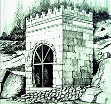
Taq-e Gara
| Taq-e Gara | |
|---|---|
Kermanshah Province, Iran | |
| Coordinates | 34°25′54″N 46°01′04″E / 34.4318°N 46.0177°E |
| Height | 11.7 m |
Taq-e Gara or some times Taq-e Shirin is a stone structure in
Kermanshah Province of Iran. This structure is located on the way from Kermanshah to Sarpol-e Zahab, on the 15th kilometer from Sarpol-e Zahab; beside an ancient paving which connects the Iranian Plateau to Mesopotamia.[1][2] Due to changes of the path, now it is located below the road slope.[3]
Design and construction
There are conflicting views as to the time of its construction.
Sassanid Empire
for a variety of reasons.
Access and attributes

The monument is located on the old road from Kermanshah to Qasr-e Shirin with the new road overlooking it. It is about a five hundred meters walk away from the main road.
See also
References
External links
Wikimedia Commons has media related to Taq-e Gara.
