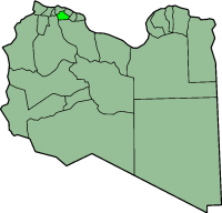
Tarhuna Municipality

Tarhunah Municipality (
Tarhuna Wa Msalata District
.
Tarhunah was brought to international attention in the 1990s, when it was believed that an underground
chemical weapons facility was being built there, following the discovery of a previous smaller above-ground facility at Rabta (Algeria
?).
See also
- Tarhuna Wa Msalata District
External links
- Reassessing Libya: an analysis from Jane's Nuclear, Biological and Chemical Defence
- U.S. Department of Defense news photo - artist's concept of the construction of the chemical weapons facility
32°26′1″N 13°38′5″E / 32.43361°N 13.63472°E
