
Timrå
Timrå | |
|---|---|
UTC+2 (CEST) | |
| Postal code | 860 xx |
| Area code | (+46) 60 |
| Website | www |
Timrå (ⓘ) is a locality and the seat of Timrå Municipality in Västernorrland County, Sweden with 10,443 inhabitants in 2010.[1]
It is located about 13 km north of Sundsvall (a town with a metropolitan area of some 100,000 inhabitants), and could arguably be considered a satellite to that town.
The two closest cities (Sundsvall and Härnösand) share one airport,
In Sweden, Timrå is mainly known for its ice hockey club Timrå IK, which, as of season 2023/24 plays in the Swedish top division SHL.
In 1995, Swedish artist Bengt Lindström constructed the Y, a 30 meter high sculpture located in Timrå.
Local legend says that Sörberge, on the north side of the town, is haunted by a tall man wearing a very large coat called 'Stor Bubbas'.
Climate
Timrå has historically had a subarctic climate, but it has in recent decades more resembled a cool-summer humid continental climate.
| Climate data for Sundsvall Airport (2002–2021); extremes since 1943; sunshine[2] 1961–1990
| |||||||||||||
|---|---|---|---|---|---|---|---|---|---|---|---|---|---|
| Month | Jan | Feb | Mar | Apr | May | Jun | Jul | Aug | Sep | Oct | Nov | Dec | Year |
| Record high °C (°F) | 11.0 (51.8) |
13.8 (56.8) |
15.2 (59.4) |
21.9 (71.4) |
27.4 (81.3) |
35.0 (95.0) |
33.0 (91.4) |
31.3 (88.3) |
27.2 (81.0) |
21.5 (70.7) |
14.0 (57.2) |
10.5 (50.9) |
35.0 (95.0) |
| Mean maximum °C (°F) | 5.3 (41.5) |
6.8 (44.2) |
11.5 (52.7) |
16.8 (62.2) |
22.2 (72.0) |
25.7 (78.3) |
27.8 (82.0) |
26.0 (78.8) |
21.1 (70.0) |
14.5 (58.1) |
8.8 (47.8) |
6.7 (44.1) |
28.8 (83.8) |
| Mean daily maximum °C (°F) | −2.5 (27.5) |
−1.2 (29.8) |
3.3 (37.9) |
8.6 (47.5) |
14.0 (57.2) |
18.8 (65.8) |
21.7 (71.1) |
20.0 (68.0) |
15.3 (59.5) |
8.3 (46.9) |
2.6 (36.7) |
−0.6 (30.9) |
9.0 (48.2) |
| Daily mean °C (°F) | −6.5 (20.3) |
−5.6 (21.9) |
−1.4 (29.5) |
3.5 (38.3) |
8.6 (47.5) |
13.5 (56.3) |
16.7 (62.1) |
15.6 (60.1) |
10.8 (51.4) |
4.6 (40.3) |
−0.4 (31.3) |
−4.1 (24.6) |
4.6 (40.3) |
| Mean daily minimum °C (°F) | −10.4 (13.3) |
−10.0 (14.0) |
−6.1 (21.0) |
−1.7 (28.9) |
3.2 (37.8) |
8.2 (46.8) |
11.7 (53.1) |
10.6 (51.1) |
6.2 (43.2) |
0.8 (33.4) |
−3.4 (25.9) |
−7.6 (18.3) |
0.1 (32.2) |
| Mean minimum °C (°F) | −22.5 (−8.5) |
−21.5 (−6.7) |
−17.4 (0.7) |
−7.4 (18.7) |
−3.0 (26.6) |
2.3 (36.1) |
6.1 (43.0) |
4.5 (40.1) |
−0.1 (31.8) |
−6.4 (20.5) |
−11.5 (11.3) |
−16.8 (1.8) |
−24.9 (−12.8) |
| Record low °C (°F) | −35.5 (−31.9) |
−34.8 (−30.6) |
−34.2 (−29.6) |
−20.0 (−4.0) |
−8.2 (17.2) |
−2.0 (28.4) |
1.9 (35.4) |
−0.6 (30.9) |
−7.7 (18.1) |
−15.2 (4.6) |
−22.1 (−7.8) |
−36.6 (−33.9) |
−36.6 (−33.9) |
| Average precipitation mm (inches) | 56.1 (2.21) |
31.7 (1.25) |
30.5 (1.20) |
27.6 (1.09) |
43.3 (1.70) |
46.9 (1.85) |
58.8 (2.31) |
72.5 (2.85) |
59.6 (2.35) |
63.6 (2.50) |
51.0 (2.01) |
59.1 (2.33) |
600.7 (23.65) |
| Average extreme snow depth cm (inches) | 38 (15) |
45 (18) |
43 (17) |
23 (9.1) |
0 (0) |
0 (0) |
0 (0) |
0 (0) |
0 (0) |
0 (0) |
9 (3.5) |
22 (8.7) |
52 (20) |
| Mean monthly sunshine hours | 43 | 81 | 135 | 185 | 259 | 287 | 267 | 215 | 142 | 98 | 57 | 34 | 1,803 |
| Source 1: SMHI Open Data for Sundsvall-Timrå flygplats, temperature[3] | |||||||||||||
| Source 2: SMHI Open Data for Stordala-Midlanda D, precipitation[4] | |||||||||||||
Notable citizens
- Lennart "Lillstrimma" Svedberg (1944–1972), ice hockey player
- Magdalena Forsberg (1967), cross country skier, biathlon
- Henrik Flyman, guitarist, composer, producer
- Henrik Forsberg (1967), cross country skier
- Mats Näslund (1959), ice hockey player
- Anna Olsson (1964), canoeist
- Anton Lander (1991), ice hockey player
Gallery
-
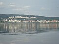 Timrå
Timrå -
 The municipal office
 -
 Town centre
 -
 Östrand pulp mill


References
- ^ a b c "Tätorternas landareal, folkmängd och invånare per km2 2005 och 2010" (in Swedish). Statistics Sweden. 14 December 2011. Archived from the original on 27 January 2012. Retrieved 10 January 2012.
- ^ "NOAA WMO Normals 1691–1990". National Oceanic & Atmospheric Administration.
- ^ "SMHI Open Data for Sundsvall-Timrå flygplats, temperature" (in Swedish). Swedish Meteorological and Hydrological Institute. Retrieved 10 May 2022.
- ^ "SMHI Open Data for Stordala-Midlanda D, precipitation" (in Swedish). SMHI. Retrieved 10 May 2022.
External links
Municipalities and seats of Västernorrland County | ||
|---|---|---|
| Municipalities | ||
| Municipal seats | ||
This article about a location in Västernorrland County, Sweden is a stub. You can help Wikipedia by expanding it. |