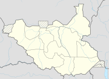
Tumbura Airport
Tumbura Airport | |||||||||||
|---|---|---|---|---|---|---|---|---|---|---|---|
| |||||||||||
| Coordinates | 05°36′00″N 27°28′21″E / 5.60000°N 27.47250°E | ||||||||||
| Map | |||||||||||
| Runways | |||||||||||
| |||||||||||
Tumbura Airport is an airport serving Tumbura in South Sudan.
Location
Tumbura Airport (
Juba International Airport, the largest airport in South Sudan.[1] The geographic coordinates of Tumbura Airport are: 5° 36' 0.00" N, 27° 28' 21.00"E (Latitude: 5.6000; Longitude: 27.4725). This airport is situated 680 metres (2,230 ft) above sea level. It has a single unpaved runway, which measures 1,247 metres (4,091 ft) in length.[2]
Overview
Tumbura Airport is a small civilian airport that serves the town of Tumbura and surrounding communities. There are no scheduled airline flights at Tumbura Airport.
See also
References
- ^ "Distance between Tambura (Al Wilayah al Istiwa'iyah) and Juba () (Airport) (Sudan)". distancecalculator.globefeed.com. Retrieved 2018-08-26.
- ^ "HSTU - Tumbura [Tumbura Airport], EW, SS - Airport - Great Circle Mapper". www.gcmap.com. Retrieved 2018-08-26.

