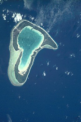
Tupai
 NASA picture of Tupai | |
| Geography | |
|---|---|
| Location | Pacific Ocean |
| Archipelago | Society Islands |
| Area | 11 km2 (4.2 sq mi) |
| Administration | |
| Overseas collectivity | French Polynesia |
| Administrative subdivision | Leeward Islands |
| Commune | Bora-Bora |
| Demographics | |
| Population | 0 (permanent) |
Tupai (
motus
on Tupai's reef. Tupai has no permanent residents apart from some workers in its coconut plantations. A private airfield was inaugurated on Tupai in 2001, and its use is restricted.
Administration
The atoll of Tupai belongs administratively to the commune of Bora Bora.
In 1926 the island was considered for settling a small community of Slovak colonists but was later dropped in favor of the Marquesas Islands[citation needed]
External links
16°17′S 151°50′W / 16.283°S 151.833°W
