
Twin Peaks (Alaska)
| Twin Peaks | |
|---|---|
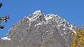
.jpg) Twin Peaks seen from near Eklutna Lake | |
| Highest point | |
| Elevation | 5,840+ ft (1,780+ m)[1] |
| Prominence | 1,378 ft (420 m)[1] |
| Parent peak | Bashful Peak (8,005 ft) |
| Coordinates | 61°26′41″N 149°08′40″W / 61.44472°N 149.14444°W[1] |
| Geography | |
 Twin Peaks Location of Twin Peaks in Alaska | |
| Location | class 3-4 |
Twin Peaks are a 5,840+ ft (1,780+ m)
Anchorage, 11 mi (18 km) south of Palmer, and 2.5 mi (4 km) north of Eklutna Lake. East Twin Peak is the higher of the two, West Twin Peak is 5,472-foot (1,668 m), and Goat Rock is a 5249+ ft crag immediately west of both.[2][3] The nearest higher peak is Pioneer Peak, 4.26 mi (7 km) to the northeast.[1] Twin Peaks' descriptive name was reported by the United States Geological Survey in 1960, but the mountain was originally known as Lach Q'a in the Denaʼina language.[4] Climbing the mountain involves scrambling
with dangerous loose rock. The trailhead for the Twin Peaks Trail is located at the end of Eklutna Lake Road near the boat launch; however, the trail ends far short of the summit.
Climate
Based on the Köppen climate classification, Twin Peaks are located in a subarctic climate zone with long, cold, snowy winters, and mild summers.[5] Temperatures can drop below −20 °C with wind chill factors below −30 °C. Precipitation runoff from the peak drains into tributaries of the Knik River.
See also
Gallery
-
 Left to right: Goat Rock, West Twin, East Twin
 -
 East Twin Peak
 -
 From the northwest at Reflections Lake
 -
 Twin Peaks from end of the trail
 -
 Northwest aspect
 -
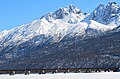 From bridge over Knik River


.jpg)


References
- ^ a b c d "East Twin Peak, Alaska". Peakbagger.com. Retrieved 2019-06-04.
- ^ "West Twin Peak". Peakbagger.com. Retrieved 2019-06-04.
- ^ "Goat Rock, Alaska". Peakbagger.com. Retrieved 2019-06-04.
- ^ "East Twin Peak". Geographic Names Information System. United States Geological Survey, United States Department of the Interior. Retrieved 2019-06-04.
- ISSN 1027-5606.
External links
- Twin Peaks weather: Mountain Forecast