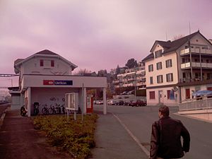
Uerikon railway station
Uerikon | ||||||||||||||||
|---|---|---|---|---|---|---|---|---|---|---|---|---|---|---|---|---|
 The station building in 2008 | ||||||||||||||||
| General information | ||||||||||||||||
| Location | Stationstrasse Uerikon, Stäfa, Zürich Switzerland | |||||||||||||||
| Coordinates | 47°14′9.2″N 8°45′7.6″E / 47.235889°N 8.752111°E | |||||||||||||||
| Elevation | 426 m (1,398 ft) | |||||||||||||||
| Owned by | Swiss Federal Railways | |||||||||||||||
| Line(s) | ||||||||||||||||
| Distance | 28.9 km (18.0 mi) from Zürich Hauptbahnhof[1] | |||||||||||||||
| Platforms | 1 island platform | |||||||||||||||
| Tracks | 2 | |||||||||||||||
| Train operators | Swiss Federal Railways | |||||||||||||||
| Connections | ||||||||||||||||
| Other information | ||||||||||||||||
| Fare zone | 143 (ZVV)[3] | |||||||||||||||
| Services | ||||||||||||||||
| ||||||||||||||||
| Location | ||||||||||||||||
 | ||||||||||||||||
Uerikon railway station (
Lake Zurich right-bank line. Uerikon station was also the junction for the former Uerikon–Bauma railway (UeBB), which between 1901 and 1948 linked Uerikon with Hombrechtikon, Bubikon, Hinwil, Bäretswil and Bauma.[4][1]
Services
As of the December 2021 timetable change,[update] the following services stop at Uerikon:[5][6][7]
- Zürich S-Bahn:
- S7: half-hourly service between Winterthur and Rapperswil
- S20: on weekdays, morning rush-hour service to Zürich Hardbrücke.
References
- ^ ISBN 978-3-89494-130-7.
- ^ "Regionalnetz" (PDF). Zürcher Verkehrsverbund. 12 December 2021. Retrieved 7 April 2022.
- ^ "Tarifzonen" (PDF) (in German). Zürcher Verkehrsverbund. 12 December 2021. Retrieved 7 April 2022.
- ^ map.geo.admin.ch (Map). Swiss Confederation. Retrieved 2012-03-08.
- ^ "S-Bahn trains, buses and boats" (PDF). ZVV. 9 December 2018. Retrieved 28 November 2019.
- ^ "Winterthur - Kloten - Zürich HB - Meilen - Rapperswil" (PDF) (in German). Bundesamt für Verkehr. 4 October 2021. Retrieved 9 April 2022.
- ^ "Zürich Hardbrücke - Zürich HB - Uerikon" (PDF) (in German). Bundesamt für Verkehr. 4 October 2021. Retrieved 9 April 2022.
External links
 Media related to Uerikon railway station at Wikimedia Commons
- Uerikon railway station – SBB
