
Uintah, Utah
Uintah, Utah | ||
|---|---|---|
FIPS code 49-77890[3] | | |
| GNIS feature ID | 1446835[4] | |
| Website | www | |
Uintah (
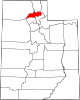
Geography
Uintah is located at the mouth of
Climate
This
History
Long before the first Anglo-Europeans came to Utah, the Uintah area was a favorite camping and hunting ground for Native Americans as they traveled through Weber Canyon. Archeological work has revealed Native American presence dating back at least 5,000 years. In fact, Uintah is named after the Weber Ute Band of Shoshone Indians which occupied the area at the time of white settlement.
The city was established in 1850.
| Census | Pop. | Note | %± |
|---|---|---|---|
| 1880 | 247 | — | |
| 1890 | 228 | −7.7% | |
| 1900 | 302 | 32.5% | |
| 1910 | 178 | −41.1% | |
| 1920 | 310 | 74.2% | |
| 1930 | 304 | −1.9% | |
| 1940 | 264 | −13.2% | |
| 1950 | 317 | 20.1% | |
| 1960 | 344 | 8.5% | |
| 1970 | 400 | 16.3% | |
| 1980 | 439 | 9.8% | |
| 1990 | 760 | 73.1% | |
| 2000 | 1,127 | 48.3% | |
| 2010 | 1,322 | 17.3% | |
| 2020 | 1,454 | 10.0% | |
| U.S. Decennial Census[7] | |||
Demographics
As of the
There were 365 households, out of which 42.2% had children under the age of 18 living with them, 72.6% were married couples living together, 3.8% had a female householder with no husband present, and 20.3% were non-families. 15.9% of all households were made up of individuals, and 6.8% had someone living alone who was 65 years of age or older. The average household size was 3.09 and the average family size was 3.51.
In the town the population was spread out, with 32.1% under the age of 18, 9.9% from 18 to 24, 27.3% from 25 to 44, 21.7% from 45 to 64, and 9.0% who were 65 years of age or older. The median age was 33 years. For every 100 females, there were 99.1 males. For every 100 females age 18 and over, there were 105.1 males.
The median income for a household in the town was $52,300, and the median income for a family was $54,519. Males had a median income of $45,903 versus $30,268 for females. The
See also
- List of cities and towns in Utah
References
- ^ "2019 U.S. Gazetteer Files". United States Census Bureau. Retrieved August 7, 2020.
- ^ "Population and Housing Unit Estimates". United States Census Bureau. May 24, 2020. Retrieved May 27, 2020.
- ^ a b c "U.S. Census website". United States Census Bureau. Retrieved January 31, 2008.
- ^ "US Board on Geographic Names". United States Geological Survey. October 25, 2007. Retrieved January 31, 2008.
- ^ §10-2-301[permanent dead link] of the Utah Code, last amended in 2003. Accessed 2008-06-14.
- ^ Climate Summary for Uintah, Utah
- ^ "Census of Population and Housing". Census.gov. Retrieved June 4, 2015.
External links
Places adjacent to Uintah, Utah | |
|---|---|
 | ||||
Town | ||||
| Townships | ||||
| CDPs | ||||
| Unincorporated communities | ||||
| ||||