
Umm er Rus
أم الرؤوس חורבת אום א-רוס | |
 Overturned stone covering at mouth of well | |
 Shown within Israel | |
| Alternative name | Khŭrbet Umm er Rûs (Arabic) / Horbat Bet Bad (Hebrew) |
|---|---|
| Location | |
| Region | Judaean Mountains |
| Coordinates | 31°41′20.9″N 35°01′16.76″E / 31.689139°N 35.0213222°E |
| Area | c. 15 dunams |
| Height | 443 m. |
| History | |
| Founded | unknown |
| Abandoned | unknown |
| Periods | Hellenistic, Roman, Byzantine |
| Site notes | |
| Excavation dates | none |
| Archaeologists | surveyed by Dani Weiss, Boaz Zissu, and Gideon Solimany |
| Condition | Ruin |
| Public access | yes |
In Arabic it is know as Umm er Rus (
History
The village, during Israel's
He (Vespasian) came to the toparchy of
Bethletephon. He then destroyed that place, and the neighboring places, by fire, and fortified, at proper places, the strong holds all about Idumaea; and when he had seized upon two villages, which were in the very midst of Idumaea, Betaris and Caphartobas, he slew above ten thousand of the people, and carried into captivity above a thousand, and drove away the rest of the multitude, and placed no small part of his own forces in them, who overran and laid waste the whole mountainous country.[4]
The site may have been resettled and destroyed a second time during the outbreak of hostilities under Hadrian, a time of great upheaval and unrest in Judea, as described by Cassius Dio's Roman History.
Fifty of their most important outposts and nine hundred and eighty-five of their most famous villages were razed to the ground. Five hundred and eighty thousand men were slain in the various raids and battles, and the number of those that perished by famine, disease and fire was past finding out. Thus nearly the whole of Judaea was made desolate .[5]
In 1883 the
Description
.jpg)
The current ruin sits at a mean elevation of 443 metres (1,453 ft) above sea-level, sprawling over an area of about 15
Umm er Rus (southern site)


The southern site (31°41′00″N 35°01′16″E / 31.683454°N 35.021127°E), also known by the name Umm er Rus, is distanced 2.5 kilometers southeast of
Wine presses are noticeable on the site, cisterns, underground storage facilities, as well as a rock-cut, plastered ritual bath (mikveh), hewn in a trapezoidal manner and measuring approximately 3.1–3.6 x 3.6–4.1 m (10.1–11.8 x 11.8–13.4 ft.), connected to a large underground water reservoir (approximately 9 x 8 m).[13][14] The potsherds and fragments of a spindle-like bottle attest to a Jewish settlement in the 2nd century BCE to the 2nd century CE.[14]
The site has a history of being plagued by antiquities robbers.[15]
Further reading
- Vincent, H. (1898). "Une église à Oumm er Rous". JSTOR 44100398.
- Vincent, H. (1898). "Encore l'église à Oumm er Rous". Revue Biblique (in French). 8. Leuven: Peeters Publishers: 452–457.
Gallery
-
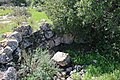
 Upturned stone covering of well
 -
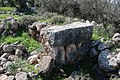
 Stone well-covering
 -
 Walled structure of old house
 -
 House ruins in Umm er Rus
 -
 Stone blocks used in wall of house
 -
 Hewn stone used as wall of house
 -
 General view of razed house
 -
 Old structure at the Umm er Rus ruin
 -
 Stones of razed house
 -
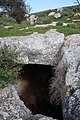 Cave-like pit (jīʻ) accessible from the side, at Umm er Rus (northern site)
 -
 Impression carved in rock, possibly a launderer's pool
 -
 Ancient burial tomb
 -
 Rock-cut tomb
 -
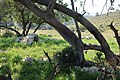 Dale near the Umm er Rus ruin
 -
 Road leading to ancient ruin (Khallat ez-Zeituna)


.jpg)


References
- ^ Palmer (1881), p. 330
- ^ Gottheil (1901), pp. 40–41
- ^ Robinson (1881), p. 342 (note 1), who places the village Um er Rûs to the immediate southeast of Beit Nettif. From Beit Nettif, Robinson describes the general area, saying (p. 341): "The whole tract is full of villages and deserted sites and ruins."
- ^ Josephus, The Jewish War (4.8.1. 4.440)
- Roman History, published in Vol. VIII of the Loeb Classical Libraryedition, 1925, Epitome of Book LXIX:14 (pp. 449–451)
- ^ Conder and Kitchener, 1883, SWP III, p.161
- ^ The Archaeological Survey of Israel, Israel Antiquities Authority, Umm er-Rus (northern site), Site no. 205
- ^ The Archaeological Survey of Israel, Israel Antiquities Authority, Umm er-Rus (southern site), Site no. 206
- ^ Macalister (1899), pp. 200–204.
- ^ Milik (1953), pp. 526-539
- ^ Klein (2018), Summary
- ^ Klein (2018), Summary
- ^ Zissu (2007), p. 1
- ^ a b Umm er-Rus, Amud-anan
- ^ Zissu (2007), p. 1
Bibliography
- Conder, C.R.; Kitchener, H.H. (1883). The Survey of Western Palestine: Memoirs of the Topography, Orography, Hydrography, and Archaeology. Vol. 3. London: Committee of the Palestine Exploration Fund.
- LCCN 16014703. Archived from the originalon 2007-09-21. Retrieved 15 February 2021.
- Klein, Eitan; Goldenberg, Gidon (2018). "Kh. Umm er-Rus (Horbat Bet Bad) Reconsidered: New Insights from an Underground Archaeological Survey". ISSN 2466-8583.
- .
- JSTOR 44091668.
- Palmer, E.H. (1881). The Survey of Western Palestine: Arabic and English Name Lists Collected During the Survey by Lieutenants Conder and Kitchener, R. E. Transliterated and Explained by E.H. Palmer. Committee of the Palestine Exploration Fund.
- Robinson, E.; Smith, E. (1841). Biblical Researches in Palestine, Mount Sinai and Arabia Petraea: A Journal of Travels in the year 1838. Vol. 2. Boston: Crocker & Brewster.
- JSTOR 26584460.
External links
- Survey of Western Palestine, 1880 Map, Map 17: IAA, Wikimedia commons, showing both the northern and southern sites of Umm er Rûs (appx. East longitude, 35.01; North latitude, 31.41)
- "Khirbat Umm er-Rûs", Hadashot Arkheologiyot, Excavations and Surveys in Israel, Boaz Zissu and Amir Ganor