
Vanderkloof Dam
| Vanderkloof Dam | ||
|---|---|---|
Annual generation 932 GWh (3,360 TJ)[3] | | |
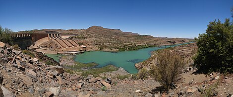
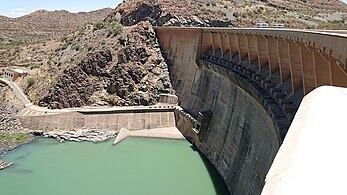
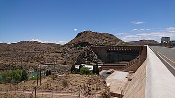
The Vanderkloof Dam (originally the P. K. Le Roux Dam) is situated approximately 130 km (81 mi) downstream from Gariep Dam and is fed by the Orange River, South Africa's largest river. Vanderkloof Dam is the second-largest dam in South Africa (in volume), having the highest dam wall in the country at 108 metres (354 ft). The dam was commissioned in 1977; it has a capacity of 3,187.557 million cubic metres (2,584,195 acre⋅ft) and a surface area of 133.43 square kilometres (51.52 sq mi) when full. Other rivers flowing into this dam are the Berg River, two unnamed streams coming in from the direction of Reebokrand, the Knapsak River, Paaiskloofspruit, Seekoei River, Kattegatspruit and the Hondeblaf River, in a clockwise direction.
The Town of VanderKloof has been established on the left bank of the dam, with the main town road entrance just up the way from the dam wall, with holiday resorts and parks, such as Rolfontein Nature Reserve (Photos Wiki Commons)
See also
- List of reservoirs and dams in South Africa
Gallery
-
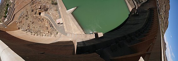
 Right side look onto the dam
 -

-
-

-
-
-

-
-


.jpg)
References
- ^ "Vanderkloof Dam". Retrieved 27 May 2009.
- ^ Department of Water Affairs and Forestry (South Africa). Retrieved 27 May 2009.
- ^ Eskom website
External links
- Vanderkloof Dam
- Vanderkloof Power Station on the Eskom-Website
This article about a hydroelectric power plant is a stub. You can help Wikipedia by expanding it. |
This article about a dam or floodgate in South Africa is a stub. You can help Wikipedia by expanding it. |