
Vernonia, Oregon
Vernonia, Oregon | ||
|---|---|---|
 Downtown Vernonia | ||
|
FIPS code 41-77250[5] | | |
| GNIS feature ID | 2412152[3] | |
| Website | www.vernonia-or.gov | |
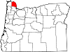
Vernonia is a city in
History
-
 Vernonia during the 2007 flooding
 -
 View of the Shay locomotive in Shay Park along Rock Creek in Vernonia


The community was first settled in 1874 by the Parker and Van Blaricom families. Cousins Judson Weed and Ozias Cherrington, both of Ohio, arrived in 1876. Sometime afterwards, the question of a name for the community came up, and Cherrington suggested the name of his daughter (Vernona) in Ohio, which was adopted. Due to a clerical error during the incorporation process, an "i" was inserted into the name. Cherrington died in a farming accident in 1894, never having seen his daughter since his departure from Ohio.[6]
Vernonia started to become more than an isolated farming community on July 10, 1924, when the Oregon-American Lumber Company opened a state-of-the-art
The city has been severely impacted by floods on multiple occasions. The rains that caused the
Community events
The Friendship Jamboree is an annual event inaugurated in 1957 and currently held on the first full weekend of August.[13]
Geography
According to the United States Census Bureau, the city has a total area of 1.66 square miles (4.30 km2), of which 1.61 square miles (4.17 km2) is land and 0.05 square miles (0.13 km2) is water.[14]
Climate
This region experiences warm (but not hot) and dry summers, with no average monthly temperatures above 71.6 °F (22.0 °C). According to the
| Climate data for Vernonia, Oregon, 1991–2020 normals, extremes 1967–present | |||||||||||||
|---|---|---|---|---|---|---|---|---|---|---|---|---|---|
| Month | Jan | Feb | Mar | Apr | May | Jun | Jul | Aug | Sep | Oct | Nov | Dec | Year |
| Record high °F (°C) | 66 (19) |
72 (22) |
79 (26) |
89 (32) |
99 (37) |
111 (44) |
104 (40) |
103 (39) |
103 (39) |
93 (34) |
73 (23) |
64 (18) |
111 (44) |
| Mean maximum °F (°C) | 55.2 (12.9) |
60.7 (15.9) |
68.3 (20.2) |
76.9 (24.9) |
84.7 (29.3) |
88.0 (31.1) |
93.4 (34.1) |
94.1 (34.5) |
89.4 (31.9) |
77.3 (25.2) |
61.7 (16.5) |
54.1 (12.3) |
97.4 (36.3) |
| Mean daily maximum °F (°C) | 45.7 (7.6) |
49.4 (9.7) |
53.6 (12.0) |
58.6 (14.8) |
65.5 (18.6) |
69.9 (21.1) |
77.3 (25.2) |
78.2 (25.7) |
73.1 (22.8) |
61.4 (16.3) |
50.6 (10.3) |
44.3 (6.8) |
60.6 (15.9) |
| Daily mean °F (°C) | 38.7 (3.7) |
40.2 (4.6) |
43.5 (6.4) |
47.1 (8.4) |
52.9 (11.6) |
57.2 (14.0) |
62.3 (16.8) |
62.5 (16.9) |
58.0 (14.4) |
49.8 (9.9) |
42.4 (5.8) |
37.8 (3.2) |
49.4 (9.6) |
| Mean daily minimum °F (°C) | 31.6 (−0.2) |
30.9 (−0.6) |
33.5 (0.8) |
35.6 (2.0) |
40.3 (4.6) |
44.4 (6.9) |
47.2 (8.4) |
46.9 (8.3) |
42.9 (6.1) |
38.3 (3.5) |
34.2 (1.2) |
31.3 (−0.4) |
38.1 (3.4) |
| Mean minimum °F (°C) | 18.5 (−7.5) |
19.7 (−6.8) |
24.1 (−4.4) |
27.4 (−2.6) |
30.7 (−0.7) |
35.3 (1.8) |
38.5 (3.6) |
37.7 (3.2) |
32.9 (0.5) |
25.8 (−3.4) |
21.6 (−5.8) |
18.6 (−7.4) |
12.4 (−10.9) |
| Record low °F (°C) | −2 (−19) |
−6 (−21) |
13 (−11) |
22 (−6) |
27 (−3) |
30 (−1) |
33 (1) |
32 (0) |
23 (−5) |
10 (−12) |
2 (−17) |
−7 (−22) |
−7 (−22) |
| Average precipitation inches (mm) | 6.94 (176) |
5.34 (136) |
5.30 (135) |
3.74 (95) |
2.39 (61) |
1.44 (37) |
0.39 (9.9) |
0.55 (14) |
1.79 (45) |
4.12 (105) |
7.70 (196) |
8.33 (212) |
48.03 (1,221.9) |
| Average snowfall inches (cm) | 0.3 (0.76) |
0.6 (1.5) |
0.0 (0.0) |
0.0 (0.0) |
0.0 (0.0) |
0.0 (0.0) |
0.0 (0.0) |
0.0 (0.0) |
0.0 (0.0) |
0.0 (0.0) |
0.0 (0.0) |
0.2 (0.51) |
1.1 (2.77) |
| Average precipitation days (≥ 0.01 in) | 20.0 | 16.8 | 19.5 | 17.4 | 12.4 | 9.5 | 3.7 | 3.5 | 7.8 | 14.8 | 19.8 | 20.0 | 165.2 |
| Average snowy days (≥ 0.1 in) | 0.2 | 0.2 | 0.0 | 0.0 | 0.0 | 0.0 | 0.0 | 0.0 | 0.0 | 0.0 | 0.0 | 0.1 | 0.5 |
| Source 1: NOAA[16] | |||||||||||||
| Source 2: National Weather Service[17] | |||||||||||||
Demographics
| Census | Pop. | Note | %± |
|---|---|---|---|
| 1900 | 62 | — | |
| 1910 | 69 | 11.3% | |
| 1920 | 142 | 105.8% | |
| 1930 | 1,625 | 1,044.4% | |
| 1940 | 1,412 | −13.1% | |
| 1950 | 1,521 | 7.7% | |
| 1960 | 1,089 | −28.4% | |
| 1970 | 1,643 | 50.9% | |
| 1980 | 1,785 | 8.6% | |
| 1990 | 1,808 | 1.3% | |
| 2000 | 2,228 | 23.2% | |
| 2010 | 2,151 | −3.5% | |
| 2020 | 2,374 | 10.4% | |
| U.S. Decennial Census[18][4] | |||
2010 census
As of the
There were 822 households, of which 35.5% had children under the age of 18 living with them, 52.6% were married couples living together, 11.1% had a female householder with no husband present, 5.8% had a male householder with no wife present, and 30.5% were non-families. 25.7% of all households were made up of individuals, and 8.9% had someone living alone who was 65 years of age or older. The average household size was 2.61 and the average family size was 3.09.[5]
The median age in the city was 38.2 years. 26.9% of residents were under the age of 18; 7.8% were between the ages of 18 and 24; 25.3% were from 25 to 44; 29.2% were from 45 to 64; and 10.8% were 65 years of age or older. The gender makeup of the city was 51.0% male and 49.0% female.[5]
2000 census
As of the census of 2000, there were 2,228 people, 789 households, and 583 families residing in the city. The population density was 1,444.2 inhabitants per square mile (557.6/km2). There were 880 housing units at an average density of 570.4 per square mile (220.2/km2). The racial makeup of the city was 95.38% White, 0.18% African American, 1.39% Native American, 0.49% Asian, 0.09% Pacific Islander, 0.54% from other races, and 1.93% from two or more races. Hispanic or Latino of any race were 2.24% of the population. 19.6% were of
There were 789 households, out of which 41.4% had children under the age of 18 living with them, 59.4% were married couples living together, 10.4% had a female householder with no husband present, and 26.0% were non-families. 20.9% of all households were made up of individuals, and 7.4% had someone living alone who was 65 years of age or older. The average household size was 2.82 and the average family size was 3.29.[5]
In the city, the population was spread out, with 34.0% under the age of 18, 6.5% from 18 to 24, 30.8% from 25 to 44, 18.9% from 45 to 64, and 9.8% who were 65 years of age or older. The median age was 32 years. For every 100 females, there were 99.5 males. For every 100 females age 18 and over, there were 99.3 males.[5]
The median income for a household in the city was $41,181, and the median income for a family was $48,563. Males had a median income of $37,447 versus $24,219 for females. The
Transportation
Public transit
Very limited
Airport
In popular culture
The December 2007 flooding in Vernonia was featured in the first season of the television show Ax Men.[25]
Vernonia has also appeared in several films, including Ring of Fire (1961),[26] The Vernonia Incident (1989),[27] Thumbsucker (2005),[28] Tillamook Treasure (2006),[29] The Water Man (2020),[30] and Twilight (2008).
See also
References
- ^ "Mayor and City Council - City of Vernonia". vernonia-or.gov. Retrieved December 30, 2019.
- ^ "ArcGIS REST Services Directory". United States Census Bureau. Retrieved October 12, 2022.
- ^ a b U.S. Geological Survey Geographic Names Information System: Vernonia, Oregon
- ^ a b "Census Population API". United States Census Bureau. Retrieved October 12, 2022.
- ^ a b c d e f g h "U.S. Census website". United States Census Bureau. Retrieved December 21, 2012.
- ^ Lewis A. McArthur, Oregon Geographic names, fifth edition (Portland: Western Imprints, 1982), pp. 760f
- ^ KATU
- ^ "Guard Evacuates Flooded Oregon Town". KNX 1070 AM. Associated Press. 2007.[permanent dead link]
- ISBN 9780784412336. Archived from the originalon March 16, 2014.
- ^ "Voters support measure to build Vernonia school". The Oregonian. November 4, 2009. Retrieved March 8, 2015.
- ^ "An entire school district must be rebuilt | Catalyst". www.vernoniaschools.org. Archived from the original on December 28, 2010. Retrieved June 6, 2022.
- ^ "Vernonia celebrates opening of state-of-art new K-12 school to replace flood-ravaged buildings". August 22, 2012.
- ^ "Event Info". Archived from the original on August 4, 2017. Retrieved March 8, 2015.
- ^ "US Gazetteer files 2010". United States Census Bureau. Archived from the original on January 12, 2012. Retrieved December 21, 2012.
- ^ "Vernonia, Oregon". Weatherbase. CantyMedia. 2015. Retrieved October 1, 2015.
- ^ "U.S. Climate Normals Quick Access – Station: Vernonia #2, OR". National Oceanic and Atmospheric Administration. Retrieved December 30, 2022.
- ^ "NOAA Online Weather Data – NWS Portland". National Weather Service. Retrieved December 30, 2022.
- ^ "Census of Population and Housing". Census.gov. Retrieved June 4, 2015.
- ^ Bilderback, Ken (February 18, 2009). "All roads lead to Vernonia". Archived from the original on April 1, 2009. Retrieved March 13, 2010.
- ^ "Crown Zellerbach trail a jewel of a ride".
- ^ "2023 national recreation trails - Office of Communications (U.S. National Park Service)". www.nps.gov. Retrieved June 3, 2023.
- ^ a b "CC Rider: Nehalem Valley Fixed Route" (PDF). Columbia County Rider. March 31, 2013. Archived from the original (PDF) on August 28, 2013. Retrieved August 18, 2013.
- ^ "News and Current Events". Columbia County Rider. July 1, 2009. Archived from the original on July 8, 2011. Retrieved May 30, 2011.
- PDF. Federal Aviation Administration. Effective 8 April 2010.
- ^ Townsley, Nancy (October 30, 2009). "'Ax Men' features local loggers: Reality TV - Vernonia loggers appear on new History Channel show". The Forest Grove News-Times. Archived from the original on February 22, 2013. Retrieved November 17, 2012.
- ^ Ring of Fire (1961)
- ^ The Vernonia Incident (1989) (V)
- ^ Thumbsucker (2005)
- ^ The Tillamook Treasure (2006)
- ^ The Water Man (2020)
External links
- Entry for Vernonia in the Oregon Blue Book
- "Vernonia". The Oregon Encyclopedia.
- Vernonia history from VanNatta Forestry
 | ||||
| CDPs | ||||
| Other unincorporated communities | ||||
| ||||