
Washingtonville, Pennsylvania
Washingtonville, Pennsylvania | |
|---|---|
570 | |
| FIPS code | 42-81424 |
Washingtonville is a
History
The small borough is named after the first American president, George Washington.[4] Before the time of the town's founding during the Revolutionary War, Fort Bosley stood along the eastern backs of Chillisquaque Creek near its confluence with Mud Creek. During, the early 20th century, millionaire Frank DeLong would often visit the borough to get away from the city.[5] He ended up donating a school, which at the time was considered one of the best facilities in the country, to the town. He also turned the old Presbyterian Church into a memorial for his mother. Today, the old school building is now a nursing home, and the memorial still stands today, containing many historical artifacts. Recently, the remains of an 18th century log cabin were discovered at the corner of Front and Water Streets, suggesting early settlement of permanent residents.[6]
Geography

According to the
Demographics
| Census | Pop. | Note | %± |
|---|---|---|---|
| 1870 | 172 | — | |
| 1880 | 203 | 18.0% | |
| 1890 | 171 | −15.8% | |
| 1900 | 212 | 24.0% | |
| 1910 | 183 | −13.7% | |
| 1920 | 177 | −3.3% | |
| 1930 | 182 | 2.8% | |
| 1940 | 175 | −3.8% | |
| 1950 | 194 | 10.9% | |
| 1960 | 198 | 2.1% | |
| 1970 | 174 | −12.1% | |
| 1980 | 218 | 25.3% | |
| 1990 | 228 | 4.6% | |
| 2000 | 201 | −11.8% | |
| 2010 | 273 | 35.8% | |
| 2020 | 200 | −26.7% | |
| 2021 (est.) | 202 | [3] | 1.0% |
| Sources:[8][9][10] | |||
As of the
There were 82 households, out of which 29.3% had children under the age of 18 living with them, 50.0% were married couples living together, 11.0% had a female householder with no husband present, and 37.8% were non-families. 32.9% of all households were made up of individuals, and 6.1% had someone living alone who was 65 years of age or older. The average household size was 2.45 and the average family size was 3.18.
In the borough the population was spread out, with 24.4% under the age of 18, 10.0% from 18 to 24, 32.3% from 25 to 44, 23.9% from 45 to 64, and 9.5% who were 65 years of age or older. The median age was 35 years. For every 100 females there were 105.1 males. For every 100 females age 18 and over, there were 100.0 males.
The median income for a household in the borough was $35,278, and the median income for a family was $38,393. Males had a median income of $37,292 versus $17,500 for females. The
References
- ^ "2019 U.S. Gazetteer Files". United States Census Bureau. Retrieved July 28, 2020.
- ^ a b c "West Branch Chillisquaque Creek Topo Map, Montour County PA (Washingtonville Area)". TopoZone. Locality, LLC. Retrieved November 28, 2019.
- ^ a b c d "City and Town Population Totals: 2020—2021". Census.gov. US Census Bureau. Retrieved July 27, 2022.
- ^ J. H.Beers., Historical and Biographical Annals of Columbia and Montour Counties Pennsylvania, 1915
- ^ Lynn Reichen (January 10, 2010). "Frank DeLong made an impression". The Daily Item.
- ^ "Colonial-era building discovered in Pennsylvania town during demolition". WJACTV. CNN. Retrieved February 15, 2020.
- ^ Terrain and Satellite imagery.
- ^ "Census of Population and Housing". U.S. Census Bureau. Retrieved December 11, 2013.
- ^ a b "U.S. Census website". United States Census Bureau. Retrieved January 31, 2008.
- ^ "Incorporated Places and Minor Civil Divisions Datasets: Subcounty Resident Population Estimates: April 1, 2010 to July 1, 2012". Population Estimates. U.S. Census Bureau. Retrieved December 11, 2013.
External links
 Media related to Washingtonville, Pennsylvania at Wikimedia Commons
Municipalities and communities of Montour County, Pennsylvania, United States | ||
|---|---|---|
| Boroughs | 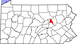 | |
| Townships | ||
| Unincorporated communities | ||
| ||
| International | |
|---|---|
| National | |