
Montour County, Pennsylvania
Montour County | |
|---|---|
 Montour County Courthouse in Danville | |
|
UTC−4 (EDT) | |
| Congressional district | 9th |
| Website | www |
Montour County is a county in the Commonwealth of Pennsylvania. As of the 2020 census, the population was 18,136.[1] Its county seat is Danville.[2] The county is named for Andrew Montour,[3] a prominent Métis interpreter who served with George Washington during the French and Indian War. It encompasses 132 sq mi, making it the smallest county by land area in the state.[4] The county is part of the Central Pennsylvania region of the state.[a]
Montour County is part of the Bloomsburg-Berwick, PA Metropolitan Statistical Area.
History
Fort Bosley, located near the present day border of Derry Township and the Borough of Washingtonville, was the county's only fortified location during the Revolutionary War.[5]
Geography
According to the
Climate
Montour has a humid continental climate (Dfa/Dfb) and average monthly temperatures in Danville range from 26.9 °F in January to 72.3 °F in July.[8]
Adjacent counties
- Lycoming County (north)
- Columbia County (east)
- Northumberland County (south & west)
Major highways
Geology


Montour County is located in the
The
There are three major
The
Demographics
| Census | Pop. | Note | %± |
|---|---|---|---|
| 1850 | 13,239 | — | |
| 1860 | 13,053 | −1.4% | |
| 1870 | 15,344 | 17.6% | |
| 1880 | 15,468 | 0.8% | |
| 1890 | 15,645 | 1.1% | |
| 1900 | 15,526 | −0.8% | |
| 1910 | 14,868 | −4.2% | |
| 1920 | 14,080 | −5.3% | |
| 1930 | 14,517 | 3.1% | |
| 1940 | 15,466 | 6.5% | |
| 1950 | 16,001 | 3.5% | |
| 1960 | 16,730 | 4.6% | |
| 1970 | 16,508 | −1.3% | |
| 1980 | 16,675 | 1.0% | |
| 1990 | 17,735 | 6.4% | |
| 2000 | 18,239 | 2.8% | |
| 2010 | 18,267 | 0.2% | |
| 2020 | 18,136 | −0.7% | |
| U.S. Decennial Census[9] 1790-1960[10] 1900-1990[11] 1990-2000[12] 2010-2017[13] 2010-2020[14] | |||
As of the
There were 7,085 households, out of which 30.00% had children under the age of 18 living with them, 56.30% were married couples living together, 8.90% had a female householder with no husband present, and 32.00% were non-families. 28.00% of all households were made up of individuals, and 12.00% had someone living alone who was 65 years of age or older. The average household size was 2.43 and the average family size was 2.98.
In Montour County, the population was spread out, with 24.40% under the age of 18, 6.40% from 18 to 24, 28.20% from 25 to 44, 24.00% from 45 to 64, and 17.10% who were 65 years of age or older. The median age was 40 years. For every 100 females, there were 90.50 males. For every 100 females age 18 and over, there were 86.00 males.
2020 census
| Race | Num. | Perc. |
|---|---|---|
White (NH)
|
16,105 | 88.8% |
Black or African American (NH)
|
320 | 1.7% |
Native American (NH)
|
27 | 0.2% |
Asian (NH)
|
668 | 3.7% |
Pacific Islander (NH)
|
0 | 0% |
Other/Mixed (NH)
|
529 | 3% |
Latino
|
487 | 2.7% |
Metropolitan Statistical Area
The
Economy
There are approximately 350 farms in Montour County. The majority of these farms produce beef, hogs, and dairy. Limestone is mined in some areas in the county.[7]
Government
| Year | Republican | Democratic | Third party | |||
|---|---|---|---|---|---|---|
| No. | % | No. | % | No. | % | |
| 2020 | 5,844 | 59.53% | 3,771 | 38.41% | 202 | 2.06% |
| 2016 | 5,288 | 61.80% | 2,857 | 33.39% | 411 | 4.80% |
| 2012 | 4,652 | 59.19% | 3,053 | 38.85% | 154 | 1.96% |
| 2008 | 4,574 | 56.64% | 3,364 | 41.65% | 138 | 1.71% |
| 2004 | 4,903 | 64.31% | 2,666 | 34.97% | 55 | 0.72% |
| 2000 | 3,960 | 60.97% | 2,356 | 36.27% | 179 | 2.76% |
| 1996 | 2,785 | 47.93% | 2,183 | 37.57% | 843 | 14.51% |
| 1992 | 3,096 | 46.58% | 2,150 | 32.35% | 1,400 | 21.07% |
| 1988 | 3,617 | 63.50% | 2,031 | 35.66% | 48 | 0.84% |
| 1984 | 4,174 | 66.81% | 2,055 | 32.89% | 19 | 0.30% |
| 1980 | 3,399 | 55.76% | 2,272 | 37.27% | 425 | 6.97% |
| 1976 | 3,259 | 53.65% | 2,727 | 44.89% | 89 | 1.47% |
| 1972 | 4,386 | 69.64% | 1,755 | 27.87% | 157 | 2.49% |
| 1968 | 3,289 | 55.04% | 2,239 | 37.47% | 448 | 7.50% |
| 1964 | 2,527 | 40.67% | 3,683 | 59.27% | 4 | 0.06% |
| 1960 | 4,154 | 61.17% | 2,629 | 38.71% | 8 | 0.12% |
| 1956 | 3,976 | 65.71% | 2,072 | 34.24% | 3 | 0.05% |
| 1952 | 3,725 | 62.12% | 2,264 | 37.76% | 7 | 0.12% |
| 1948 | 2,690 | 57.60% | 1,964 | 42.06% | 16 | 0.34% |
| 1944 | 2,727 | 55.12% | 2,212 | 44.71% | 8 | 0.16% |
| 1940 | 2,723 | 46.89% | 3,080 | 53.04% | 4 | 0.07% |
| 1936 | 2,350 | 39.74% | 3,534 | 59.76% | 30 | 0.51% |
| 1932 | 2,159 | 44.24% | 2,677 | 54.86% | 44 | 0.90% |
| 1928 | 3,692 | 71.69% | 1,445 | 28.06% | 13 | 0.25% |
| 1924 | 2,499 | 55.83% | 1,799 | 40.19% | 178 | 3.98% |
| 1920 | 2,296 | 53.76% | 1,872 | 43.83% | 103 | 2.41% |
| 1916 | 1,068 | 40.11% | 1,530 | 57.45% | 65 | 2.44% |
| 1912 | 308 | 10.98% | 1,492 | 53.19% | 1,005 | 35.83% |
| 1908 | 1,164 | 42.34% | 1,490 | 54.20% | 95 | 3.46% |
| 1904 | 1,518 | 51.37% | 1,358 | 45.96% | 79 | 2.67% |
| 1900 | 1,292 | 39.89% | 1,875 | 57.89% | 72 | 2.22% |
| 1896 | 1,384 | 42.65% | 1,747 | 53.84% | 114 | 3.51% |
| 1892 | 1,108 | 35.97% | 1,877 | 60.94% | 95 | 3.08% |
| 1888 | 1,289 | 39.91% | 1,865 | 57.74% | 76 | 2.35% |
Montour County has traditionally been heavily Republican, with it voting for every Republican presidential candidate since 1944, with the exception of Barry Goldwater. Donald Trump won it by just over 21% in 2020, down from his 28-point margin in 2016 and slightly better than Mitt Romney's margin in 2012.
The county is run by three locally elected commissioners, each of whose term of office lasts for four years.
State senate
State House of Representatives
- Mike Stender, Republican, Pennsylvania's 108th Representative District[20]
United States House of Representatives
United States Senate
- John Fetterman, Democratic
- Bob Casey, Jr., Democrat
Education

Central Susquehanna Intermediate Unit #16 provides a wide variety of services to children living in Montour County. These include early intervention, special education support services, driver education on road training, speech and hearing therapy and autistic support. Services for children during the preschool years are provided without cost to their families when the child is determined to meet eligibility requirements.[21]
Danville Area Head Start[22]
Public school districts
- Danville Area School District (also in Northumberland County)
- Warrior Run School District (also in Northumberland and Union Counties)
Private schools
As reported by the Pennsylvania Department of Education - EdNA. February 2014[23]
- Alternative Education Program - Danville
- Breezy Meadow - Danville [24]
- Chillisquaque Valley Parochial School - Bloomsburg
- County Line Parochial School - Danville
- Creek Side School[25] - Turbotville
- Danville Child Development Center - Danville
- Danville Mennonite School - Danville
- Delong Alternative Educ Program - Washingtonville
- Limestone Mennonite Parochial School - Milton
- Ridgeview Amish School - Watsontown
- St Cyril Kindergarten - Danville
- St Joseph School - Danville
- The Learning Tree Child Care Center, LLC - Danville
CSIU16 School Directory 2014 [26]
Library
- Thomas Beaver Free Library - Danville
Communities

Under Pennsylvania law, there are four types of incorporated municipalities: cities, boroughs, townships, and, in one case, towns. The following boroughs and townships are located in Montour County:
Boroughs
- Danville (county seat)
- Washingtonville
Townships
Unincorporated communities
- Exchange
- Kaseville
- Limestoneville
- Mausdale
- Mechanicsville
- Mexico
- Mooresburg
- Ottawa
- Ridgeville
Population ranking
The population ranking of the following table is based on the 2010 census of Montour County.[27]
† county seat
| Rank | City/Town/etc. | Municipal type | Population (2010 Census) |
|---|---|---|---|
| 1 | † Danville | Borough | 4,699 |
| 2 | Washingtonville | Borough | 273 |
See also
References
- ^ Includes Centre, Lycoming, Northumberland, Columbia, Mifflin, Union, Snyder, Clinton, Juniata and Montour Counties
- ^ "Census - Geography Profile: Montour County, Pennsylvania". United States Census Bureau. Retrieved December 18, 2022.
- ^ "Find a County". National Association of Counties. Retrieved June 7, 2011.
- ISBN 1-889037-11-7. Archived (PDF) from the original on October 9, 2022. Retrieved March 7, 2007., Andrew's mother.
ISBN refers to a 1999 reprint edition, URL is for the Susquehanna River Basin Commission's web page of Native American Place names, quoting and citing the book. Some older sources say the county was named for Madame Montour
- ^ The State Museum (April 12, 2013). "Montour County - Our Smallest County THIS WEEK IN PENNSYLVANIA ARCHAEOLOGY".
- ^ Buckalew, John M., Captain The Frontier Forts Within The North and West Branches of the Susquehanna River Pennsylvania. Read Before The Wyoming Historical And Geological, Society, October 1, 1895. Reprinted From The State Report, 1896. Wilkes-Barre, PA.: E. B. Yoruy, Printer. 1896 AccessGenealogy.com. Web. February 21, 2016.
- ^ "2010 Census Gazetteer Files". United States Census Bureau. August 22, 2012. Retrieved March 9, 2015.
- ^ a b c d e f Joseph J. Eckenrode (1985), Soil Survey of Montour County, Pennsylvania, retrieved July 15, 2013
- ^ "PRISM Climate Group at Oregon State University".
- ^ "U.S. Decennial Census". United States Census Bureau. Retrieved March 9, 2015.
- ^ "Historical Census Browser". University of Virginia Library. Retrieved March 9, 2015.
- ^ Forstall, Richard L., ed. (March 24, 1995). "Population of Counties by Decennial Census: 1900 to 1990". United States Census Bureau. Retrieved March 9, 2015.
- ^ "Census 2000 PHC-T-4. Ranking Tables for Counties: 1990 and 2000" (PDF). United States Census Bureau. April 2, 2001. Archived (PDF) from the original on October 9, 2022. Retrieved March 9, 2015.
- ^ "State & County QuickFacts". United States Census Bureau. Archived from the original on June 6, 2011. Retrieved November 20, 2013.
- ^ "Census 2020".
- ^ "U.S. Census website". United States Census Bureau. Retrieved January 31, 2008.
- ^ "P2 HISPANIC OR LATINO, AND NOT HISPANIC OR LATINO BY RACE – 2020: DEC Redistricting Data (PL 94-171) – Montour County, Pennsylvania".
- ^ "Office of Management and Budget | The White House". whitehouse.gov. Retrieved October 16, 2014.
- ^ "2010 Census". census.gov. Retrieved October 16, 2014.
- ^ Leip, David. "Dave Leip's Atlas of U.S. Presidential Elections". uselectionatlas.org. Retrieved December 26, 2020.
- ^ a b Center, Legislativate Data Processing. "Find Your Legislator". The official website for the Pennsylvania General Assembly. Retrieved May 11, 2017.
- ^ Central Susquehanna Intermediate Unit 16 Administration (2014). "About the CSIU". Archived from the original on October 29, 2014.
{{cite web}}: CS1 maint: numeric names: authors list (link) - ^ Danville Area School District Administration (2014). "Danville Head Start web site". Archived from the original on September 23, 2015. Retrieved February 6, 2014.
- ^ Pennsylvania Department of Education (February 6, 2014). "PDE Education Names and addresses".
- ^ "Entity Detail". Archived from the original on April 15, 2012. Retrieved November 3, 2011.
- ^ "Creek Side School in Turbotville, PA 17772". localschooldirectory.com. Retrieved October 16, 2014.
- ^ "CSIU16 School Directory 2014" (PDF). January 20, 2014. Archived from the original (PDF) on February 23, 2014.
- ^ "Decennial Census by Decades". www.census.gov. Retrieved November 29, 2018.
Municipalities and communities of Montour County, Pennsylvania, United States | ||
|---|---|---|
| Boroughs | 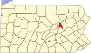 | |
| Townships | ||
| Unincorporated communities | ||
| ||
| International | |
|---|---|
| National | |
| Other | |