
Yachats River
| Yachats River | |
|---|---|
 Mouth of the Yachats River | |
| Location | |
| Country | United States |
| Physical characteristics | |
| Source | |
| • location | Central Oregon Coast Range |
| • elevation | 1,200 ft (370 m) |
| Mouth | |
• location | Pacific Ocean |
• elevation | sea level |
| Length | 15 mi (24 km) |
| Basin size | 44 sq mi (110 km2)[1] |
| Discharge | |
| • average | |
The Yachats River (native name meaning at the foot of the mountain.[3]
The river begins about 12 miles (19 km) east-south-east of
river bar
is normally very shallow, which allows the tide to change the length of the river as much as a mile.
Named tributaries from source to mouth are Grass Creek, School Fork, then Keller, Stump, and Neiglick creeks followed by the North Fork Yachats River. Below that come Axtell, Helms, Werner, Bend, Clear, Carlson, Dawson, Beamer, South Beamer, Marks, Reedy, and Salmon creeks.[4]
Gallery
-
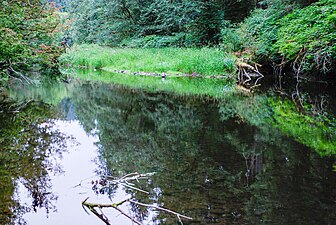
 Yachats River, July 2010.
 -
 Yachats River, July 2010.
 -
 Sitka spruce on Yachats River Road.


See also
- List of Oregon rivers
References
- Forest Service. 2006. p. 1. Retrieved 2006-08-20.
- word document). pp. Figure 11.3. Retrieved 2007-07-31.
- ^ "Oregon's Covered Bridges—North Fork of the Yachats Bridge". 2004-02-24. Retrieved 2006-08-20.
- ^ "United States Topographic Map". United States Geological Survey. Retrieved January 16, 2016 – via ACME Mapper. The map includes mile markers along the river as far upstream as Grass Creek.
44°18′30″N 124°06′28″W / 44.30836°N 124.10772°W
| International | |
|---|---|
| National | |
This Lane County, Oregon state location article is a stub. You can help Wikipedia by expanding it. |
This Lincoln County, Oregon state location article is a stub. You can help Wikipedia by expanding it. |