
Yarkand River
| Yarkand River | |
|---|---|
 Yarkand River | |
 | |
| Location | |
| Country | China |
| Province | Xinjiang |
| Physical characteristics | |
| Source | North Siachen Muztagh, Karakoram range at an Altitude of 7,462 m (24,482 ft) |
| • coordinates | 35°32′53″N 77°28′58″E / 35.547983°N 77.482907°E |
| 2nd source | East Siachen Muztagh, North Rimo Glacier |
| • coordinates | 35°29′17″N 77°26′52″E / 35.488°N 77.4479°E |
| 3rd source | Karakoram_Pass |
| • coordinates | 35°30′48″N 77°49′22″E / 35.51346°N 77.8227°E |
| • elevation | 5539 |
| Mouth | |
• location | Tarim River or Neinejoung River |
• coordinates | 38°25′00″N 77°21′36″E / 38.416667°N 77.36°E |
| Length | 1,332.25 km (827.82 mi) |
| Basin size | 98,900 km2 (38,200 sq mi) |
| Discharge | |
| • average | 210 m3/s (7,400 cu ft/s) |
| Basin features | |
| Progression | Yarkand |
| Tributaries | |
| • left | Shaksgam, Tashkurgan, Kashgar |
| • right | Aktagh River |
| Waterbodies | Altash Water Conservancy Project (Midstream Reservoir) |
| Yarkand River | |
|---|---|
| Uyghur name | |
Hanyu Pinyin | Yè'ěrqiāng Hé |
| Wade–Giles | Yeh4-erh3-ch'iang1 He2 |
| IPA | [jêàɚtɕʰjáŋ xɤ̌] |
The Yarkand River (or Yarkent River, Yeh-erh-ch'iang Ho) is a
A part of the river valley is known to the Kyrgyz people as Raskam Valley, and the upper course of the river itself is called the Raskam River.[1] Another name of the river is Zarafshan.[2] The area was once claimed by the ruler of Hunza.
Course
The river originates from the
Then Yarkand River flows north, through the
After this, the river turns northeast and enters the
Even though the river originally drained into the Tarim River, development along its course in recent decades has depleted its flow. During the period 1986 to 2000, it flowed into the Tarim River only once.[5]
The drainage area of Yarkand is 108,000 sq. km. It irrigates areas in
History
The ancient
With the Arab conquest of
It is possible that alternative trade routes developed after this time between Yarkand and
Gallery
-
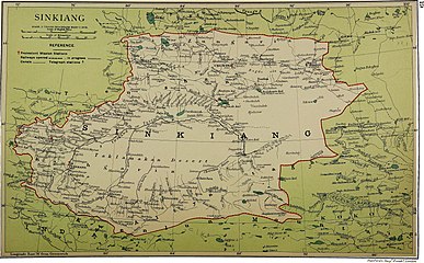 Map including Zerafshan R. and Raskem daria (1917)
 -
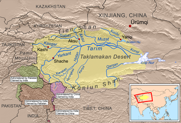 Rivers of the Tarim Basin
 -
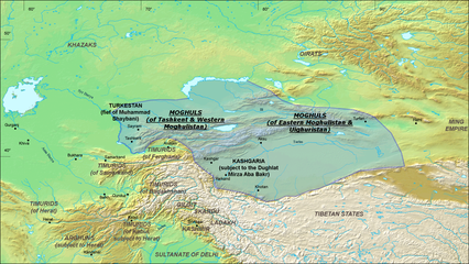 Moghulistan (Chagatai Khanate), 1490 AD
 -
 Map including part of the Yarkand River (labeled as YĀRKAND RIVER) (AMS, 1955)
 -
![Map including the Yarkand River (labeled as Yeh-erh-ch'iang Ho) and surrounding region from the International Map of the World (AMS, 1966)[a]](//upload.wikimedia.org/wikipedia/commons/thumb/a/ae/Txu-oclc-6654394-nj-43-5th-ed.jpg/215px-Txu-oclc-6654394-nj-43-5th-ed.jpg) Map including the Yarkand River (labeled as Yeh-erh-ch'iang Ho) and surrounding region from the International Map of the World (AMS, 1966)[a]
Map including the Yarkand River (labeled as Yeh-erh-ch'iang Ho) and surrounding region from the International Map of the World (AMS, 1966)[a] -
 Map including part of the Yarkand River (Yeh-erh-ch'iang Ho) (ACIC, 1969)
 -
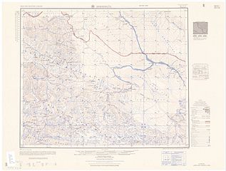
 Map including the upper reaches of the Yarkand River
 -
 Yarkand River
 -
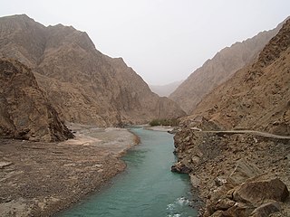
 Sheep on the bank of the Yarkand River
 -
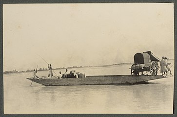 Ferry on the Yarkand River (1915)
 -
 Langar Bridge (兰干桥) on the Yarkand River
_p61_PLATE19._SINKIANG_(14597194848).jpg)

.png)

![Map including the Yarkand River (labeled as Yeh-erh-ch'iang Ho) and surrounding region from the International Map of the World (AMS, 1966)[a]](/File:Txu-oclc-6654394-nj-43-5th-ed.jpg)


Notes
- ^ From map: "DELINEATION OF INTERNATIONAL BOUNDARIES MUST NOT BE CONSIDERED AUTHORITATIVE"
References
- ISBN 81-85431-71-Xvol 1 p.22, in Google Books
- ^ NGIA GeoNames search
- ISBN 978-81-7024-946-7
- ^ "Hydro dam built to tame Yarkant River in Xinjiang". China Daily. 2019-09-06.
- ISBN 978-1-84339-501-0
- ISBN 978-94-017-8017-9
- ^ Harmatta 1996, pp. 492–493.
- ISBN 978-0-85728-821-9
- ^ Harmatta 1996, pp. 425–426.
- ^ Litvinsky 1996, pp. 374–375.
- ^ Dani 1998, p. 222.
- ^ Dani 1998, pp. 223, 224.
- ^ Pirumshoev & Dani 2003, pp. 238, 242.
- ^ Khan & Habib 2003, p. 330.
Bibliography
- ISBN 978-92-3-102846-5
- Litvinsky, B. A. (1996), History of Civilizations of Central Asia, Volume III: The crossroads of civilizations: A.D. 250 to 750 (PDF), UNESCO Publishing, ISBN 978-92-3-103211-0
- ISBN 978-92-3-103467-1
- Pirumshoev, H. S.; ISBN 978-92-3-103876-1
- Khan, Iqtidar A.; ISBN 978-92-3-103876-1
External links
- Yarkand River plotted on OpenStreetMap.