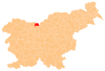
Zgornje Jezersko
Zgornje Jezersko | |
|---|---|
Carinthia | |
| Statistical region | Upper Carniola |
| Municipality | Jezersko |
| Area | |
| • Total | 40.97 km2 (15.82 sq mi) |
| Elevation | 889.3 m (2,917.7 ft) |
| Population (2002) | |
| • Total | 558 |
| [1] | |
Zgornje Jezersko (pronounced
Geographical features
The settlement is located in a high valley between the Karawanks mountain range in the north and the Kamnik–Savinja Alps in the south. The road from Kranj runs through the valley further up to Seeberg Saddle and the border with Austria.
Jezernica Creek, a tributary of the Kokra River, flows through Zgornje Jezersko. Other major geographical features in or bordering the settlement's territory include Lake Planšar (Planšarsko jezero), the Ravne Cirque (Ravenska kočna), the Makek Cirque (Makekova kočna), and Mount Kočna (2,540 meters or 8,330 feet), as well as mounts Grintovec, Skuta, and Storžič to the south. Mount Roblek (1,374 meters or 4,508 feet) stands due north of the village and is surrounded by the Roblek Pasture (Slovene: Roblekova planina, German: Roblekalm), the Anko Pasture (Ankova planina) with an abandoned Yugoslav border post, and the Rakež Pasture (Rakeževa planina). Anko Falls (Ankova slapova) is located immediately south of the Anko Pasture.
Churches

There are three churches in the settlement. Two of them, including the parish church, are dedicated to Saint Oswald. The older one, a chapel of ease above the village, was built around 1320. The larger 19th-century church is on the northern outskirts of the main settlement.[2]
St. Andrew's Church, another chapel of ease, is located in the hamlet of Ravne, northeast of the main settlement.[3]
References
- ^ Statistical Office of the Republic of Slovenia Archived November 18, 2008, at the Wayback Machine
- ^ Slovenian Tourist Board
- ^ Župnija Jezersko (Parish of Jezersko ) (in Slovene)
External links
 Media related to Zgornje Jezersko at Wikimedia Commons
- Zgornje Jezersko on Geopedia


