
Alburgh (village), Vermont
Alburgh, Vermont | ||
|---|---|---|
FIPS code 50-00850[2] | | |
| GNIS feature ID | 2378298[3] | |
| Website | villageofalburgh | |
Alburgh is a
History
The town in which this village is located was chartered in 1781 as "Alburgh". The town's name was changed in 1891 to "Alburg" by recommendation of the United States Board on Geographic Names, so it was that name adopted by Alburg Village when it was incorporated in 1917. By vote of village residents and approval by the Vermont Department of Libraries (in its capacity as the authority on Vermont place names), in 2006 its name reverted to the original spelling of Alburgh. As an incorporated village, it is administered by a publicly elected board of trustees.[6]
Geography
According to the United States Census Bureau, the village has a total area of 0.64 square miles (1.65 km2), all land.[7]
The community is located on U.S. Route 2 in the northwestern part of the town of Alburgh, on the eastern shore of Lake Champlain. US 2 leads north, then west over the lake to Rouses Point, New York, 5 miles (8 km) distant. Burlington, Vermont, is 46 miles (74 km) to the south via US 2 and Interstate 89. Alburgh village is 2.5 miles (4.0 km) south of the Canada–United States border via Vermont Route 225.
Demographics
| Census | Pop. | Note | %± |
|---|---|---|---|
| 1920 | 364 | — | |
| 1930 | 633 | 73.9% | |
| 1940 | 638 | 0.8% | |
| 1950 | 563 | −11.8% | |
| 1960 | 426 | −24.3% | |
| 1970 | 520 | 22.1% | |
| 1980 | 496 | −4.6% | |
| 1990 | 436 | −12.1% | |
| 2000 | 488 | 11.9% | |
| 2010 | 497 | 1.8% | |
| 2020 | 571 | 14.9% | |
| U.S. Decennial Census[8] | |||
As of the
There were 209 households, out of which 28.7% had children under the age of 18 living with them, 49.8% were married couples living together, 10.5% had a female householder with no husband present, and 38.8% were non-families. 33.5% of all households were made up of individuals, and 18.2% had someone living alone who was 65 years of age or older. The average household size was 2.33 and the average family size was 2.98.
In the village, the population was spread out, with 24.8% under the age of 18, 9.6% from 18 to 24, 25.8% from 25 to 44, 21.9% from 45 to 64, and 17.8% who were 65 years of age or older. The median age was 39 years. For every 100 females, there were 95.2 males. For every 100 females age 18 and over, there were 94.2 males.
The median income for a household in the village was $30,536, and the median income for a family was $39,792. Males had a median income of $27,917 versus $20,781 for females. The
Images
-
 Post office
 -
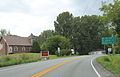 Sign on US2
 -
 Village offices


References
- ^ "2019 U.S. Gazetteer Files". United States Census Bureau. Retrieved August 7, 2020.
- ^ a b "U.S. Census website". United States Census Bureau. Retrieved January 31, 2008.
- ^ "US Board on Geographic Names". United States Geological Survey. October 25, 2007. Retrieved January 31, 2008.
- ^ Official map by the United States Census Bureau; Grand Isle County listed on page 3
- ^ "Census - Geography Profile: Alburg village, Vermont". United States Census Bureau. Retrieved December 26, 2021.
- ^ "Alburgh Village Office". www.alburghvt.org. Archived from the original on October 3, 2017. Retrieved March 16, 2018.
- ^ "Geographic Identifiers: 2010 Demographic Profile Data (G001): Alburg village, Vermont". U.S. Census Bureau, American Factfinder. Retrieved March 29, 2017.[dead link]
- ^ "Census of Population and Housing". Census.gov. Retrieved June 4, 2015.
External links
| Towns | ||
|---|---|---|
Village | ||
| CDP | ||
| ||