
Alburgh (town), Vermont
Alburgh, Vermont | ||
|---|---|---|
FIPS code 50-00625[2] | | |
| GNIS feature ID | 1456120[3] | |
| Website | alburghvt | |
Alburgh (formerly Alburg) is a
Name spelling change
The original name of the town, "Alburgh", was changed to "Alburg" in 1891 by recommendation of the United States Board on Geographic Names. The board recommended that all municipality names ending in "-burgh" be revised to end in "-burg" for the sake of standardization.[5] In April 2006, the Vermont Department of Libraries (in its capacity as the authority on Vermont place names) approved the town's request to change its name from Alburg back to Alburgh after a majority vote on town meeting day.[6]
European settlement of Alburgh Tongue and founding of Alburgh
A two-
In 1763 at the end of the French and Indian War, New France was ceded to Great Britain. General James Murray purchased the lands including Foucault's seigneurie, and his nephew Richard Murray granted a 99-year lease of the seigneurie to Colonel Henry Caldwell in 1774.[7]
Alburgh was charted February 23, 1781, by Ira Allen and 64 others. Allen paid for the charting, and the name of the town is probably derived from "Allensburgh".
In 1781 Allen was part of the commission that negotiated the Vermont–New York boundary, placing the Alburgh Tongue in Vermont. In 1783 the Canada–United States border was established at the 45th parallel north, making the Vermonter claims to the land undisputed.[8]
Geography
According to the United States Census Bureau, the town has a total area of 48.8 square miles (126.4 km2), of which 29.2 square miles (75.5 km2) are land and 19.7 square miles (51.0 km2), or 40.31%, are water.[9]
Alburgh is one of only
Demographics
| Census | Pop. | Note | %± |
|---|---|---|---|
| 1790 | 446 | — | |
| 1800 | 750 | 68.2% | |
| 1810 | 1,106 | 47.5% | |
| 1820 | 1,172 | 6.0% | |
| 1830 | 1,239 | 5.7% | |
| 1840 | 1,344 | 8.5% | |
| 1850 | 1,568 | 16.7% | |
| 1860 | 1,793 | 14.3% | |
| 1870 | 1,716 | −4.3% | |
| 1880 | 1,614 | −5.9% | |
| 1890 | 1,390 | −13.9% | |
| 1900 | 1,474 | 6.0% | |
| 1910 | 1,211 | −17.8% | |
| 1920 | 1,491 | 23.1% | |
| 1930 | 1,609 | 7.9% | |
| 1940 | 1,623 | 0.9% | |
| 1950 | 1,402 | −13.6% | |
| 1960 | 1,123 | −19.9% | |
| 1970 | 1,271 | 13.2% | |
| 1980 | 1,352 | 6.4% | |
| 1990 | 1,362 | 0.7% | |
| 2000 | 1,952 | 43.3% | |
| 2010 | 1,998 | 2.4% | |
| 2020 | 2,106 | 5.4% | |
| U.S. Decennial Census[10] | |||
As of the
There were 791 households, out of which 31.2% had children under the age of 18 living with them, 55.4% were married couples living together, 7.8% had a female householder with no husband present, and 33.1% were non-families. 26.2% of all households were made up of individuals, and 11.8% had someone living alone who was 65 years of age or older. The average household size was 2.47 and the average family size was 2.97.
In the town, the population was spread out, with 25.4% under the age of 18, 7.2% from 18 to 24, 28.8% from 25 to 44, 24.6% from 45 to 64, and 14.0% who were 65 years of age or older. The median age was 38 years. For every 100 females, there were 100.8 males. For every 100 females age 18 and over, there were 99.0 males.
The median income for a household in the town was $33,148, and the median income for a family was $39,783. Males had a median income of $30,655 versus $23,750 for females. The
Notable people
- Jeptha Bradley (1802–1862), Vermont Auditor of Accounts, served as U.S. Customs Inspector in Alburgh
- Barbour Lewis (1818–1893), US congressman from Tennessee, born in Alburgh
- Norman Albert Mott (1855–1920), member of the Mississippi Legislature; born in Alburgh
Images
-
 Post office
 -
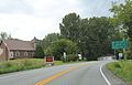 Sign on US2


References
- ^ "2018 U.S. Gazetteer Files". United States Census Bureau. Retrieved February 16, 2020.
- ^ a b "U.S. Census website". United States Census Bureau. Retrieved January 31, 2008.
- ^ "US Board on Geographic Names". United States Geological Survey. October 25, 2007. Retrieved January 31, 2008.
- ^ "Census - Geography Profile: Alburgh town, Grand Isle County, Vermont". United States Census Bureau. Retrieved December 27, 2021.
- ^ United States Board on Geographic Names (1892). First report of the United States Board on Geographic Names. 1890–1891. U.S. Govt. Print. Off. p. 8. Retrieved August 4, 2010.
- ^ "Burlington Free Press article, April 19, 2006 (subscription required)".
- ^ Clarenceville, Quebec, Rootsweb.com
- ^ Allburgh, Vermont VirtualVermont.com (from Esther Munroe Swift's "Vermont Place-Names: Footprints of History")
- ^ "Geographic Identifiers: 2010 Demographic Profile Data (G001): Alburg town, Grand Isle County, Vermont". U.S. Census Bureau, American Factfinder. Retrieved March 28, 2017.[dead link]
- ^ "U.S. Decennial Census". United States Census Bureau. Retrieved May 16, 2015.
External links
| Towns | ||
|---|---|---|
Village | ||
| CDP | ||
| ||