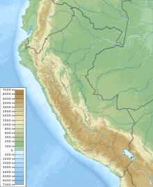
Alférez FAP Alfredo Vladimir Sara Bauer Airport
Alférez FAP Vladimir Sara Bauer Airport Andoas Airport | |||||||||||
|---|---|---|---|---|---|---|---|---|---|---|---|
| |||||||||||
| Coordinates | 2°47′45″S 76°28′00″W / 2.79583°S 76.46667°W | ||||||||||
| Map | |||||||||||
| Runways | |||||||||||
| |||||||||||
Alférez FAP Alfredo Vladimir Sara Bauer Airport (official name Alférez FAP Vladimir Sara Bauer Airport) (
Loreto Region of Peru. It is currently not served by any scheduled airline but it is by private and charter airlines. The airport is less than 1 kilometre (0.62 mi) in from the Pastaza River and is 20 kilometres (12 mi) downstream from the Peruvian border with Ecuador
.
The airport is named after Vladimir Enrique Sara Bauer,[clarification needed] who died in a helicopter accident on October 6, 1977.
Airlines and Destinations
| Airlines | Destinations |
|---|---|
| Saeta Peru | Iquitos |
Accidents and incidents
- On May 5, 1998, the 1998 Occidental Petroleum Boeing 737 crash took place near the airport, when a chartered Boeing 737 crashed near the airport, killing 75 out of 88 occupants.
See also
References
- ^ Airport information for SPAS[usurped] from DAFIF (effective October 2006)
- ^ Airport information for SPAS at Great Circle Mapper.
External links
- Accident history for SPAS at Aviation Safety Network
- OurAirports - Andoas
- SkyVector Aeronautical Charts

