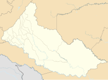
Araracuara Airport
Araracuara Airport | |||||||||||
|---|---|---|---|---|---|---|---|---|---|---|---|
| |||||||||||
| Coordinates | 0°36′03″S 72°23′53″W / 0.60083°S 72.39806°W | ||||||||||
| Map | |||||||||||
| Runways | |||||||||||
| |||||||||||
Source: GCM Aeronáutica Civil[3] | |||||||||||
Araracuara Airport (
Caquetá River, an eventual tributary of the Amazon River
.
The Araracuara non-directional beacon (Ident: ARA) is located just south of the airport.[6]
Airlines and destinations
| Airlines | Destinations |
|---|---|
| SATENA | Florencia, La Chorrera |
Accidents and incidents
- On 6 September 2014, ten people were killed when a twin-engine Piper PA-31 Navajo aircraft, a small passenger plane belonging to the Laser company, crashed in the Amazon rainforest near Puerto Santander after taking off from Araracuara Airport. Among those killed were two researchers from the Alexander von Humboldt Biological Resources Research Institute. There were no survivors.[7]
- On the first of May 2023, a Huitoto children, the only survivors of the crash, were found alive 40 days later.[9]
See also
References
- ^ Airport information for ACR at Great Circle Mapper.
- ^ "Araracuara Airport". HERE Maps. Retrieved 25 October 2018.
- Aeronáutica Civil. Archived from the original(PDF) on 4 May 2014. Retrieved 4 December 2015.
- ^ "Araracuara prison". The Culture Trip. 24 November 2017. Retrieved 25 October 2018.
- ^ Molano Jimeno, Alfredo (June 5, 2011). "La selva por cárcel". El Espectador (in Spanish). Retrieved May 18, 2023.
- ^ "Araracuara NDB". Our Airports. Retrieved 24 October 2018.
- ^ "Small passenger plane crashes in Colombian jungle, killing 10". BNO News. Archived from the original on 28 September 2014. Retrieved 26 December 2014.
- ^ "Accident Cessna U206G Stationair II HK-2803, 01 May 2023". aviation-safety.net. Retrieved 2023-06-10.
- ^ Missing children found alive in Colombian Amazon 40 days after plane crash
External links
- OpenStreetMap - Araracuara
- OurAirports - Araracuara Airport
- SkyVector - Araracuara
- Google Maps - Araracuara
- Accident history for Araracuara Airport at Aviation Safety Network


