
Bad Peterstal-Griesbach
You can help expand this article with text translated from the corresponding article in German. (February 2009) Click [show] for important translation instructions.
|
Bad Peterstal-Griesbach | |
|---|---|
 View to the village from the mountains | |
 Coat of arms | |
Location of Bad Peterstal-Griesbach within Ortenaukreis district 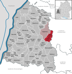 | |
 Bad Peterstal-Griesbach  Bad Peterstal-Griesbach | |
| Coordinates: 48°25′44″N 08°12′19″E / 48.42889°N 8.20528°E | |
| Country | Germany |
| State | Baden-Württemberg |
| Admin. region | Freiburg |
| District | Ortenaukreis |
| Government | |
| • Mayor (2018–26) | Meinrad Baumann[1] (Ind.) |
| Area | |
| • Total | 41.24 km2 (15.92 sq mi) |
| Elevation | 393 m (1,289 ft) |
| Population (2022-12-31)[2] | |
| • Total | 2,795 |
| • Density | 68/km2 (180/sq mi) |
| Time zone | UTC+01:00 (CET) |
| • Summer (DST) | UTC+02:00 (CEST) |
| Postal codes | 77740, 72250 (Zuflucht) |
| Dialling codes | 07806 |
| Vehicle registration | OG, BH, KEL, LR, WOL |
| Website | gemeinde |
Bad Peterstal-Griesbach (
Ortenau in Baden-Württemberg in Germany
.
Armistice for the German Empire
.
Two former military fortifications are located in Zuflucht, a village in Bad Peterstal-Griesbach: the Schwedenschanze (Zuflucht) and the Röschenschanze. They are two of the many military protection forces in the history of the Black Forest, which were created since the Thirty Years' War (1618–1648) mainly to repel French troops.[3]


See also
References
- ^ Aktuelle Wahlergebnisse, Staatsanzeiger, accessed 13 September 2021.
- Statistisches Landesamt Baden-Württemberg. June 2023.
- ^ "Schwarzwald Röschenschanze". www.schwarzwald-informationen.de. Retrieved 2021-01-17.
External links
- . Encyclopædia Britannica (11th ed.). 1911.
- Relief map of the Schwedenschanze and the Röschenschanze

| International | |
|---|---|
| National | |
This Ortenaukreis location article is a stub. You can help Wikipedia by expanding it. |