
Beaulieu River
| Beaulieu River | |
|---|---|
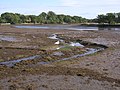
 The Beaulieu River at Longwater Lawn, near Lyndhurst | |
| Location | |
| Country | England |
| Region | Hampshire |
| District | New Forest |
| Physical characteristics | |
| Source | |
| • location | Lyndhurst, Hampshire |
| • coordinates | 50°52′47″N 1°34′55″W / 50.879746°N 1.582054°W |
| Mouth | |
• location | Needs Ore Point, Hampshire |
• coordinates | 50°46′16″N 1°23′30″W / 50.770997°N 1.391578°W |
| Length | 20 km (12 mi) |
| Basin features | |
| Tributaries | |
| • left | Beaulieu Abbey Stream |
| • right | Hatchet Stream |
The Beaulieu River (
Etymology
The current name, Beaulieu is
Course
The Beaulieu River rises near
Below Beaulieu village the river is navigable to small craft. Bucklers Hard was once a significant shipbuilding centre, building many wooden sailing ships, both merchant and naval, including Nelson's Agamemnon. Since 2000 the navigable channel at the entrance to the river has been marked by a lighthouse known as the Millennium Lighthouse or the Beaulieu River Beacon.[3][4]
Tributaries
The river has two main tributaries, the Beaulieu Abbey Stream to the left and the Hatchet Stream to the right. In addition there are a series of artificial lakes near the mouth of the river, known as the Black Lagoons.
Water quality
The Environment Agency measures the water quality of the river systems in England. Each is given an overall ecological status, which may be one of five levels: high, good, moderate, poor and bad. There are several components that are used to determine this, including biological status, which looks at the quantity and varieties of
The water quality of the Beaulieu River was as follows in 2019:
| Section | Ecological Status |
Chemical Status |
Overall Status |
Length | Catchment | Channel |
|---|---|---|---|---|---|---|
| Beaulieu River[6] | Good | Fail | Moderate | 20.0 km (12.4 mi) | 3.075 km2 (1.187 sq mi) | Heavily modified |
| Hatchet Stream[7] | Moderate | Fail | Moderate | 7.916 km (4.919 mi) | 9.523 km2 (3.677 sq mi) | Heavily modified |
| Beaulieu Abbey Stream[8] | Moderate | Fail | Moderate | 2.535 km (1.575 mi) | 2.253 km2 (0.870 sq mi) | Heavily modified |
| Black Lagoons[9] | Good | Fail | Moderate | 0.119 km2 (0.046 sq mi) | Artificial |
Film appearances
The river was used as a backdrop for some scenes of the 1966 film A Man for All Seasons – the tree-lined waters were used to portray the 16th century River Thames.[10]
Gallery
-
 The infant river upstream from Dunces Arch
 -
 The river passes beneath the railway, north of Fulliford Passage
 -
 Bend in the river near Pottern Ford
 -
 Alder trees in the river north of Fawley Ford
 -
 The Mill Dam at Beaulieu
 -
 The upper tidal limit of the river
 -
 The river between Beaulieu and Bucklers Hard
 -
 The river at Bucklers Hard
 -
 A yacht entering the river from the Solent
 -
 Millennium Lighthouse at the mouth of the river


.JPG)


References
- ^ Lewis, S. (1848) A Topographical Dictionary of England: Southampton County in British History Online
- ^ Plunkett, David (2014). "Eling and Beaulieu Tide Mills: Restoring and Learning from the Past" (PDF). Hampshire Industrial Archaeology Society. 22: 26–29. Retrieved 3 March 2021.
- ISBN 9781849657075.
- ^ "60 years in the New Forest". New Forest National Park Authority. Archived from the original on 8 September 2011. Retrieved 10 January 2013.
- ^ "Glossary (see Biological quality element; Chemical status; and Ecological status)". Catchment Data Explorer. Environment Agency. 17 February 2016.
 Text was copied from this source, which is available under an Open Government Licence v3.0. © Crown copyright.
- ^ "Beaulieu River". Catchment Data Explorer. Environment Agency.
- ^ "Hatchet Stream". Catchment Data Explorer. Environment Agency.
- ^ "Beaulieu Abbey Stream". Catchment Data Explorer. Environment Agency.
- ^ "Black Lagoons". Catchment Data Explorer. Environment Agency.
- ISBN 0812910532
External links
| Main rivers main tributaries & sub-tributaries |
|  | ||||||||||
|---|---|---|---|---|---|---|---|---|---|---|---|---|
| Canals and navigations | ||||||||||||
| Ordinary watercourses | ||||||||||||
| Lakes, ponds and wetlands | ||||||||||||
| Coast | ||||||||||||
50°46′N 1°24′W / 50.767°N 1.400°W
| International | |
|---|---|
| National | |