Berching
You can help expand this article with text translated from the corresponding article in German. (December 2021) Click [show] for important translation instructions.
|
Berching | |
|---|---|
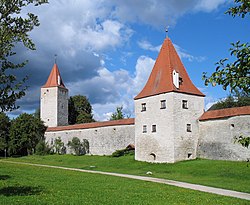
 Town walls of Berching | |
Location of Berching within Neumarkt in der Oberpfalz district  | |
Ortsteile | |
| Government | |
| • Mayor (2020–26) | Ludwig Eisenreich[1] (CSU) |
| Area | |
| • Total | 131.18 km2 (50.65 sq mi) |
| Elevation | 385 m (1,263 ft) |
| Population (2022-12-31)[2] | |
| • Total | 9,044 |
| • Density | 69/km2 (180/sq mi) |
| Time zone | UTC+01:00 (CET) |
| • Summer (DST) | UTC+02:00 (CEST) |
| Postal codes | 92334 |
| Dialling codes | 08462 |
| Vehicle registration | NM |
| Website | www.berching.de |
Berching (Bavarian: Bacham) is a town in the district of Neumarkt in Bavaria, Germany.
Berching is a historical town with a fully preserved town wall and low streamlet. The first settlement was registered in 883, so it is more than 1100 years old. Berching is located in the
Rhine-Main-Danube Canal, 20 km south of Neumarkt in der Oberpfalz. The old town or altstadt
is surrounded by a large wall interspaced with towers. One of the towers has been converted into a 6-story apartment. A small inn called the Blaue Traube is also located in the town center.

Residents
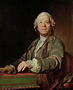
- Christoph Willibald Gluck, (1714-1787), composer, was born in Weidenwang, today a district of Berching
- Claudia Brücken, (born 1963), singer, member of the bands Propaganda, Act and Onetwo

References
- Bayerisches Landesamt für Statistik, 15 July 2021.
- ^ Genesis Online-Datenbank des Bayerischen Landesamtes für Statistik Tabelle 12411-003r Fortschreibung des Bevölkerungsstandes: Gemeinden, Stichtag (Einwohnerzahlen auf Grundlage des Zensus 2011) (Hilfe dazu).


