
Bjelašnica
| Bjelašnica | |
|---|---|
| Бјелашница | |
 The ski resort at Bjelašnica | |
| Highest point | |
| Elevation | 2,067 m (6,781 ft) |
| Coordinates | 43°42′14″N 18°15′25″E / 43.704°N 18.257°E |
| Geography | |
 Bjelašnica Location in BiH | |
| Location | |
| Parent range | Dinaric Alps |
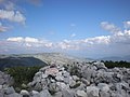
Bjelašnica (Serbian Cyrillic: Бјелашница, pronounced [bjělaːʃnit͡sa]) is a mountain in central Bosnia and Herzegovina. It is to the southwest of Sarajevo, bordering Mount Igman. Bjelašnica's tallest peak, by which the mountain group got its name, rises to an elevation of 2,067 metres (6,781 ft). Other notable peaks are Krvavac (2,061 m (6,762 ft)), Mali Vlahinja (2,055 m (6,742 ft)), and Hranisava (1,964 m (6,444 ft)). The Bjelašnica range is bordered by the Rakitnica in the south, the Neretva in the west, Mount Igman in the north-east and Mount Ivan in the north-west. Only at 20 minutes distance of Sarajevo, it is a tourist attraction for hiking and skiing.
Bjelašnica was, in certain areas, the site of extensive combat during the 1992–95 Siege of Sarajevo and particular areas pose a high mine risk. There are numerous trails set up and maintained by local mountain clubs that lead to the bald peaks higher up. The mountain is also visited by mountain bikers and has become a base for some paragliders.[citation needed]
Etymology
The mountain's name stems from the root bijel, which means "white".
Geology
Geologically, Bjelašnica is part of the Dinaric Alps and formed largely of secondary and tertiary sedimentary rock, mostly limestone and dolomite.
Climate and vegetation
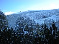
The white snow cupola of Bjelašnica is a familiar sight from the higher points in Sarajevo in the period from mid October until early June. Bjelašnica's base is largely forested with mostly beech, however there are no trees above the 1,500 metre tree line.
Bjelašnica has an alpine tundra climate (ET) with long, cold winters lasting for most of the year and short, cool summers. During winter, snowfall is extremely heavy and very constant, falling on most winter days.
| Climate data for Bjelašnica (1961–1990) | |||||||||||||
|---|---|---|---|---|---|---|---|---|---|---|---|---|---|
| Month | Jan | Feb | Mar | Apr | May | Jun | Jul | Aug | Sep | Oct | Nov | Dec | Year |
| Record high °C (°F) | 5.4 (41.7) |
5.3 (41.5) |
9.4 (48.9) |
13.8 (56.8) |
18.2 (64.8) |
21.0 (69.8) |
23.2 (73.8) |
22.0 (71.6) |
20.3 (68.5) |
15.9 (60.6) |
10.8 (51.4) |
8.8 (47.8) |
23.2 (73.8) |
| Mean daily maximum °C (°F) | −4.1 (24.6) |
−4.3 (24.3) |
−2.4 (27.7) |
0.8 (33.4) |
6.0 (42.8) |
9.9 (49.8) |
12.3 (54.1) |
12.4 (54.3) |
9.4 (48.9) |
5.1 (41.2) |
0.7 (33.3) |
−2.6 (27.3) |
3.6 (38.5) |
| Daily mean °C (°F) | −6.5 (20.3) |
−6.5 (20.3) |
−4.4 (24.1) |
−1.2 (29.8) |
3.8 (38.8) |
7.2 (45.0) |
9.5 (49.1) |
9.6 (49.3) |
6.8 (44.2) |
2.8 (37.0) |
−1.6 (29.1) |
−4.9 (23.2) |
1.2 (34.2) |
| Mean daily minimum °C (°F) | −8.8 (16.2) |
−8.7 (16.3) |
−6.5 (20.3) |
−3.1 (26.4) |
1.6 (34.9) |
4.7 (40.5) |
6.7 (44.1) |
7.0 (44.6) |
4.5 (40.1) |
0.6 (33.1) |
−3.7 (25.3) |
−7.2 (19.0) |
−1.1 (30.0) |
| Record low °C (°F) | −29.2 (−20.6) |
−26.2 (−15.2) |
−25.4 (−13.7) |
−19.0 (−2.2) |
−11.0 (12.2) |
−6.4 (20.5) |
−3.0 (26.6) |
−3.7 (25.3) |
−9.0 (15.8) |
−12.2 (10.0) |
−19.2 (−2.6) |
−26.8 (−16.2) |
−29.2 (−20.6) |
| Average precipitation mm (inches) | 78.0 (3.07) |
83.8 (3.30) |
84.4 (3.32) |
79.7 (3.14) |
88.1 (3.47) |
110.0 (4.33) |
84.2 (3.31) |
98.6 (3.88) |
95.9 (3.78) |
118.4 (4.66) |
110.6 (4.35) |
82.7 (3.26) |
1,114.5 (43.88) |
| Average precipitation days (≥ 0.1 mm) | 14.4 | 14.6 | 15.5 | 16.3 | 15.9 | 16.5 | 12.9 | 12.4 | 11.5 | 11.4 | 15.1 | 15.2 | 171.7 |
| Average relative humidity (%)
|
85.5 | 87.6 | 88.1 | 88.4 | 85.0 | 85.3 | 81.5 | 80.1 | 81.6 | 82.8 | 84.4 | 85.2 | 84.6 |
| Mean monthly sunshine hours | 90.4 | 82.7 | 110.6 | 126.7 | 162.6 | 167.6 | 229.9 | 218.0 | 177.3 | 149.4 | 96.1 | 82.8 | 1,694.2 |
| Percent possible sunshine | 32 | 29 | 30 | 32 | 36 | 37 | 50 | 51 | 48 | 45 | 34 | 30 | 39 |
| Source: MeteoBiH[1] | |||||||||||||
Weather station
Bjelašnica summit is easily recognized from the distance by the structures that have been erected on top of it. After the
1984 Winter Olympics
During the
Bosnian War (1992–95)
The strategic value of Bjelašnica summit, overlooking the Igman plateau, had already been recognized by the
However, Bjelašnica was usurped in the course of the
A major
The situation around the frontlines in nearby Treskavica and around Babin Dol, remained explosive with violent exchanges of hostilities between VRS and ARBiH units. The villages on the southern slopes of Bjelašnica, like Umoljani and Lukavac were not in the frontline, but sustained heavy damage from shelling. Discussion about real or alleged use by ARBiH forces of the Igman DMZ was an issue of constant contention, between UNPROFOR Commander General Michael Rose, ARBiH General Rasim Delić, and VRS Commander Ratko Mladić.[7]
By mid-1995, the military situation became very tense again, and in August 1995 the VRS launched another offensive, forcing UNPROFOR from the Bjelasnica ridge and advancing through Babin Dol towards Veliko Polje. However, after the second Markale shelling, on August, 30, NATO started Operation Deliberate Force, in which NATO aircraft engaged VRS Command & Control facilities and other targets.[8] Also the VRS-held radar station on Vlahinja ridge was completely destroyed during these air strikes that lasted until 14 September 1995, when the air strikes were suspended to allow the implementation of the withdrawal of VRS heavy weapons from the Sarajevo exclusion zone, effectively ending the Siege of Sarajevo.
Mine risks
Extensive
Gallery
-
 Bjelašnica summit as seen from Josipova Staze
 -
 View from Krvavac summit
 -
 View from Hranisava summit
 -
 View of Umoljani and the Bjelašnica main ridge from the trail above Rakitnica Canyon
 -
 Mount Bjelašnica (snowy peaks) view from Sarajevo


.JPG)
Bjelašnica Olympic Mountain Ski Centre
The Bjelašnica Olympic Mountain Ski Centre and its facilities are all located on the eastern slope of Bjelašnica main summit. There are 6 lifts, with one modern three-seat carrier lift departing from Babin Dol, three anchor lifts and two remaining single saucer lifts. Next to the original 3100 meter Olympic Downhill run and the Giant Slalom run there are four more pistes varying in length between 3200 and 550 meters and covering all difficulty levels between blue-red-black.[10] A lot of investment has been done to develop the Ski Centre and the Babin Dol area since the era directly following the Dayton Agreement, with another peak during the last couple of years. New hotels, apartment complexes and restaurants have turned this area into a modern ski resort. The latest redevelopment has seen the replacement of the old ski lift with two modern ski lifts and a state of the art snow production system, ready to operate for the 2017/2018 ski season. This was done as part of the preparations for the 2019 European Youth Olympic Winter Festival, which was hosted by Sarajevo and Istočno Sarajevo in February 2019.[11]
Hiking
The Bjelašnica range consists of basically three ridges, the Vlahinja ridge, the Strug ridge and a more southern ridge parallel to the Rakitnica and separated from the other ridges by a wide valley called Dugo Polje. A number of hikes exist in these mountains. One trail approaches the Bjelašnica main summit (2,067 m.) from the north and is called Josipova Staza after its most famous hiker: Josip Broz Tito.[12] From the main summit a ridge walk leads north-east towards the summit of Mala Vlahinja (2,055 m.). The last summit of this ridge in the west is called Hranisava (1,964 m.) and can be better ascended to by a trail starting in the hamlet of Lokve, between Hadžići and Pazarić. This offers a hike towards a view from this most western summit of the Bjelašnica range.[13] Another hike departs from Dugo Polje and leads via a difficultly retrieved trail through thick shrubs of Pinus Mugo the summit of Krvavac (2,061 m.). One of the hikes leads parallel to the Rakitnica Canyon, departing from Umoljani and ending at Lukomir, known to be the last all-year-through inhabited semi-nomadic settlement at this altitude in the Balkans.[14] There is quite a number of well equipped mountain huts to be found within this mountain group. Stanari P.D. (1,540 m.) is an excellent base for hikes in the central-western part of the mountain range. There are other mountain huts at Sitnik, Umoljani and Lukomir that might require prior reservation.[15]
See also
References
- ^ "Meteorlogical data for station Bjelašnica in period 1961–1990". Federal Hydrometeorological Service of the Federation of Bosnia and Herzegovina. Archived from the original on 1 May 2018. Retrieved 30 April 2018.
- ISBN 9958-9845-1-2.
- ^ 1984 Winter Olympics official report. pp. 18-23, 107.
- ^ Milos Stankovic: Trusted Mole page 192-193 Harper Collins London paperback ed 2001.
- ^ Mark A. Bucknam: Responsibility of Command, page 108-112, Air university Press, Alabama 2003.
- ^ Tariq Ali,Susan L.Woodward, a.o.: Masters of the Universe? NATO's Balkan Crusade , Ch 9. Building States from Nations by Susan L.Woodward, page 215, Verso, London/New York 2000.
- ^ Steven L. Burg, Paul S. Shoup: The War in Bosnia Herzegovina: Ethnic Conflict and International Intervention page 142-144 M.E. Sharpe Inc. New York 2000.
- ^ Mark A. Bucknam: Responsibility of Command, page 279-288, Air university Press, Alabama 2003.
- ^ BiH Mine Action Centre (Annually updated) Mine Map.
- ^ Listing of runs and facilities on the official site: Bjelasnica.ba
- ^ News article about the 2017 redevelopment klix.ba(In Bosnian) Retrieved 6 December 2017.
- ISBN 978-9958-630-59-0.
- ISBN 978-9958-630-59-0.
- ISBN 978-9958-630-59-0.
- ^ Listing of mountain huts at [www.behremplaninar.com].
External links
![]() Media related to Bjelašnica at Wikimedia Commons
Media related to Bjelašnica at Wikimedia Commons
- Summitpost page on Bjelašnica
- Bjelasnica.ba - official site
- History page of the website of the Hydro-Meteorological Service of the BiH Federation
