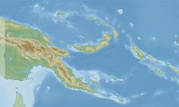
Bootless Inlet
Appearance
| Bootless Inlet | |
|---|---|
| Coordinates | 9°30′16″S 147°15′46″E / 9.504444°S 147.262778°E |
| Islands | Motupore Island, Loloata Island, Manunouha Island, and Bunamotu Island. |
Bootless Inlet or Bootless Bay is a body of water in south-eastern
barrier reef across the mouth of the inlet protects it from rough seas. Several small creeks empty into the bay, but no large rivers.[2]
History
During World War II, the Australian Army laid land mines along the shore of the inlet near Port Moresby, which later needed to be cleared by divers.[3]
Flora and fauna
Numerous species of fish, shellfish, and turtles may be found in Bootless Bay, and historical evidence indicates that dugongs and crocodiles were once present as well.[2] The islands within the bay are home to various species of reef corals and sponges.[4]
In 1989, Motupore Island was proposed as an
Wildlife Management Area.[5] There is a University of Papua New Guinea research station on the island.[6]
References
- ISBN 9789980848154.
- ^ .
- ^ Dann, Shannon (2013-06-14). "Divers have strong connections". The Singleton Argus. Retrieved 2019-02-04.
- ^ "Systematics and ecology of the sponges of Motupore Island, Papua New Guinea". Professor Patricia Bergquist. 1986.
{{cite journal}}: Cite journal requires|journal=(help)CS1 maint: others (link) - ISBN 9782831700694.
motupore island.
- ISBN 9782831700892.
External links

