
Bradfordsville, Kentucky
Bradfordsville, Kentucky | ||
|---|---|---|
FIPS code 21-09100 | | |
| GNIS feature ID | 0487792 | |
Bradfordsville is a home rule-class city in Marion County, Kentucky, in the United States. The population was 270 at the time of the 2020 census.[3]
History
The community at the site was first known as Centerville from its supposed location at the center of the state. (Having since gained the
Geography
Bradfordsville is located in southeastern Marion County at 37°29′43″N 85°8′54″W / 37.49528°N 85.14833°W (37.495328, -85.148452).
Bradfordsville is concentrated around the intersection of
Climate
| Climate data for Bradfordsville, Kentucky (1991–2020) | |||||||||||||
|---|---|---|---|---|---|---|---|---|---|---|---|---|---|
| Month | Jan | Feb | Mar | Apr | May | Jun | Jul | Aug | Sep | Oct | Nov | Dec | Year |
| Mean daily maximum °F (°C) | 43.7 (6.5) |
48.5 (9.2) |
57.8 (14.3) |
68.8 (20.4) |
77.1 (25.1) |
84.7 (29.3) |
87.8 (31.0) |
87.2 (30.7) |
81.9 (27.7) |
71.0 (21.7) |
58.2 (14.6) |
47.9 (8.8) |
67.9 (19.9) |
| Daily mean °F (°C) | 33.9 (1.1) |
37.0 (2.8) |
44.9 (7.2) |
54.9 (12.7) |
64.6 (18.1) |
72.4 (22.4) |
76.2 (24.6) |
74.8 (23.8) |
68.4 (20.2) |
56.9 (13.8) |
45.6 (7.6) |
37.9 (3.3) |
55.6 (13.1) |
| Mean daily minimum °F (°C) | 24.1 (−4.4) |
25.6 (−3.6) |
31.9 (−0.1) |
41.0 (5.0) |
52.1 (11.2) |
60.2 (15.7) |
64.7 (18.2) |
62.3 (16.8) |
55.0 (12.8) |
42.7 (5.9) |
32.9 (0.5) |
27.8 (−2.3) |
43.4 (6.3) |
| Average precipitation inches (mm) | 4.09 (104) |
4.25 (108) |
4.86 (123) |
4.85 (123) |
5.02 (128) |
4.99 (127) |
5.31 (135) |
3.85 (98) |
4.22 (107) |
2.96 (75) |
3.27 (83) |
4.73 (120) |
52.4 (1,331) |
| Average snowfall inches (cm) | 5.0 (13) |
5.0 (13) |
1.6 (4.1) |
0.0 (0.0) |
0.0 (0.0) |
0.0 (0.0) |
0.0 (0.0) |
0.0 (0.0) |
0.0 (0.0) |
0.0 (0.0) |
0.1 (0.25) |
2.8 (7.1) |
14.5 (37.45) |
| Source: NOAA[7] | |||||||||||||
Demographics
| Census | Pop. | Note | %± |
|---|---|---|---|
| 1860 | 186 | — | |
| 1870 | 155 | −16.7% | |
| 1880 | 150 | −3.2% | |
| 1890 | 179 | 19.3% | |
| 1900 | 301 | 68.2% | |
| 1910 | 330 | 9.6% | |
| 1920 | 298 | −9.7% | |
| 1960 | 387 | — | |
| 1970 | 338 | −12.7% | |
| 1980 | 331 | −2.1% | |
| 1990 | 199 | −39.9% | |
| 2000 | 304 | 52.8% | |
| 2010 | 294 | −3.3% | |
| 2020 | 270 | −8.2% | |
| U.S. Decennial Census[8] | |||
As of the
There were 133 households, out of which 29.3% had children under the age of 18 living with them, 39.1% were married couples living together, 12.0% had a female householder with no husband present, and 42.9% were non-families. 37.6% of all households were made up of individuals, and 14.3% had someone living alone who was 65 years of age or older. The average household size was 2.29 and the average family size was 2.97.
In the city, the population was spread out, with 25.7% under the age of 18, 10.9% from 18 to 24, 30.3% from 25 to 44, 18.8% from 45 to 64, and 14.5% who were 65 years of age or older. The median age was 35 years. For every 100 females, there were 83.1 males. For every 100 females age 18 and over, there were 88.3 males.
The median income for a household in the city was $16,125, and the median income for a family was $21,250. Males had a median income of $22,917 versus $17,500 for females. The
Notable people
- U. M. Rose, Arkansas lawyer
References
- ^ a b Commonwealth of Kentucky. Office of the Secretary of State. Land Office. "Bradfordsville, Kentucky". Accessed 26 August 2013.
- ^ a b "2022 U.S. Gazetteer Files: Kentucky". United States Census Bureau. Retrieved May 3, 2023.
- ^ a b "P1. Race – Bradfordsville city, Kentucky: 2020 DEC Redistricting Data (PL 94-171)". U.S. Census Bureau. Retrieved May 3, 2023.
- ^ University of Kentucky. Kentucky Atlas and Gazetteer. "Geographic Center of Kentucky". Accessed 5 October 2013.
- ^ Rennick, Robert. Kentucky Place Names, p. 34. University Press of Kentucky (Lexington), 1987. Accessed 1 August 2013.
- ^ "US Gazetteer files: 2010, 2000, and 1990". United States Census Bureau. February 12, 2011. Retrieved April 23, 2011.
- ^ "NOAA NCEI U.S. Climate Normals Quick Access". NOAA. Retrieved October 10, 2022.
- ^ "Census of Population and Housing". Census.gov. Retrieved June 4, 2015.
- ^ "U.S. Census website". United States Census Bureau. Retrieved January 31, 2008.
External links
 Media related to Bradfordsville, Kentucky at Wikimedia Commons
Municipalities and communities of Marion County, Kentucky, United States | ||
|---|---|---|
| Cities | 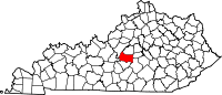 | |
| Unincorporated communities | ||
| ||
| International | |
|---|---|
| National | |