
Bridgeport, Washington
Bridgeport | ||
|---|---|---|
FIPS code 53-07870 | | |
| GNIS feature ID | 1503541[3] | |
| Website | City of Bridgeport | |
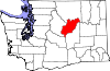
Bridgeport is a city in
History
The area that is now Bridgeport was settled in the late 19th century and originally named Westfield. Some of the earliest settlers in the area were Chinese miners extracting gold from the banks of the Columbia River.[4] Developers purchased the town in 1892 and renamed it Bridgeport after where they had come from, Bridgeport, Connecticut. The city of Bridgeport was officially incorporated on March 21, 1910. The biggest economic boom to come to the city came from the building of the massive Foster Creek Dam, later renamed the Chief Joseph Dam, just upstream from the city limits.[5]
Geography

Bridgeport is located at 48°0′22″N 119°40′18″W / 48.00611°N 119.67167°W (48.006238, -119.671540).[6]
According to the United States Census Bureau, the city has a total area of 1.05 square miles (2.72 km2), all of it land.[7] Bridgeport has over 1½ miles of Columbia River Waterfront that is within the City Limits. Bridgeport is currently experiencing expansion and development of waterfront properties with a re-newed energy.
Climate
Bridgeport is tied with
| Climate data for Chief Joseph Dam 1991–2020 normals, extremes 1949–present | |||||||||||||
|---|---|---|---|---|---|---|---|---|---|---|---|---|---|
| Month | Jan | Feb | Mar | Apr | May | Jun | Jul | Aug | Sep | Oct | Nov | Dec | Year |
| Record high °F (°C) | 64 (18) |
64 (18) |
78 (26) |
93 (34) |
103 (39) |
115 (46) |
110 (43) |
110 (43) |
103 (39) |
91 (33) |
75 (24) |
59 (15) |
115 (46) |
| Mean daily maximum °F (°C) | 34.3 (1.3) |
41.5 (5.3) |
54.2 (12.3) |
64.4 (18.0) |
73.8 (23.2) |
80.7 (27.1) |
90.9 (32.7) |
90.4 (32.4) |
79.9 (26.6) |
62.6 (17.0) |
45.4 (7.4) |
34.6 (1.4) |
62.7 (17.1) |
| Mean daily minimum °F (°C) | 22.7 (−5.2) |
25.0 (−3.9) |
31.5 (−0.3) |
37.8 (3.2) |
45.9 (7.7) |
52.0 (11.1) |
58.3 (14.6) |
57.5 (14.2) |
49.1 (9.5) |
38.3 (3.5) |
29.5 (−1.4) |
23.2 (−4.9) |
39.2 (4.0) |
| Record low °F (°C) | −19 (−28) |
−19 (−28) |
2 (−17) |
16 (−9) |
17 (−8) |
28 (−2) |
31 (−1) |
35 (2) |
29 (−2) |
10 (−12) |
−9 (−23) |
−19 (−28) |
−19 (−28) |
| Average precipitation inches (mm) | 1.42 (36) |
0.95 (24) |
1.05 (27) |
0.62 (16) |
0.92 (23) |
0.81 (21) |
0.48 (12) |
0.22 (5.6) |
0.35 (8.9) |
0.78 (20) |
1.16 (29) |
2.01 (51) |
10.77 (273.5) |
| Average snowfall inches (cm) | 8.5 (22) |
3.1 (7.9) |
0.6 (1.5) |
0 (0) |
0 (0) |
0 (0) |
0 (0) |
0 (0) |
0 (0) |
0 (0) |
2.2 (5.6) |
13.5 (34) |
27.9 (71) |
| Source: NOAA[9] | |||||||||||||
Demographics
| Census | Pop. | Note | %± |
|---|---|---|---|
| 1910 | 431 | — | |
| 1920 | 337 | −21.8% | |
| 1930 | 305 | −9.5% | |
| 1940 | 320 | 4.9% | |
| 1950 | 802 | 150.6% | |
| 1960 | 876 | 9.2% | |
| 1970 | 952 | 8.7% | |
| 1980 | 1,174 | 23.3% | |
| 1990 | 1,498 | 27.6% | |
| 2000 | 2,059 | 37.4% | |
| 2010 | 2,409 | 17.0% | |
| 2020 | 2,141 | −11.1% | |
| U.S. Decennial Census[10] | |||
2010 census
As of the
There were 673 households, of which 54.4% had children under the age of 18 living with them, 57.5% were married couples living together, 13.1% had a female householder with no husband present, 7.4% had a male householder with no wife present, and 22.0% were non-families. 15.9% of all households were made up of individuals, and 8.2% had someone living alone who was 65 years of age or older. The average household size was 3.58 and the average family size was 4.00.
The median age in the city was 25.6 years. 37.4% of residents were under the age of 18; 11.7% were between the ages of 18 and 24; 26% were from 25 to 44; 16.7% were from 45 to 64; and 8.3% were 65 years of age or older. The gender makeup of the city was 52.3% male and 47.7% female.
2000 census
As of the
There were 624 households, out of which 51.0% had children under the age of 18 living with them, 61.7% were married couples living together, 13.1% had a female householder with no husband present, and 20.2% were non-families. 17.1% of all households were made up of individuals, and 5.9% had someone living alone who was 65 years of age or older. The average household size was 3.30 and the average family size was 3.70.
In the city, the age distribution of the population shows 38.0% under the age of 18, 10.3% from 18 to 24, 28.1% from 25 to 44, 16.0% from 45 to 64, and 7.6% who were 65 years of age or older. The median age was 26 years. For every 100 females, there were 107.1 males. For every 100 females age 18 and over, there were 108.8 males.
The median income for a household in the city was $25,531, and the median income for a family was $26,086. Males had a median income of $22,333 versus $17,788 for females. The
Notable people
- Clyde Pangborn, pioneering aviator [12]
References
- ^ "2019 U.S. Gazetteer Files". United States Census Bureau. Retrieved August 7, 2020.
- ^ "Census Bureau profile: Bridgeport, Washington". United States Census Bureau. May 2023. Retrieved May 12, 2024.
- ^ "US Board on Geographic Names". United States Geological Survey. October 25, 2007. Retrieved January 31, 2008.
- ^ * Marshall, Maureen E. Wenatchee's Dark Past. Wenatchee, Wash: The Wenatchee World, 2008.
- ^ https://web.archive.org/web/20161202192711/http://www.usbr.gov/projects/Project.jsp?proj_Name=Chief+Joseph+Dam+Project. Archived from the original on December 2, 2016. Retrieved November 18, 2016.
{{cite web}}: Missing or empty|title=(help) - ^ "US Gazetteer files: 2010, 2000, and 1990". United States Census Bureau. February 12, 2011. Retrieved April 23, 2011.
- ^ "US Gazetteer files 2010". United States Census Bureau. Archived from the original on January 25, 2012. Retrieved December 19, 2012.
- ^ "Bridgeport State Park". Geographic Names Information System. United States Geological Survey, United States Department of the Interior. Retrieved April 7, 2013.
- ^ "NOAA NCEI U.S. Climate Normals Quick Access". National Oceanic and Atmospheric Administration. Retrieved July 16, 2021.
- ^ United States Census Bureau. "Census of Population and Housing". Retrieved October 5, 2013.
- ^ "U.S. Census website". United States Census Bureau. Retrieved December 19, 2012.
- ^ Long, Priscilla. "Pangborn, Clyde Edward (1894-1958)". History Link. University of Washington. Retrieved April 10, 2020.
External links
 | ||||
Towns | ||||
| Unincorporated communities | ||||
| Ghost towns | ||||
| Footnotes | ‡This populated place also has portions in an adjacent county or counties | |||
| International | |
|---|---|
| National | |