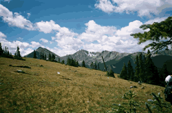
Byers Peak Wilderness
Appearance
| Byers Peak Wilderness | |
|---|---|
wilderness area)[1] | |
 | |
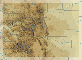
Location in United States | |
| Location | Grand County, Colorado, USA |
| Nearest city | Fraser, CO |
| Coordinates | 39°51′50″N 105°56′50″W / 39.86389°N 105.94722°W[2] |
| Area | 8,913 acres (36.07 km2) |
| Established | 1993 |
| Governing body | U.S. Forest Service |
| www | |
The Byers Peak Wilderness is a
References
- ^ Protected Planet Website- Retrieved March 29, 2023
- ^ "Byers Peak Wilderness". Geographic Names Information System. United States Geological Survey, United States Department of the Interior. Retrieved August 8, 2012.
- ^ "Byers Peak Wilderness". U.S. Forest Service. Retrieved August 8, 2012.
- ^ "Byers Peak Wilderness". Wilderness.net. Retrieved August 8, 2012.
External links
- U.S. Geological Survey Map at the U.S. Geological Survey Map Website. Retrieved March 29, 2023.


