
Cholupice
Cholupice | |
|---|---|
Cadastral subdivision of Prague 12 | |
UTC+2 (CEST ) | |
| Postal code | 143 00 |
Cholupice (
recreational airport
. The Cholupice Cemetery lies to the east.
Cholupice was, at one time, an independent municipality. The village of Točná was joined to Cholupice in 1960.[2] The municipality of Cholupice, including Točná, was amalgamated into the city of Prague in 1974. The local government in Cholupice was dissolved, and both villages were attached to the local government in Modřany,[3] which is now part of Prague 12.
Every year on April 30, near Ke Kálku street at the eastern end of the village, Cholupice hosts Prague's largest symbolic
Welcoming of Spring celebration (Czech: vítání jara), including the raising of a maypole, and a parade through the village wearing folk costumes (Czech
: kroj).
Photo gallery
-
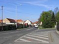 Podchýšská Street, towards Písnice
 -
 Memorial to the fallen of World War I
 -
 Lichá Street ("Odd Street") - there is no street in Prague named Sudá ("Even")


References
- ^ "Obyvatelstvo a rozloha katastrálních území Prahy 2001–2015". Czech Statistical Office. 2016-06-08.
- ^ M. Lašťovka, V. Ledvinka a kol.: Pražský uličník – Encyklopedie názvů pražských veřejných prostranství, 2. díl (O–Ž), Libri, Praha, 1998, p. 263, keyword „Točenská“
- ^ Jan Mareš: Praha 12-Modřany, Kronika, volební období 1981–1985[permanent dead link], MNV Praha-Modřany, chapter Vývoj zemědělství v Modřanech, source: Pamětní kniha MNV Točná
| Authority control databases: National |
|---|
This Prague location article is a stub. You can help Wikipedia by expanding it. |