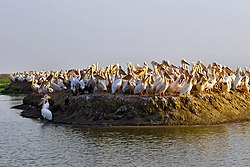
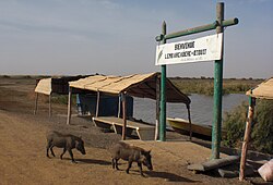
Djoudj National Bird Sanctuary
You can help expand this article with text translated from the corresponding article in French. (January 2009) Click [show] for important translation instructions.
|
| Djoudj National Bird Sanctuary | |
|---|---|
 | |
| Location | Senegal |
| Coordinates | 16°30′N 16°10′W / 16.500°N 16.167°W |
| Area | 160 km2 |
| Established | April 14, 1971 |
| Type | Natural |
| Criteria | vii, x |
| Designated | 1981 (5th session) |
| Reference no. | 25 |
| Region | Africa |
| Endangered | 1984–1988; 2000–2006 |
| Official name | Parc National des Oiseaux du Djoudj |
| Designated | 11 July 1977 |
| Reference no. | 138[1] |
The Djoudj National Bird Sanctuary (French: Parc national des oiseaux du Djoudj, [d͡ʒud͡ʒ]) lies on the southeast bank of the Senegal River in Senegal, in northern Biffeche, north east of St-Louis.
It provides a variety of
giant salvinia
plant, which threatens to choke out the park's native vegetation. However it was removed from the list in 2006.
Environmental issues
silting. The changes pose a threat to the fauna and flora. There has been in particular a proliferation of typhas and Phragmites
. To the left, satellite photos take by NASA in 1979 (before construction of the dam) and 1999 (afterwards) give evidence of the significant impact on the region's ecosystem.
In 2006, though no cases of
avian flu
had been reported in Senegal, a monitoring program was put into effect.
See also
References
- ^ "Parc National des Oiseaux du Djoudj". Ramsar Sites Information Service. Retrieved 25 April 2018.
- ^ "Expedition solves Aquatic Warbler mystery". BirdLife International. 22 February 2007. Archived from the original on 24 February 2007.
- WCMC Natural Site Data Sheet
- Official UNESCO website entry
- Ministère de l’Environnement, de la Protection de la nature, des Bassins de rétention et des Lacs artificiels: Parcs et réserves, 13 October 2005.


Wikimedia Commons has media related to Djoudj National Bird Sanctuary.


