
Dobbin, Texas

Dobbin is an
.Geography
Dobbin is located at 30°21′56″N 95°46′34″W / 30.36556°N 95.77611°W (30.3654842, -95.7760598 ). It is situated at the junction of
History
In 1878, the
Dobbin was home to 100 people and several businesses in 1915. By the late 1940s, the community had three churches, two schools, two sawmills, two factories, nine businesses, a railroad station, and a population of 175.[1] The number of residents fell to a low of 106 by the mid-1960s, but rose to 170 in the early 1970s. The population remained consistent throughout the latter half of the twentieth century.[1]
Despite its unincorporated status, Dobbin continues to have a functioning post office (zip code: 77333).[3]
Education
Public education in the community of Dobbin is provided by the Montgomery Independent School District, but used to be provided by the Dobbin Independent School District, that had only one operating school, first to fifth grade. In 1978, the Dobbin Independent School District was sold to the Montgomery Independent School District, for $150.
References
- ^ The Handbook of Texasonline. Retrieved May 22, 2009.
- ^ a b c "Dobbin, Texas". Texas Escapes Online Magazine. Retrieved May 22, 2009.
- ^ "Zip Code Lookup". Archived from the original on June 15, 2011.
External links
- U.S. Geological Survey Geographic Names Information System: Dobbin, Texas
- Dobbin, Texas from the Handbook of Texas Online
Municipalities and communities of Montgomery County, Texas, United States | ||
|---|---|---|
| Cities | 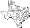 | |
| Towns | ||
| CDPs | ||
| Other communities | ||
| Ghost town | ||
| Footnotes | ‡This populated place also has portions in an adjacent county or counties | |
| ||