
Dunavant, Kansas

Dunavant is an unincorporated community in Jefferson County, Kansas, United States.[1]
History
A post office was opened in Dunavant in 1888, and remained in operation until it was discontinued in 1932.[2]
In 1910, Dunavant's population was 85 people.[3] In 1912, Dunavant had a money order Post Office and a telegraph office, and was on a branch of the Missouri Pacific Railroad.[4]
Battle of Hickory Point


The Battle of Hickory Point proceeded on September 13 and 14, 1856. On September 13, 1856,
With a small force of jayhawkers Lane attacked but was repulsed. Then Lane sent to Lawrence for artillery to drive the Border Ruffians out. Reinforcements led by Col. James A. Harvey arrived the next day, on September 14, 1856, and the skirmish ended with 4 Proslavery men wounded, 1 killed, and 5 Free-State men injured. Around 100 Free-Staters were detained by U.S. troops afterwards since the skirmish occurred after declaration issued by Territorial Governor John W. Geary directing to cease all hostilities in the Kansas Territory. Jayhawkers claimed self-defense and were let go.[6]
A Kansas Historical Marker for the Battle of Hickory Point stands a half mile away, on today's U.S. Route 59.[7][8]
Farm where John Steuart Curry was born
.jpg)
Also nearby, just 1/4 mi. from the Battle of Hickory Point marker, is the farm on which painter John Steuart Curry was born. The farmhouse has been moved to Oskaloosa and there are plans to turn it into a museum.[10]
Later in life, John Steuart Curry would become known for his painting of abolitionist John Brown at the Kansas State Capitol, and also for his painting Law vs. Mob Rule at the Department of Justice in Washington, DC, in which a judge in black robes protects a man from a lynch mob.[11]
Geography
Dunavant is located at 39°18′07″N 95°19′58″W / 39.30194°N 95.33278°W. Its elevation is 1,155 ft (352 m).[1]
Notable people
- John Stuart Curry(1897–1946), painter
References
- ^ a b "Dunavant, Kansas", Geographic Names Information System, United States Geological Survey, United States Department of the Interior
- ^ "Kansas Post Offices, 1828-1961 (archived)". Kansas Historical Society. Archived from the original on October 9, 2013. Retrieved June 11, 2014.
- ^ Kansas: a cyclopedia of state history, embracing events, institutions, industries, counties, cities, towns, prominent persons, etc. Standard Pub. Co. Chicago : 1912.
- ^ "Dunavant - KS-Cyclopedia - 1912". Retrieved February 19, 2012.
- ^ Legends of Kansas: Stony Point, Kansas
- ^ Battle of Hickory Point, Civil War on the Western Border: The Missouri-Kansas Conflict, 1855-1865
- ^ "Panoramio - Photo of Hickory Point". Retrieved February 19, 2012.
- ^ The Historical Marker Database: Battle of Hickory Point
- ^ Kansas Memory: Street scene in Dunavant, Kansas
- Ebsco.
- ISBN 978-0-8478-3089-3.
Further reading
- The First Day's Battle at Hickory Point. From the Diary and Reminiscenses [sic of Samuel James Reader, Kansas historical Society.
External links
- Plum Grove Cemetery, Dunavant, Kansas
- Historical marker for Battle of Hickory Point, located 1/4 mil E of John Steuart Curry's birthplace, on U.S. Route 59
- Photographs of Dunevant, Kansas, Panoramio
- Battle of Hickory Point reenactment Archived September 7, 2015, at the Wayback Machine, Jefferson News
- Jefferson County maps: Current, Historic, KDOT
Municipalities and communities of Jefferson County, Kansas, United States | ||
|---|---|---|
| Cities | 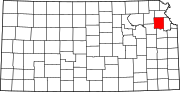 | |
| Unincorporated communities | ||
| Townships | ||
| Footnotes | †This community is designated a Census-Designated Place (CDP) by the United States Census Bureau. | |
| ||
39°18′07″N 95°19′58″W / 39.30194°N 95.33278°W
This article about a location in Jefferson County, Kansas is a stub. You can help Wikipedia by expanding it. |