
Elst, Gelderland
Elst | |
|---|---|
 Flag  Coat of arms | |
| Coordinates: 51°54′56″N 5°50′16″E / 51.91556°N 5.83778°E | |
| Country | Netherlands |
| Province | Gelderland |
| Municipality | Overbetuwe |
| Population (2022) | 22,509[1] |
Elst is a town in the municipality of
Elst is known for its Roman temples, which are situated under St Martin's (or the St Werenfried) church. Elst was a separate municipality until 2001, when it became a part of Overbetuwe.[2]
Elstar is an apple cultivar that was developed in Elst in the 1950s.

History
A number of archeological finds have been made in Elst. In 1947, while repairing war damage, the remains of two Roman temples were discovered under St Martin's Church, including one of the largest found north of the Alps. Further Roman buildings have since been found in the town,[3] as have prehistoric items.[4]
The missionary Saint Werenfried of Elst, was buried in Elst in circa 780. In the middle ages his tomb attracted pilgrims, as his intercession was believed to cure disorders, especially those related to arthritis.[5]
In September 1944, Elst was the scene of fighting between Allied and German troops during Operation Market Garden. During this, the tower of St Martin's Church was used as an observation post, and was largely destroyed by shelling.[6] The church was rebuilt after the war.
The municipality of Elst has existed since 1812. In January 2001 it became a part of the new municipality of Overbetuwe, when it merged with of Heteren and Valburg.[7] Since then, Elst has expanded with the building of new housing and industrial estates
Education
Elst is home to three
Sports
There are several
- Spero (Football)
- BCE (badminton)
- Elistha (Football)
- ETV (tennis)
- EZ & PC (swimming)
- Gaviiformes (scuba diving)
- Gemini (Volleyball)
- HCOB (field hockey)
- Unlimited (basketball)
- Budo vereniging (martial arts)
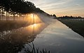
The Linge near Elst
The river Linge flows just north of Elst.
-
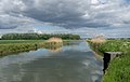
 The Linge from the Welsh Guardsbrug
 -
 The Linge in the autumn
 -
 The Linge in the winter
 -
 The Linge near the viaduct across the railway
 -
 The Linge near the first Weteringswal
 -
 The Linge at the second Weteringswal
 -
 The Linge in the fog near Romeins Lint Oost
 -
 The Linge from the bridge (the Raaijebrug)
 -
 The Linge near the bridge (the Raaijebrug)
 -
 The Linge from the bridge (the Langstraatbrug)


People born in Elst
- Pierre Kartner (1935–2022), singer and composer
- Frits Kuipers (1899–1943), footballer
- Paul Kuypers (1939–1971), agricultural scientist
- Henk "Henkie" Leeuwis(born 1946), singer
- Jeffrey Leiwakabessy (born 1981), footballer
- Dirk Proper (born 2002), footballer
- Hans Weijs (born 1986), rally driver
- Peter J. Williamson (1823–1907), architect, American Civil War adjutant to General William T. Sherman
- Jan Zwartkruis (1925–2013), footballer
Transportation
References
- ^ a b "Number of inhabitants per village 2001–22". www.overbetuwe.nl (in Dutch). Archived from the original on 6 October 2022. Retrieved 30 September 2023.
- ^ Ad van der Meer and Onno Boonstra, Repertorium van Nederlandse gemeenten, KNAW, 2011.
- ^ Derks, T. (10 March 2016). "The temples of Elst found". omroepgelderland.nl (in Dutch). Archeological Institute Vrije Universiteit Amsterdam. Retrieved 28 September 2023.
- ^ "Prehistoric tree canoe found". omroepgelderland.nl (in Dutch). Omroep Gelderland. 2 March 2010. Archived from the original on 2010-03-04. Retrieved 28 September 2023.
- ISBN 978-90-8890-220-8.
- ISBN 0850528615.
- ^ "Municipal divisions on 1 January 2001". cbs.nl (in Dutch). CBS. 11 March 2006. Retrieved 28 September 2023.
| Authority control databases: Geographic |
|---|