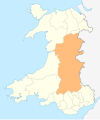
Epynt Way

The Epynt Way is a
Sennybridge Training Area (SENTA)' and artillery range on Mynydd Epynt in Powys, Wales. There is, understandably, virtually no public access across the land used by the MoD, pre-existing public rights of way
and public roads having been closed, with only one or two exceptions. The establishment of the Epynt Way, section by section in recent years has gone some way to compensating for that reduction in public access across the area.
Route

The circular route which is described as a permissive bridleway is 75 km / 49 mi in total length and available to walkers, cyclists and horseriders. It travels around the edge of the plateau, and keeps clear of MOD firing ranges. Nearest towns are
waymarked
throughout with 1.2 metre posts and finger posts at junctions with external paths, but local large-scale maps such as the OS Explorer map series should be used for information.
References
- ^ "Epynt Way". Archived from the original on 17 February 2009. Retrieved 7 January 2009.
- ^ "Long Distance Walkers Association".
External links
- MOD leaflet on short walks near Sennybridge
- General guidance about access to MOD training areas
- Detailed advice on access with maps of the route
52°07′01″N 3°30′00″W / 52.117°N 3.500°W

