
Fairview, Kentucky
Fairview, Kentucky | ||
|---|---|---|
ZIP code 42266 | ||
| GNIS feature ID | 0491893[2] | |
Fairview is a small
History
The community was likely first established by Samuel Davis, a Revolutionary War veteran who settled on the Todd County side around 1793. Davis opened the first post office there on October 1, 1802, naming the locale "Davisburg." His son, Jefferson Davis, the future President of the Confederate States of America, was born here on June 3, 1808.[5]
The Davis family remained in the area until 1810, when they relocated to the Bayou Teche in St. Mary Parish, Louisiana.[6] The community was later known as "Georgetown" after local tavern keeper George Nichols. The town was incorporated as "Fairview" on February 6, 1846; the Fairview Post Office opened on the Christian County side on June 8. The post office moved back and forth between Christian and Todd counties over the years; in the early 1980s it was located on the Christian County side.[5]
In the 1880s ten Fairview locals purchased the old Davis property as a new home for
In 1917, construction of the Jefferson Davis State Historic Site began. It was completed in 1924.
Geography
Fairview is located along U.S. Route 68 / Kentucky Route 80, about 10 miles (16 km) east of Hopkinsville and 9 miles (14 km) west of Elkton. The original route of U.S. 68 passed through the town; the new route passes less than 0.25 miles (0.40 km) north of the town, and the original route is now called Jefferson Davis Road.[9] The community is part of the Clarksville, TN–KY Metropolitan Statistical Area.
Demographics
| Census | Pop. | Note | %± |
|---|---|---|---|
| 2010 | 286 | — | |
| 2020 | 258 | −9.8% | |
| U.S. Decennial Census[10] | |||
References
- ^ "2020 U.S. Gazetteer Files". United States Census Bureau. Retrieved March 18, 2022.
- ^ "Fairview". Geographic Names Information System. United States Geological Survey, United States Department of the Interior. Retrieved July 17, 2009.
- ^ "Profile of General Population and Housing Characteristics: 2010". United States Census Bureau. Archived from the original on February 12, 2020. Retrieved August 29, 2013.
- ^ "Kentucky 2010: Population and Housing Unit Counts" (PDF). United States Census Bureau. p. 38. Retrieved August 29, 2013.
- ^ ISBN 0813126312. Retrieved September 5, 2013.
- ISBN 978-0807147382. Retrieved August 29, 2013.
- ISBN 0807147389. Retrieved August 29, 2013.
- ^ "Bethel Church Listed in Historic Register". Kentucky New Era. January 7, 1978. Retrieved August 29, 2013.
- ^ Google (August 29, 2013). "Fairview, Kentucky" (Map). Google Maps. Google. Retrieved August 29, 2013.
- ^ "Census of Population and Housing". Census.gov. Retrieved June 4, 2016.
External links
- "Fairview", Kentucky Atlas and Gazetteer, University of Kentucky
- Entry at CityTownInfo.com Archived 2016-05-19 at the Wayback Machine
Municipalities and communities of Christian County, Kentucky, United States | ||
|---|---|---|
| Cities |  | |
| CDPs | ||
| Unincorporated communities | ||
| Footnotes | ‡This populated place also has portions in an adjacent county or counties | |
| ||
Municipalities and communities of Todd County, Kentucky, United States | ||
|---|---|---|
| Cities | 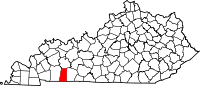 | |
| CDP | ||
| Other unincorporated communities | ||
| Footnotes | ‡This populated place also has portions in an adjacent county or counties | |
| ||