Fuaʻamotu International Airport
Fuaʻamotu International Airport Malaʻe Vakapuna Fakavahaʻapuleʻanga Fuaʻamotu | |||||||||||||||
|---|---|---|---|---|---|---|---|---|---|---|---|---|---|---|---|
AMSL 126 ft / 38 m | | ||||||||||||||
| Coordinates | 21°14′28″S 175°08′58″W / 21.24111°S 175.14944°W | ||||||||||||||
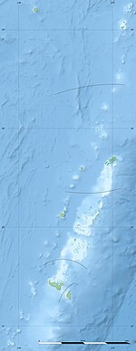
| Map | |||||||||||||||
| Runways | |||||||||||||||
| |||||||||||||||
Fuaʻamotu International Airport (
The air field was constructed by
Fuaʻamotu International Airport is equipped with VOR/DME (114.5) and NDB (245) navigational facilities. No
Air traffic control
Fuaʻamotu is a total controlled aerodrome and all traffic are guided by air traffic control. The tower is contactable on 118.5, and Ground on 121.9. Outside of the hours of service at Fuaʻamotu a limited FIS is available by Auckland Oceanic.
Runway 11/29: (Elev 91 ft/28m) PCN 45 FBXT (
Size restrictions

It is the strength of the runway rather than the length that restricts operations from Fuaʻamotu. Even a fully laden
Ground transport
There is no public bus service to the airport, but several hostels and hotels in Nukuʻalofa meet flights and taxis are available.
Airlines and destinations
| Airlines | Destinations |
|---|---|
| Air New Zealand | Auckland |
| Fiji Airways | Nadi |
| Sydney[9]
| |
| Talofa Airways | Apia, Pago Pago |
See also
- Transportation in Tonga
- List of airports in Tonga
References
- ^ Airport information for NFTF[usurped] from DAFIF (effective October 2006)
- ^ Airport information for TBU at Great Circle Mapper. Source: DAFIF (effective October 2006).
- ^ Tongatabu Airfield (Tonga Tabu, Fua Amotu Airport, Fua'amotu Airport), Tongatapu, Tonga, Pacific Wrecks webpage, up-dated September 24, 2018 [1]
- ^ "Air New Zealand Plans 787 Dreamliner Debut in Tonga in mid-June 2016". airlineroute. 24 March 2016. Retrieved 24 March 2016.
- ^ Boeing commercial aircraft specifications Archived 2011-01-29 at the Wayback Machine
- ^ "Flights to 'EUA: Explore Tonga's Enchanting Island with Lulutai".
- ^ "Tonga's Lulutai Airlines resumes flight operations".
- ^ "Tonga to Vava'u Flights: Explore Idyllic Islands & Adventures".
- ^ Matt Lennon (18 August 2022). "Qantas connects Australia to Tonga with direct flights - Executive Traveller". Executive Traveller.
External links
![]() Media related to Fuaʻamotu International Airport at Wikimedia Commons
Media related to Fuaʻamotu International Airport at Wikimedia Commons
- Aeronautical chart and airport information for NFTF at SkyVector
- Matangi Tonga


