
Gesgapegiag
Gesgapegiag Indian Reserve | |
|---|---|
| Population (2021) | |
| • Total | 637[1] |
| Highways | |
Gesgapegiag is one of two
Indian Act Election Regulations. The community is also allied to other Mi'kmaq communities in the Gaspé region of Quebec and in northern New Brunswick
. Together, their elected chiefs advance ancestral claims to self-government and to the traditional territory called Gespe'gewa'gi ('Kespékewáki), the last land.
Gespe'gewa'gi is the Mi'kmaq Nation District that extends from the Miramichi River to the tip of the Gaspé Peninsula, a land area that straddles the modern day
Aboriginal peoples in Canada and of aboriginal and treaty rights. Its main resource is the Atlantic salmon and water and forest resources, including modern harvest of timber. Political representatives of the Mi'kmaq of Gesgapegiag and the greater district of Gespe'gewa'gi continue talks with the Government of Quebec
over access to traditional lands.
The name Gesgapegiag, is the origin for the name of the Cascapédia River, as well as other nearby places carrying the name Cascapedia.
Gallery
-
 Band office
 -
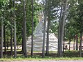
 Galgoasiet
 -
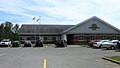
 Gas station
 -
 Old village
 -
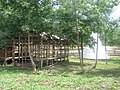 Old village


Notes
- ^ "Profile table, Census Profile: Gesgapegiag, Indian reserve". Statistics Canada. 2021. Retrieved 16 August 2023.
External links
Places adjacent to Gesgapegiag | ||||||||||||||||
|---|---|---|---|---|---|---|---|---|---|---|---|---|---|---|---|---|
| ||||||||||||||||
| International | |
|---|---|
| Geographic | |