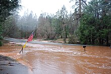
Glencoe, California
Glencoe | |
|---|---|
| Coordinates: 38°21′15″N 120°35′06″W / 38.35417°N 120.58500°W | |
| Country | United States |
| State | California |
| County | Calaveras County |
| Elevation | 2,749 ft (838 m) |
| Reference no. | 280 |


Glencoe (formerly, Mosquito and Mosquito Gulch) is an
Glencoe was formerly called Mosquito Gulch. [1] The business portion of the town was on the north side of Mosquito Gulch, but not one of the old buildings remains. The mines were first worked by Mexicans in the early 1850s. Quartz mining predominated but there was some placer mining as well.
The town today is registered as California Historical Landmark #280.[2]
The first post office was opened at Mosquito in 1858 but closed in 1869; it was re-established as Mosquito Gulch in 1873. The name was changed to Glencoe in 1912; the post office closed again in 1916, but was re-established in 1947.[3]
Politics
In the
Wildfires
In 2022, a large part of Glencoe, California was evacuated due to the Electra Fire (2022). Other fires have affected Glencoe in the past, including the Butte Fire in September 2019.
References
- ^ a b c "Glencoe". Geographic Names Information System. United States Geological Survey, United States Department of the Interior. Retrieved May 24, 2023.
- ^ "Glencoe". Office of Historic Preservation, California State Parks. Retrieved October 6, 2012.
- ISBN 1-884995-14-4.
- ^ "Senators". State of California. Retrieved March 21, 2013.
- ^ "Members Assembly". State of California. Retrieved March 21, 2013.
- ^ "California's 4th Congressional District - Representatives & District Map". Civic Impulse, LLC. Retrieved March 1, 2013.


