Gmina Jabłonowo Pomorskie
Gmina Jabłonowo Pomorskie
Jabłonowo Pomorskie Commune | |
|---|---|
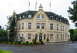
 Town Hall in Jabłonowo Pomorskie, seat of the gmina office | |
|
UTC+2 (CEST) | |
| Vehicle registration | CBR |
| Website | http://www.jablonowo.com/ |
Gmina Jabłonowo Pomorskie is an urban-rural
The gmina covers an area of 134.36 square kilometres (51.9 sq mi), and as of 2006 its total population is 9,060 (out of which the population of Jabłonowo Pomorskie amounts to 3,658, and the population of the rural part of the gmina is 5,402).
The gmina contains parts of the protected areas of Brodnica Landscape Park and Górzno-Lidzbark Landscape Park.
Villages
Apart from the town of Jabłonowo Pomorskie, Gmina Jabłonowo Pomorskie contains the villages and settlements of Adamowo, Budziszewo, Buk Góralski, Buk Pomorski, Bukowiec, Górale, Gorzechówko, Jabłonowo-Zamek, Kamień, Konojady, Lembarg, Mileszewy, Nowa Wieś, Piecewo, Płowęż and Szczepanki.
Neighbouring gminas
Gmina Jabłonowo Pomorskie is bordered by the gminas of Biskupiec, Bobrowo, Książki, Świecie nad Osą and Zbiczno.


