
Grong Grong
| Grong Grong Federal division(s) | Riverina | |
|---|---|---|
Grong Grong
The name Grong Grong is an Aboriginal term meaning "bad camping ground" or "very bad camping ground".[2][3]
Bypass
Grong Grong was bypassed in February 2018, to straighten the Newell Highway or A39 by about 2 kilometres and also to eliminate a notorious 25 km/h bend that had caused many accidents, especially trucks overturning.[4]
Demography
Like many rural localities in the area, the population has progressively declined over a number of years, evidenced as follows:
| Selected historical census data for Grong Grong state suburb | ||||||
|---|---|---|---|---|---|---|
| Census year | 2001 | 2006[5] | 2011[6] | 2016[1] | ||
| Population | Estimated residents on Census night | unavailable | 537 | 391 | 250 | |
Facilities
The Grong Grong post office was opened on 1 November 1881.[7]
The town has a railway station on the Hay branch off the Main Southern Line. However, the line has closed so with it has the station. Only part of the line is used by a weekly passenger train to Griffith which does not stop at the station. Grong Grong can be accessed by coaches that stop at the town on the way to Hay and Mildura.
Berembed Weir is located 20 km south of the town.[8] The weir diverts water from the Murrumbidgee River into the main canal which flows onto the Murrimbidgee Irrigation Area to serve irrigation farmers in the Leeton and Griffith area. The weir and nearby reserve is popular among local anglers, as well as the various riverside locations situated just 5 km to Grong Grong's south.
Sport
The most popular sport in Grong Grong is
Regular sporting events include golf, tennis and softball, all hosted at the Grong Grong Sports Club.
Grong Grong also hosts annual sporting events such as the Grong Grong Rodeo, Team Penning and Gymkhana.
Heritage listings
Grong Grong has a number of heritage-listed sites, including:
- Murrumbidgee River: Wooden Wicket, Berembed Weir[10]
Gallery
-
 The Royal Hotel at Grong Grong
 -
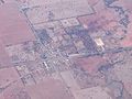 An aerial view of Grong Grong, in 2007
 -
 St Patrick's Roman Catholic Church
 -
 School of Arts hall
 -
 Grong Grong railway siding


See also
References
- ^ a b Australian Bureau of Statistics (27 June 2017). "Grong Grong (State Suburb)". 2016 Census QuickStats. Retrieved 3 February 2018.
- ISBN 0-589-07115-7.
- ^ "Search: Grong Grong". Geoscience Australia. Australian Government. Archived from the original on 12 March 2007.
- ^ Improvements to the Newell Highway at Grong Grong Roads & Meritime
- ^ Australian Bureau of Statistics (25 October 2007). "Grong Grong (State Suburb)". 2006 Census QuickStats. Retrieved 29 September 2009.
- ^ Australian Bureau of Statistics (31 October 2012). "Grong Grong (State Suburb)". 2011 Census QuickStats. Retrieved 5 January 2015.
- ^ "Post office list". Phoenix Auctions history. Retrieved 18 January 2021.
- ^ "Berembed weir, between Wagga and Narrandera closed by WaterNSW". The Daily Advertiser. 14 April 2017. Retrieved 18 February 2018.
- ^ "2018 Arthur J Gallagher Riverina FNL Seniors". SportsTG. Sports TG. Retrieved 9 March 2018.
- .
External links
![]() Media related to Grong Grong at Wikimedia Commons
Media related to Grong Grong at Wikimedia Commons
| Preceding station | Former Services | Following station | ||
|---|---|---|---|---|
| Narrandera towards Hay
|
Hay Line | Matong towards Junee
| ||