
Hagarville, Arkansas
Hagarville, Arkansas | |
|---|---|
UTC-5 (CDT) | |
| Area code | 479 |
| GNIS feature ID | 2612126[2] |
Hagarville is a
2020 census, the population was 142.[3]
Demographics
| Census | Pop. | Note | %± |
|---|---|---|---|
| 2010 | 129 | — | |
| 2020 | 142 | 10.1% | |
| U.S. Decennial Census[4] 2010[5] 2020[6] | |||
2020 census
| Race / Ethnicity | Pop 2010[5] | Pop 2020[6] | % 2010 | % 2020 |
|---|---|---|---|---|
White alone (NH)
|
116 | 133 | 89.92% | 93.66% |
Black or African American alone (NH)
|
3 | 1 | 2.33% | 0.70% |
Alaska Native alone (NH)
|
0 | 1 | 0.00% | 0.70% |
| Asian alone (NH) | 0 | 0 | 0.00% | 0.00% |
| Pacific Islander alone (NH) | 0 | 0 | 0.00% | 0.00% |
| Some Other Race alone (NH) | 0 | 0 | 0.00% | 0.00% |
| Mixed Race/Multi-Racial (NH) | 5 | 6 | 3.88% | 4.23% |
| Hispanic or Latino (any race) | 5 | 1 | 3.88% | 0.70% |
| Total | 129 | 142 | 100.00% | 100.00% |
References
- ^ "2020 U.S. Gazetteer Files". United States Census Bureau. Retrieved October 29, 2021.
- ^ a b U.S. Geological Survey Geographic Names Information System: Hagarville, Arkansas
- ^ "Hagarville CDP, Arkansas". United States Census Bureau. Retrieved April 15, 2022.
- US Census Bureau.
- ^ a b "P2 HISPANIC OR LATINO, AND NOT HISPANIC OR LATINO BY RACE – 2010: DEC Redistricting Data (PL 94-171) – Hagarville CDP, Arkansas". United States Census Bureau.
- ^ a b "P2 HISPANIC OR LATINO, AND NOT HISPANIC OR LATINO BY RACE – 2020: DEC Redistricting Data (PL 94-171) – Hagarville CDP, Arkansas". United States Census Bureau.
Municipalities and communities of Johnson County, Arkansas, United States | ||
|---|---|---|
| Cities | 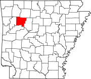 | |
| Town | ||
| CDPs | ||
| Other unincorporated communities | ||
| ||
This article about a location in Johnson County, Arkansas is a stub. You can help Wikipedia by expanding it. |