
Johnson County, Arkansas
Johnson County | |
|---|---|
UTC−5 (CDT) | |
| Congressional district | 4th |
| Website | johnsoncounty |
Johnson County is a
Geography
According to the
Major highways
 Interstate 40
 U.S. Route 64
 Arkansas Highway 21
 Arkansas Highway 103
 Arkansas Highway 109
 Arkansas Highway 123
Adjacent counties
- Newton County (north)
- Pope County (east)
- Logan County (south)
- Franklin County (west)
- Madison County (northwest)
National protected area
- Ozark National Forest(part)
Demographics
| Census | Pop. | Note | %± |
|---|---|---|---|
| 1840 | 3,433 | — | |
| 1850 | 5,227 | 52.3% | |
| 1860 | 7,612 | 45.6% | |
| 1870 | 9,152 | 20.2% | |
| 1880 | 11,565 | 26.4% | |
| 1890 | 16,758 | 44.9% | |
| 1900 | 17,448 | 4.1% | |
| 1910 | 19,698 | 12.9% | |
| 1920 | 21,062 | 6.9% | |
| 1930 | 19,289 | −8.4% | |
| 1940 | 18,795 | −2.6% | |
| 1950 | 16,138 | −14.1% | |
| 1960 | 12,421 | −23.0% | |
| 1970 | 13,630 | 9.7% | |
| 1980 | 17,423 | 27.8% | |
| 1990 | 18,221 | 4.6% | |
| 2000 | 22,781 | 25.0% | |
| 2010 | 25,540 | 12.1% | |
| 2020 | 25,749 | 0.8% | |
| 2023 (est.) | 26,129 | [5] | 1.5% |
| U.S. Decennial Census[6] 1790–1960[7] 1900–1990[8] 1990–2000[9] 2010[10] 2020-2021[1] | |||

2000 census
As of the
There were 8,738 households, out of which 32.40% had children under the age of 18 living with them, 58.10% were married couples living together, 9.50% had a female householder with no husband present, and 28.60% were non-families. 24.60% of all households were made up of individuals, and 11.60% had someone living alone who was 65 years of age or older. The average household size was 2.54 and the average family size was 3.01.
In the county, the population was spread out, with 25.20% under the age of 18, 9.70% from 18 to 24, 27.60% from 25 to 44, 22.70% from 45 to 64, and 14.80% who were 65 years of age or older. The median age was 36 years. For every 100 females there were 99.00 males. For every 100 females age 18 and over, there were 95.40 males.
The median income for a household in the county was $27,910, and the median income for a family was $33,630. Males had a median income of $25,779 versus $19,924 for females. The
2020 census
As of the 2020 United States census, there were 25,749 people and 9,792 households in the county.[1]
Racial composition
| Race | Number | Percentage |
|---|---|---|
White (non-Hispanic)
|
19,400 | 75.34% |
Black or African American (non-Hispanic)
|
454 | 1.76% |
Native American
|
202 | 0.78% |
Asian
|
918 | 3.57% |
Pacific Islander
|
27 | 0.1% |
Other/Mixed
|
1,309 | 5.08% |
Latino
|
3,439 | 13.36% |
Government
Politics
Over the past few election cycles, Johnson County has trended heavily toward the GOP. The last Democratic presidential candidate to carry this county was Arkansas native Bill Clinton in 1992 and 1996.
| Year | Republican | Democratic | Third party | |||
|---|---|---|---|---|---|---|
| No. | % | No. | % | No. | % | |
| 2020 | 6,938 | 73.05% | 2,283 | 24.04% | 277 | 2.92% |
| 2016 | 6,091 | 66.85% | 2,427 | 26.64% | 594 | 6.52% |
| 2012 | 5,064 | 62.53% | 2,799 | 34.56% | 235 | 2.90% |
| 2008 | 4,922 | 60.17% | 3,034 | 37.09% | 224 | 2.74% |
| 2004 | 4,311 | 53.59% | 3,622 | 45.03% | 111 | 1.38% |
| 2000 | 3,657 | 51.07% | 3,270 | 45.66% | 234 | 3.27% |
| 1996 | 2,367 | 34.64% | 3,585 | 52.47% | 881 | 12.89% |
| 1992 | 2,563 | 33.82% | 3,951 | 52.14% | 1,064 | 14.04% |
| 1988 | 4,046 | 58.29% | 2,818 | 40.60% | 77 | 1.11% |
| 1984 | 4,720 | 60.30% | 3,056 | 39.04% | 51 | 0.65% |
| 1980 | 3,619 | 47.39% | 3,709 | 48.57% | 308 | 4.03% |
| 1976 | 2,173 | 30.11% | 5,044 | 69.89% | 0 | 0.00% |
| 1972 | 4,107 | 66.76% | 2,045 | 33.24% | 0 | 0.00% |
| 1968 | 1,667 | 32.64% | 1,747 | 34.21% | 1,693 | 33.15% |
| 1964 | 1,535 | 32.78% | 3,127 | 66.77% | 21 | 0.45% |
| 1960 | 1,490 | 42.29% | 1,938 | 55.01% | 95 | 2.70% |
| 1956 | 1,520 | 46.84% | 1,697 | 52.30% | 28 | 0.86% |
| 1952 | 1,728 | 45.90% | 2,021 | 53.68% | 16 | 0.42% |
| 1948 | 523 | 23.25% | 1,565 | 69.59% | 161 | 7.16% |
| 1944 | 593 | 31.03% | 1,311 | 68.60% | 7 | 0.37% |
| 1940 | 318 | 18.11% | 1,429 | 81.38% | 9 | 0.51% |
| 1936 | 318 | 17.95% | 1,432 | 80.81% | 22 | 1.24% |
| 1932 | 284 | 14.88% | 1,557 | 81.60% | 67 | 3.51% |
| 1928 | 766 | 36.93% | 1,292 | 62.30% | 16 | 0.77% |
| 1924 | 311 | 19.78% | 1,029 | 65.46% | 232 | 14.76% |
| 1920 | 996 | 36.15% | 1,579 | 57.31% | 180 | 6.53% |
| 1916 | 571 | 27.85% | 1,479 | 72.15% | 0 | 0.00% |
| 1912 | 189 | 12.57% | 927 | 61.64% | 388 | 25.80% |
| 1908 | 544 | 29.14% | 1,164 | 62.35% | 159 | 8.52% |
| 1904 | 507 | 31.30% | 1,047 | 64.63% | 66 | 4.07% |
| 1900 | 552 | 29.30% | 1,317 | 69.90% | 15 | 0.80% |
| 1896 | 491 | 21.06% | 1,831 | 78.55% | 9 | 0.39% |
Cities
- Clarksville (county seat)
- Coal Hill
- Hartman
- Knoxville
- Lamar
Census-designated places
Other unincorporated communities
Townships

Townships in Arkansas are the divisions of a county. Each township includes unincorporated areas; some may have incorporated cities or towns within part of their boundaries. Arkansas townships have limited purposes in modern times. However, the United States census does list Arkansas population based on townships (sometimes referred to as "county subdivisions" or "minor civil divisions"). Townships are also of value for historical purposes in terms of genealogical research. Each town or city is within one or more townships in an Arkansas county based on census maps and publications. The townships of Johnson County are listed below; listed in parentheses are the cities, towns, and/or census-designated places that are fully or partially inside the township. [15][16]
- Batson
- Dickerson-Hill
- Grant (Coal Hill)
- Hickey
- Horsehead
- Howell (most of Knoxville)
- Lee
- Low Gap
- McKennon
- Mulberry
- Perry (CDP Hagarville)
- Pittsburg (most of Lamar, small part of Knoxville)
- Prairie (small part of Clarksville)
- Red Lick
- Sherman
- Spadra (most of Clarksville, small part of Lamar)
- Stonewall
- Ward (Hartman)
Notable people
See also
- List of lakes in Johnson County, Arkansas
- National Register of Historic Places listings in Johnson County, Arkansas
References
- ^ a b c "QuickFacts, Johnson County, Arkansas". United States Census Bureau. Retrieved November 2, 2022.
- ^ "Find a County". National Association of Counties. Archived from the original on May 9, 2015. Retrieved June 7, 2011.
- ^ Gannett, Henry (1905). The Origin of Certain Place Names in the United States. Govt. Print. Off. pp. 169.
- ^ "2010 Census Gazetteer Files". United States Census Bureau. August 22, 2012. Retrieved August 26, 2015.
- ^ "Annual Estimates of the Resident Population for Counties: April 1, 2020 to July 1, 2023". United States Census Bureau. Retrieved March 30, 2024.
- ^ "U.S. Decennial Census". United States Census Bureau. Retrieved August 26, 2015.
- ^ "Historical Census Browser". University of Virginia Library. Retrieved August 26, 2015.
- ^ Forstall, Richard L., ed. (March 27, 1995). "Population of Counties by Decennial Census: 1900 to 1990". United States Census Bureau. Retrieved August 26, 2015.
- ^ "Census 2000 PHC-T-4. Ranking Tables for Counties: 1990 and 2000" (PDF). United States Census Bureau. April 2, 2001. Archived (PDF) from the original on March 27, 2010. Retrieved August 26, 2015.
- ^ "State & County QuickFacts". United States Census Bureau. Archived from the original on June 7, 2011. Retrieved May 22, 2014.
- ^ Based on 2000 census data
- ^ "U.S. Census website". United States Census Bureau. Retrieved May 14, 2011.
- ^ "Explore Census Data". data.census.gov. Retrieved January 1, 2022.
- ^ "Dave Leip's Atlas of U.S. Presidential Elections". Retrieved November 18, 2016.
- ^ 2011 Boundary and Annexation Survey (BAS): Johnson County, AR (PDF) (Map). U. S. Census Bureau. Archived from the original (PDF) on October 19, 2012. Retrieved August 18, 2011.
- ^ "Arkansas: 2010 Census Block Maps - County Subdivision". United States Census Bureau. Archived from the original on May 28, 2014. Retrieved May 29, 2014.
Places adjacent to Johnson County, Arkansas | ||||||||||||||||
|---|---|---|---|---|---|---|---|---|---|---|---|---|---|---|---|---|
| ||||||||||||||||
Municipalities and communities of Johnson County, Arkansas, United States | ||
|---|---|---|
| Cities | 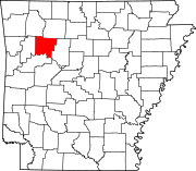 | |
| Town | ||
| CDPs | ||
| Other unincorporated communities | ||
| ||
35°33′N 93°28′W / 35.550°N 93.467°W
| International | |
|---|---|
| National | |
| Geographic | |
| Other | |